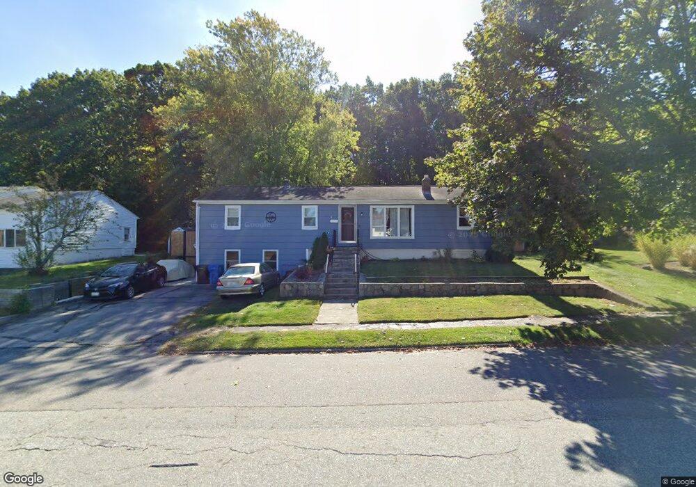
130 Mockingbird Dr Cranston, RI 02920
Thornton NeighborhoodEstimated Value: $469,000 - $528,000
4
Beds
3
Baths
2,002
Sq Ft
$245/Sq Ft
Est. Value
About This Home
This home is located at 130 Mockingbird Dr, Cranston, RI 02920 and is currently estimated at $491,412, approximately $245 per square foot. 130 Mockingbird Dr is a home located in Providence County with nearby schools including Stone Hill School, Western Hills Middle School, and Cranston High School West.
Ownership History
Date
Name
Owned For
Owner Type
Purchase Details
Closed on
Nov 13, 2009
Sold by
Flamino Robert
Bought by
Fhlmc
Current Estimated Value
Purchase Details
Closed on
Dec 16, 2005
Sold by
Pizzi Angelo R
Bought by
Flamingo Robert
Home Financials for this Owner
Home Financials are based on the most recent Mortgage that was taken out on this home.
Original Mortgage
$252,000
Interest Rate
6.34%
Mortgage Type
Purchase Money Mortgage
Purchase Details
Closed on
Aug 3, 2004
Sold by
Shroyer Daniel and Shroyer Lisa
Bought by
Pizzi Angelo
Purchase Details
Closed on
Oct 23, 1998
Sold by
Parrillo Walter R
Bought by
Shroyer Daniel S and Shroyer Lisa
Create a Home Valuation Report for This Property
The Home Valuation Report is an in-depth analysis detailing your home's value as well as a comparison with similar homes in the area
Home Values in the Area
Average Home Value in this Area
Purchase History
| Date | Buyer | Sale Price | Title Company |
|---|---|---|---|
| Fhlmc | $210,000 | -- | |
| Flamingo Robert | $319,000 | -- | |
| Pizzi Angelo | $276,000 | -- | |
| Shroyer Daniel S | $145,000 | -- |
Source: Public Records
Mortgage History
| Date | Status | Borrower | Loan Amount |
|---|---|---|---|
| Open | Shroyer Daniel S | $171,770 | |
| Previous Owner | Shroyer Daniel S | $252,000 | |
| Previous Owner | Shroyer Daniel S | $63,000 |
Source: Public Records
Tax History
| Year | Tax Paid | Tax Assessment Tax Assessment Total Assessment is a certain percentage of the fair market value that is determined by local assessors to be the total taxable value of land and additions on the property. | Land | Improvement |
|---|---|---|---|---|
| 2025 | $5,302 | $382,000 | $138,200 | $243,800 |
| 2024 | $5,199 | $382,000 | $138,200 | $243,800 |
| 2023 | $5,173 | $273,700 | $99,200 | $174,500 |
| 2022 | $5,066 | $273,700 | $99,200 | $174,500 |
| 2021 | $4,927 | $273,700 | $99,200 | $174,500 |
| 2020 | $4,833 | $232,700 | $99,200 | $133,500 |
| 2019 | $4,833 | $232,700 | $99,200 | $133,500 |
| 2018 | $4,439 | $218,800 | $99,200 | $119,600 |
| 2017 | $4,170 | $181,800 | $79,400 | $102,400 |
| 2016 | $4,081 | $181,800 | $79,400 | $102,400 |
| 2015 | $4,081 | $181,800 | $79,400 | $102,400 |
| 2014 | $4,461 | $195,300 | $79,400 | $115,900 |
Source: Public Records
Map
Nearby Homes
- 244 Stony Acre Dr
- 44 Village Ave
- 46 Lake Garden Dr
- 71 Elite Dr
- 75 Elite Dr
- 51 Janet Dr
- 65 Traymore St
- 72 Westfield Dr
- 74 Woodside St
- 20 Doreen Ct
- 333 Phenix Ave
- 0 Macera Dr
- 0 Phenix Ave Unit 1408504
- 1757 Plainfield Pike
- 1603 Plainfield Pike Unit G8
- 00 Burton St
- 93 Elena St
- 77 Rockwood Ave
- 27 Nardolillo St
- 60 Imperial Ave
- 223 Pheasant Dr
- 120 Mockingbird Dr
- 215 Pheasant Dr
- 131 Mockingbird Dr
- 114 Mockingbird Dr
- 222 Pheasant Dr
- 237 Lake Garden Dr
- 209 Pheasant Dr
- 150 Quail Hollow Rd
- 141 Quail Hollow Rd
- 210 Pheasant Dr
- 227 Lake Garden Dr
- 203 Pheasant Dr
- 100 Mockingbird Dr
- 142 Quail Hollow Rd
- 242 Lake Garden Dr
- 128 Eagle Rd
- 135 Quail Hollow Rd
- 215 Lake Garden Dr
- 197 Pheasant Dr
Your Personal Tour Guide
Ask me questions while you tour the home.