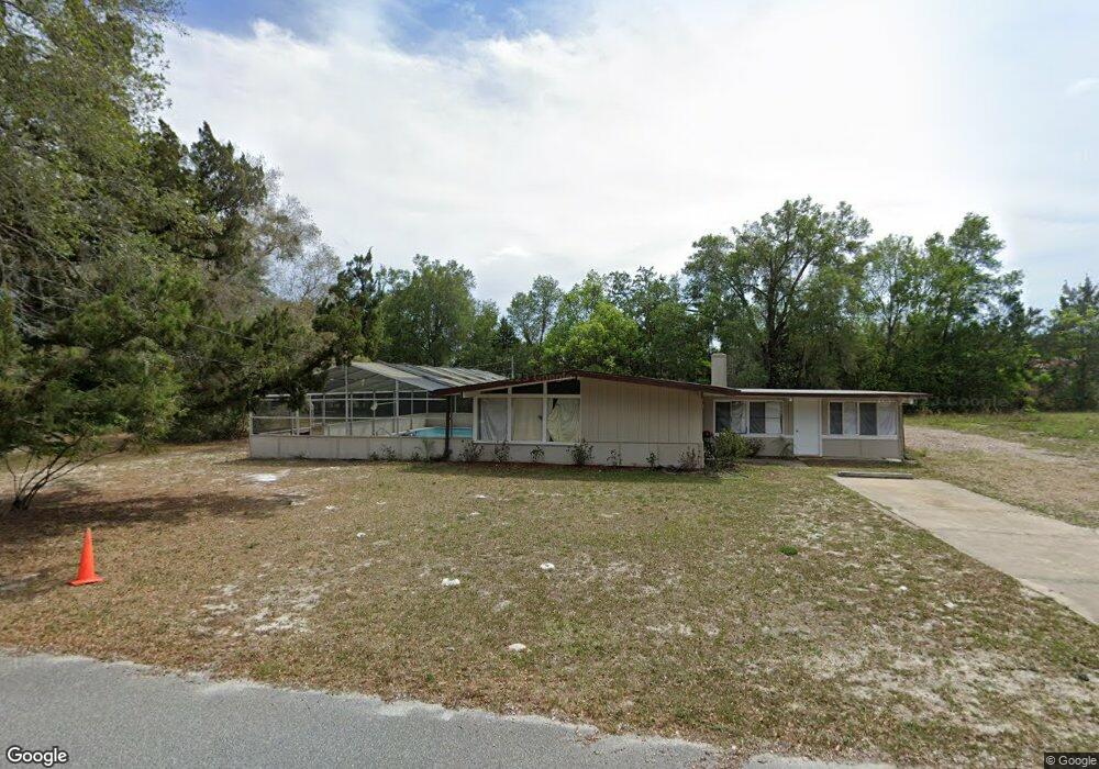
130 Mohawk Ave Deland, FL 32724
North DeLand NeighborhoodEstimated Value: $184,000 - $265,186
3
Beds
2
Baths
1,499
Sq Ft
$149/Sq Ft
Est. Value
About This Home
This home is located at 130 Mohawk Ave, Deland, FL 32724 and is currently estimated at $223,047, approximately $148 per square foot. 130 Mohawk Ave is a home located in Volusia County with nearby schools including George W. Marks Elementary School, Deland High School, and Deland Middle School.
Ownership History
Date
Name
Owned For
Owner Type
Purchase Details
Closed on
Jul 26, 2023
Sold by
Murphy Richard Francis
Bought by
Paul Harlan L
Current Estimated Value
Purchase Details
Closed on
Jun 18, 2008
Sold by
Hsbc Mortgage Services Inc
Bought by
Murphy Richard
Purchase Details
Closed on
Feb 29, 2008
Sold by
Crow Ronald A and Crow Heather R
Bought by
Hsbc Mortgage Services Inc
Purchase Details
Closed on
May 10, 2006
Sold by
Brandt Donald
Bought by
Crow Ronald A and Crow Heather R
Home Financials for this Owner
Home Financials are based on the most recent Mortgage that was taken out on this home.
Original Mortgage
$140,000
Interest Rate
8.95%
Mortgage Type
Purchase Money Mortgage
Create a Home Valuation Report for This Property
The Home Valuation Report is an in-depth analysis detailing your home's value as well as a comparison with similar homes in the area
Home Values in the Area
Average Home Value in this Area
Purchase History
| Date | Buyer | Sale Price | Title Company |
|---|---|---|---|
| Paul Harlan L | $100 | None Listed On Document | |
| Murphy Richard | $77,000 | Attorney | |
| Hsbc Mortgage Services Inc | -- | Attorney | |
| Crow Ronald A | $140,000 | Volusia Title Services |
Source: Public Records
Mortgage History
| Date | Status | Borrower | Loan Amount |
|---|---|---|---|
| Previous Owner | Crow Ronald A | $140,000 | |
| Previous Owner | Brandt Donald T | $30,000 |
Source: Public Records
Tax History Compared to Growth
Tax History
| Year | Tax Paid | Tax Assessment Tax Assessment Total Assessment is a certain percentage of the fair market value that is determined by local assessors to be the total taxable value of land and additions on the property. | Land | Improvement |
|---|---|---|---|---|
| 2025 | $2,847 | $194,540 | $43,993 | $150,547 |
| 2024 | $2,847 | $195,501 | $43,993 | $151,508 |
| 2023 | $2,847 | $184,385 | $36,754 | $147,631 |
| 2022 | $2,617 | $161,892 | $25,059 | $136,833 |
| 2021 | $2,503 | $135,280 | $18,934 | $116,346 |
| 2020 | $2,230 | $109,735 | $16,149 | $93,586 |
| 2019 | $2,219 | $107,617 | $16,149 | $91,468 |
| 2018 | $2,129 | $105,967 | $13,365 | $92,602 |
| 2017 | $1,947 | $88,075 | $9,431 | $78,644 |
| 2016 | $1,689 | $70,507 | $0 | $0 |
| 2015 | $1,597 | $63,776 | $0 | $0 |
| 2014 | $1,424 | $51,069 | $0 | $0 |
Source: Public Records
Map
Nearby Homes
- 260 Mercers Fernery Rd
- 1601 N Woodland Blvd
- 2401 N Woodland Blvd
- 2200 N Clara Ave
- 305 Violetwood Rd
- 124 Lake Molly Ave
- 195 Lake Molly Ave
- 425 Mercers Fernery Rd
- 7 Valencia Ct
- 4 Navel Ct
- 0 Newport Ave
- 0 Vacant Land Unit MFRA4667659
- 580 Mercers Fernery Rd
- 0 Greens Dairy Rd Unit 1216610
- 0 No St Unit MFRV4933386
- 0 No St Unit MFRO6357154
- 0 No St Unit MFRV4941771
- 0 No St Unit 1121839
- 104 E Rosehill Ave
- 0 North St Unit 1211817
- 196 Mohawk Ave
- 195 Mohawk Ave
- 143 Mohawk Ave
- 137 Mohawk Ave
- 280 Tupelo Honey Cir
- 276 Tupelo Honey Cir
- 284 Tupelo Honey Cir
- 125 Mohawk Ave
- 288 Tupelo Honey Cir
- 292 Tupelo Honey Cir
- 120 E Mercers Fernery Rd
- 123 Mohawk Ave
- 136 E Mercers Fernery Rd
- 296 Tupelo Honey Cir
- 110 E Mercers Fernery Rd
- 268 Tupelo Honey Cir
- 1755 N Woodland Blvd
- 300 Tupelo Honey Cir
- 204 Mohawk Ave
- 1765 N Woodland Blvd