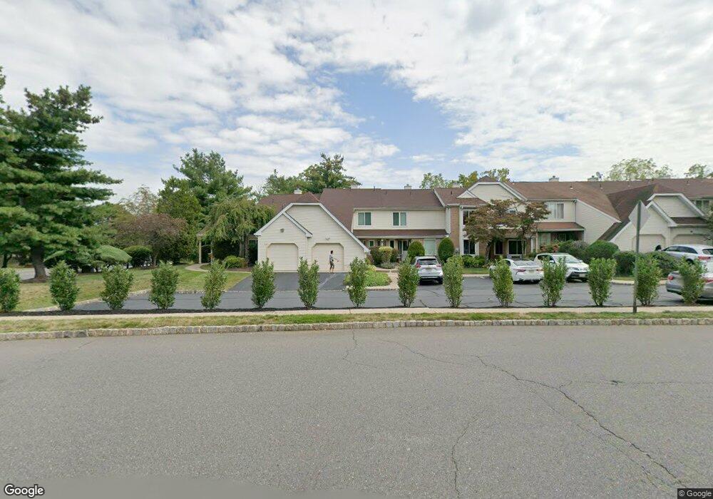
130 Nathan Dr North Brunswick, NJ 08902
Estimated Value: $445,000 - $465,000
2
Beds
3
Baths
1,324
Sq Ft
$342/Sq Ft
Est. Value
About This Home
This home is located at 130 Nathan Dr, North Brunswick, NJ 08902 and is currently estimated at $453,217, approximately $342 per square foot. 130 Nathan Dr is a home located in Middlesex County with nearby schools including Livingston Park Elementary School, Linwood Middle School, and North Brunswick Twp High School.
Ownership History
Date
Name
Owned For
Owner Type
Purchase Details
Closed on
Jul 5, 2018
Sold by
Quershy Maliha and Subrati Rahman Ryan
Bought by
Napolitano Joseph
Current Estimated Value
Home Financials for this Owner
Home Financials are based on the most recent Mortgage that was taken out on this home.
Original Mortgage
$195,000
Outstanding Balance
$168,997
Interest Rate
4.5%
Mortgage Type
New Conventional
Estimated Equity
$284,220
Purchase Details
Closed on
May 28, 2014
Sold by
Rothman Robert
Bought by
Quresby Maliha
Home Financials for this Owner
Home Financials are based on the most recent Mortgage that was taken out on this home.
Original Mortgage
$157,500
Interest Rate
3%
Mortgage Type
Adjustable Rate Mortgage/ARM
Purchase Details
Closed on
Jun 11, 2004
Sold by
Mowatt Heather
Bought by
Rothman Robert
Purchase Details
Closed on
Apr 30, 2003
Sold by
Fliszar Lynette
Bought by
Mowatt Heather
Create a Home Valuation Report for This Property
The Home Valuation Report is an in-depth analysis detailing your home's value as well as a comparison with similar homes in the area
Home Values in the Area
Average Home Value in this Area
Purchase History
| Date | Buyer | Sale Price | Title Company |
|---|---|---|---|
| Napolitano Joseph | $245,000 | Clear Skies Title Agency | |
| Quresby Maliha | $210,000 | Premier Abstract & Title Age | |
| Rothman Robert | $252,000 | -- | |
| Mowatt Heather | $190,000 | -- |
Source: Public Records
Mortgage History
| Date | Status | Borrower | Loan Amount |
|---|---|---|---|
| Open | Napolitano Joseph | $195,000 | |
| Previous Owner | Quresby Maliha | $157,500 |
Source: Public Records
Tax History Compared to Growth
Tax History
| Year | Tax Paid | Tax Assessment Tax Assessment Total Assessment is a certain percentage of the fair market value that is determined by local assessors to be the total taxable value of land and additions on the property. | Land | Improvement |
|---|---|---|---|---|
| 2025 | $7,603 | $120,000 | $41,000 | $79,000 |
| 2024 | $7,466 | $120,000 | $41,000 | $79,000 |
| 2023 | $7,466 | $120,000 | $41,000 | $79,000 |
| 2022 | $7,212 | $120,000 | $41,000 | $79,000 |
| 2021 | $5,018 | $120,000 | $41,000 | $79,000 |
| 2020 | $6,943 | $120,000 | $41,000 | $79,000 |
| 2019 | $6,802 | $120,000 | $41,000 | $79,000 |
| 2018 | $6,496 | $117,000 | $41,000 | $76,000 |
| 2017 | $6,381 | $117,000 | $41,000 | $76,000 |
| 2016 | $6,248 | $117,000 | $41,000 | $76,000 |
| 2015 | $6,141 | $117,000 | $41,000 | $76,000 |
| 2014 | $6,072 | $117,000 | $41,000 | $76,000 |
Source: Public Records
Map
Nearby Homes
- 174 Nathan Dr
- 1103 Schmidt Ln
- 280 Willowbrook Dr
- 1074 Schmidt Ln
- 66 Riverbend Dr
- 320 Willowbrook Dr
- 1027 Schmidt Ln
- 1008 Schmidt Ln
- 84 Clay St
- 38 Brighton Way Unit H2
- 1 Michael Ct
- 448 Northam Dr Unit A3
- 464 Northam Dr
- 1899 Noah Dr
- 480 Witney Ct
- 78 Albury Way
- 11 Reins Ct
- 1067 Grove St
- 131 Albury Way
- 204 Darwin Ln