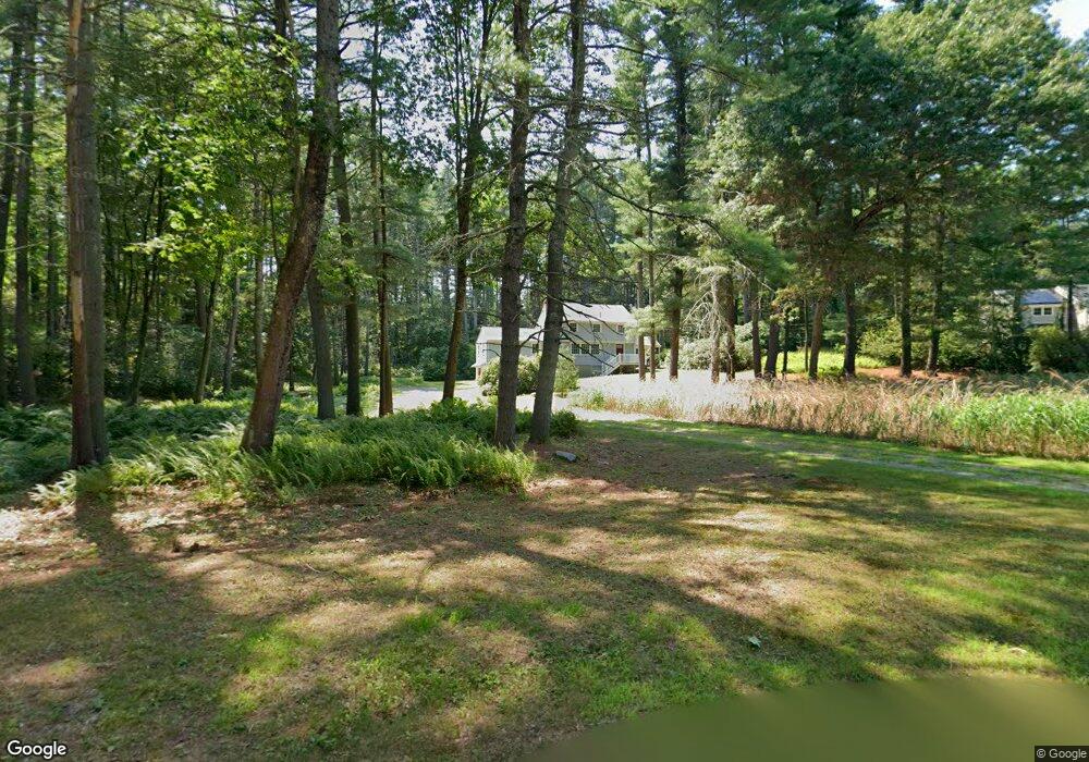
130 Peter Hans Rd Carlisle, MA 01741
Estimated Value: $945,966 - $1,047,000
5
Beds
3
Baths
2,171
Sq Ft
$451/Sq Ft
Est. Value
About This Home
This home is located at 130 Peter Hans Rd, Carlisle, MA 01741 and is currently estimated at $978,992, approximately $450 per square foot. 130 Peter Hans Rd is a home located in Middlesex County with nearby schools including Carlisle School.
Ownership History
Date
Name
Owned For
Owner Type
Purchase Details
Closed on
Sep 17, 2018
Sold by
Bygrave William W
Bought by
Bygrav William W Drury
Current Estimated Value
Purchase Details
Closed on
Jan 1, 1967
Bought by
Bygrave William D and Bygrave Jane
Create a Home Valuation Report for This Property
The Home Valuation Report is an in-depth analysis detailing your home's value as well as a comparison with similar homes in the area
Home Values in the Area
Average Home Value in this Area
Purchase History
| Date | Buyer | Sale Price | Title Company |
|---|---|---|---|
| Bygrav William W Drury | -- | -- | |
| William W Drury Bygrav W | -- | -- | |
| Jane Bygrave T | -- | -- | |
| Jane Bygrave T | -- | -- | |
| Bygrave Jane | -- | -- | |
| Bygrave Jane | -- | -- | |
| Bygrave William W | -- | -- | |
| Bygrave William W | -- | -- | |
| Bygrave William D | -- | -- |
Source: Public Records
Mortgage History
| Date | Status | Borrower | Loan Amount |
|---|---|---|---|
| Previous Owner | Bygrave William D | $100,000 |
Source: Public Records
Tax History Compared to Growth
Tax History
| Year | Tax Paid | Tax Assessment Tax Assessment Total Assessment is a certain percentage of the fair market value that is determined by local assessors to be the total taxable value of land and additions on the property. | Land | Improvement |
|---|---|---|---|---|
| 2025 | $10,432 | $791,500 | $548,200 | $243,300 |
| 2024 | $10,097 | $757,500 | $503,900 | $253,600 |
| 2023 | $10,146 | $717,000 | $502,900 | $214,100 |
| 2022 | $9,918 | $601,100 | $414,900 | $186,200 |
| 2021 | $9,786 | $601,100 | $414,900 | $186,200 |
| 2020 | $9,437 | $514,000 | $327,800 | $186,200 |
| 2019 | $9,308 | $508,900 | $327,800 | $181,100 |
| 2018 | $9,247 | $508,900 | $327,800 | $181,100 |
| 2017 | $8,967 | $508,900 | $327,800 | $181,100 |
| 2016 | $8,753 | $508,900 | $327,800 | $181,100 |
| 2015 | $8,805 | $463,400 | $314,700 | $148,700 |
| 2014 | $8,638 | $463,400 | $314,700 | $148,700 |
Source: Public Records
Map
Nearby Homes
- 282 Brook St
- 373 E Riding Dr
- 383 E Riding Dr
- 125 Maple St
- 11 Kay's Walk
- 63 Outlook Rd
- 6 Edgehill Rd
- 43 Outlook Rd
- 4 Dove Ln
- 3 Kay's Walk
- 15 Kay's Walk
- 1 Kay's Walk Unit 1
- 1 Kay's Walk
- 13 Kay's Walk
- 15 Kay's Walk Unit 4
- 3 Kay's Walk Unit 3
- 232 Baldwin Rd
- 8 Kay's Walk Unit 13
- 14 Kay's Walk
- 6 Kay's Walk Unit 6
- 120 Peter Hans Rd
- 121 Page Brook Rd
- 101 Page Brook Rd
- 312 Brook St
- 85 Page Brook Rd
- 296 Brook St
- 125 Craigie Cir
- 111 Craigie Cir
- 90 Page Brook Rd
- 65 Page Brook Rd
- 0 Page Brook Rd
- 188 Peter Hans Rd
- 74 Peter Hans Rd
- 75 Peter Hans Rd
- 306 Brook St
- 33 Page Brook Rd
- 84 Craigie Cir
- 56 Peter Hans Rd
- 64 Page Brook Rd
- 203 Peter Hans Rd