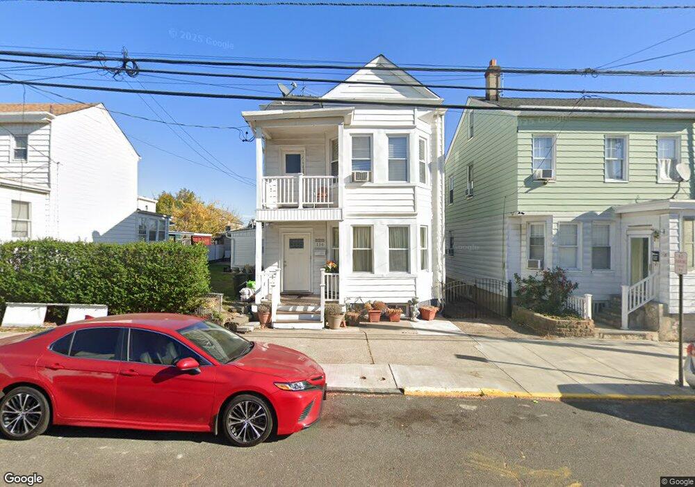
130 Sherman Ave Unit 132 Paterson, NJ 07502
Totowa Section NeighborhoodEstimated Value: $517,000 - $627,000
4
Beds
1
Bath
2,326
Sq Ft
$251/Sq Ft
Est. Value
About This Home
This home is located at 130 Sherman Ave Unit 132, Paterson, NJ 07502 and is currently estimated at $584,005, approximately $251 per square foot. 130 Sherman Ave Unit 132 is a home located in Passaic County with nearby schools including Edward W. Kilpatrick School of Discovery, Dale Avenue Elementary School, and Paterson Public School No. 5.
Ownership History
Date
Name
Owned For
Owner Type
Purchase Details
Closed on
Aug 26, 2016
Sold by
Paucar Wilson
Bought by
Paucar Carolina and Paucar Wilson
Current Estimated Value
Home Financials for this Owner
Home Financials are based on the most recent Mortgage that was taken out on this home.
Interest Rate
3.43%
Purchase Details
Closed on
Jan 21, 2005
Sold by
Bermudez Carlos
Bought by
Wilson Paucar
Home Financials for this Owner
Home Financials are based on the most recent Mortgage that was taken out on this home.
Original Mortgage
$255,526
Interest Rate
5.56%
Mortgage Type
FHA
Create a Home Valuation Report for This Property
The Home Valuation Report is an in-depth analysis detailing your home's value as well as a comparison with similar homes in the area
Home Values in the Area
Average Home Value in this Area
Purchase History
| Date | Buyer | Sale Price | Title Company |
|---|---|---|---|
| Paucar Carolina | -- | -- | |
| Wilson Paucar | $265,000 | -- |
Source: Public Records
Mortgage History
| Date | Status | Borrower | Loan Amount |
|---|---|---|---|
| Closed | Paucar Carolina | -- | |
| Previous Owner | Wilson Paucar | $255,526 |
Source: Public Records
Tax History Compared to Growth
Tax History
| Year | Tax Paid | Tax Assessment Tax Assessment Total Assessment is a certain percentage of the fair market value that is determined by local assessors to be the total taxable value of land and additions on the property. | Land | Improvement |
|---|---|---|---|---|
| 2025 | $12,172 | $238,900 | $56,300 | $182,600 |
| 2024 | $11,713 | $238,900 | $56,300 | $182,600 |
| 2022 | $11,090 | $238,900 | $56,300 | $182,600 |
| 2021 | $10,693 | $238,900 | $56,300 | $182,600 |
| 2020 | $9,974 | $238,900 | $56,300 | $182,600 |
| 2019 | $9,562 | $231,300 | $53,000 | $178,300 |
| 2018 | $9,868 | $228,100 | $52,600 | $175,500 |
| 2017 | $9,418 | $226,400 | $52,300 | $174,100 |
| 2016 | $9,745 | $224,600 | $55,000 | $169,600 |
| 2015 | $9,227 | $224,600 | $55,000 | $169,600 |
| 2014 | $11,185 | $385,700 | $183,800 | $201,900 |
Source: Public Records
Map
Nearby Homes
- 94 Manchester Ave
- 100 Albion Ave
- 255 Paterson Ave Unit 257
- 255-257 Paterson Ave
- 150 Redwood Ave
- 6 Doremus St
- 271-273 Preakness Ave
- 2 Colonial Ave
- 202 Kearney St
- 371 Totowa Ave Unit 373
- 28 Plymouth Rd
- 249 Edmund Ave
- 235 Marion St Unit 237
- 195 Preakness Ave
- 194-196 Union Ave
- 241 Liberty St
- 262-280 Chamberlain Ave Unit 4
- 48 Jasper St
- 13 Garrison St
- 515 Union Ave
- 128 Sherman Ave
- 134 Sherman Ave
- 124 Sherman Ave Unit 126
- 124 Sherman Ave Unit 2
- 386 Crosby Ave Unit 388
- 382 Crosby Ave Unit 384
- 384 Crosby Ave Unit 386
- 382-384 Crosby Ave
- 131 Sherman Ave
- 129 Sherman Ave Unit 131
- 127 Sheridan Ave
- 125 Sheridan Ave
- 135 Sheridan Ave
- 125 Sherman Ave Unit 127
- 123 Sheridan Ave
- 118 Sherman Ave
- 129-131 Sherman Ave
- 390 Crosby Ave Unit 392
- 133 Sherman Ave Unit 135
- 390-392 Crosby Ave