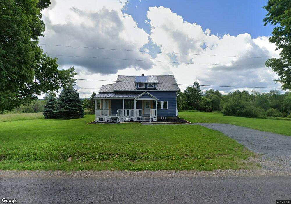
130 Smith Rd Hermon, NY 13652
Estimated Value: $82,000 - $115,000
3
Beds
1
Bath
940
Sq Ft
$100/Sq Ft
Est. Value
About This Home
This home is located at 130 Smith Rd, Hermon, NY 13652 and is currently estimated at $94,457, approximately $100 per square foot. 130 Smith Rd is a home located in St. Lawrence County with nearby schools including Edwards-Knox Elementary School and Edwards-Knox Junior/Senior High School.
Ownership History
Date
Name
Owned For
Owner Type
Purchase Details
Closed on
Nov 7, 2023
Sold by
County Of St Lawrence
Bought by
Peterson Frederick and Peterson Jeanrette
Current Estimated Value
Purchase Details
Closed on
Sep 9, 2013
Sold by
Roberson Clint
Bought by
Carpenter Veronica J and Weaver Terry L
Home Financials for this Owner
Home Financials are based on the most recent Mortgage that was taken out on this home.
Original Mortgage
$44,800
Interest Rate
3.25%
Mortgage Type
New Conventional
Create a Home Valuation Report for This Property
The Home Valuation Report is an in-depth analysis detailing your home's value as well as a comparison with similar homes in the area
Home Values in the Area
Average Home Value in this Area
Purchase History
| Date | Buyer | Sale Price | Title Company |
|---|---|---|---|
| Peterson Frederick | $35,000 | None Listed On Document | |
| Carpenter Veronica J | $56,000 | None Available |
Source: Public Records
Mortgage History
| Date | Status | Borrower | Loan Amount |
|---|---|---|---|
| Previous Owner | Carpenter Veronica J | $44,800 |
Source: Public Records
Tax History Compared to Growth
Tax History
| Year | Tax Paid | Tax Assessment Tax Assessment Total Assessment is a certain percentage of the fair market value that is determined by local assessors to be the total taxable value of land and additions on the property. | Land | Improvement |
|---|---|---|---|---|
| 2024 | $1,713 | $38,300 | $6,500 | $31,800 |
| 2023 | $1,563 | $38,300 | $6,500 | $31,800 |
| 2022 | $1,579 | $38,300 | $6,500 | $31,800 |
| 2021 | $1,603 | $38,300 | $6,500 | $31,800 |
| 2020 | $1,898 | $38,300 | $6,500 | $31,800 |
| 2019 | $1,609 | $38,300 | $6,500 | $31,800 |
| 2018 | $1,609 | $38,300 | $6,500 | $31,800 |
| 2017 | $1,348 | $38,300 | $6,500 | $31,800 |
| 2016 | $1,332 | $38,300 | $6,500 | $31,800 |
| 2015 | -- | $38,300 | $6,500 | $31,800 |
| 2014 | -- | $38,300 | $6,500 | $31,800 |
Source: Public Records
Map
Nearby Homes
- 779 County Route 25
- 18 Pyrites Russell Rd
- 1472 Cr 17
- Burnell Rd
- 00 Burnell Rd
- 0 County Route 19 Unit 51602
- 432 Blanchard Hill Rd
- 122 Main St
- 111 Main St
- 108 Main St
- 9 Boyd Pond Rd
- 9 Boyd Pond Rd Unit 387
- 0 Boyd Pond Rd Unit 25475186
- 00 Boyd Pond Rd Unit Lot 8 & 9
- 00 Owl Pond Rd Pvt
- 5533 County Route 24
- 119 Mackin Rd
- 590 County Road 17
- 590 Cr 17 Rd
- 5730 County Road 24
- 0 Smith Rd
- 273 Cr 25
- 355 County Route 25
- 260 West Rd
- 198 County Road 25
- 279 West Rd Unit 285
- 326 County Route 25
- 372 County Route 25
- 278 County Route 25
- 259 County Route 25
- 353 West Rd
- 107 Hewlett Rd
- 361 White Rd
- 331 West Rd
- 458 County Route 25
- 212 County Route 25
- 198 County Route 25
- 198 County Road 25
- 474 County Route 25
- 484 County Route 25