Estimated Value: $211,000 - $955,189
4
Beds
1
Bath
1,523
Sq Ft
$383/Sq Ft
Est. Value
About This Home
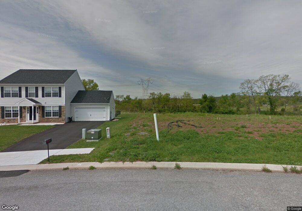
This home is located at 130 Smith Rd, York, PA 17406 and is currently estimated at $583,095, approximately $382 per square foot. 130 Smith Rd is a home located in York County with nearby schools including Northeastern Senior High School and Bible Baptist Christian Academy.
Ownership History
Date
Name
Owned For
Owner Type
Purchase Details
Closed on
Dec 31, 2002
Sold by
Warfield Mangold Partnership
Bought by
Wandering Streams Inc
Current Estimated Value
Home Financials for this Owner
Home Financials are based on the most recent Mortgage that was taken out on this home.
Original Mortgage
$98,300
Interest Rate
3.62%
Mortgage Type
Purchase Money Mortgage
Purchase Details
Closed on
Dec 6, 2002
Sold by
Haverstock Kathy A and Neubauer Linda A
Bought by
Painter Winnifred W
Home Financials for this Owner
Home Financials are based on the most recent Mortgage that was taken out on this home.
Original Mortgage
$98,300
Interest Rate
3.62%
Mortgage Type
Purchase Money Mortgage
Create a Home Valuation Report for This Property
The Home Valuation Report is an in-depth analysis detailing your home's value as well as a comparison with similar homes in the area
Home Values in the Area
Average Home Value in this Area
Purchase History
| Date | Buyer | Sale Price | Title Company |
|---|---|---|---|
| Wandering Streams Inc | $400,000 | First American Title Ins Co | |
| Painter Winnifred W | $122,900 | -- |
Source: Public Records
Mortgage History
| Date | Status | Borrower | Loan Amount |
|---|---|---|---|
| Previous Owner | Painter Winnifred W | $98,300 |
Source: Public Records
Tax History Compared to Growth
Tax History
| Year | Tax Paid | Tax Assessment Tax Assessment Total Assessment is a certain percentage of the fair market value that is determined by local assessors to be the total taxable value of land and additions on the property. | Land | Improvement |
|---|---|---|---|---|
| 2025 | -- | $0 | $0 | $0 |
| 2024 | -- | $0 | $0 | $0 |
| 2023 | $0 | $0 | $0 | $0 |
| 2022 | $3,174 | $0 | $0 | $0 |
| 2021 | $3,174 | $0 | $0 | $0 |
| 2020 | $3,174 | $0 | $0 | $0 |
| 2019 | $3,174 | $94,760 | $94,760 | $0 |
| 2018 | $5,418 | $162,520 | $96,240 | $66,280 |
| 2017 | $5,418 | $162,520 | $96,240 | $66,280 |
| 2016 | $0 | $162,520 | $96,240 | $66,280 |
| 2015 | -- | $162,520 | $96,240 | $66,280 |
| 2014 | -- | $162,520 | $96,240 | $66,280 |
Source: Public Records
Map
Nearby Homes
- 1145 Stone Gate Dr
- 175 Stone Creek Dr
- 45 Stony Run Way
- 240 Fisher Dr
- 365 Fisher Dr
- 435 Fisher Dr
- 645 Fisher Dr
- 810 Copenhaffer Rd
- 15 Eli Dr
- 19 Eli Dr
- 120 Eli Dr
- 115 Eli Dr
- 130 Eli Dr
- 5 Witmer Rd
- 140 Eli Dr
- 151 Eli Dr
- 595 Locust Point Rd
- 225 E Canal Rd
- Woodford Plan at Welbourne Reserve
- Sebastian Plan at Welbourne Reserve
- 25 Quarry Run Place Unit 116
- 35 Quarry Run Place Unit 117
- 15 Quarry Run Place Unit 115
- 40 Quarry Run Place Unit 135
- 10 Quarry Run Place Unit 137
- 45 Quarry Run Place Unit 118
- 5 Quarry Run Place Unit 114
- 65 Old Stone Way Unit 138
- 95 Wickfield Place Unit 134
- 55 Quarry Run Place Unit 119 PAYK2003194
- 55 Old Stone Way Unit 139
- 85 Wickfield Place Unit 133
- 45 Old Stone Way Unit 140
- 115 Old Stone Way Unit 113
- 65 Quarry Run Place Unit 120
- 90 Old Stone Way Unit 144
- 80 Old Stone Way Unit 143
- 100 Old Stone Way Unit 145
- 110 Old Stone Way Unit 146
- 70 Old Stone Way Unit 142