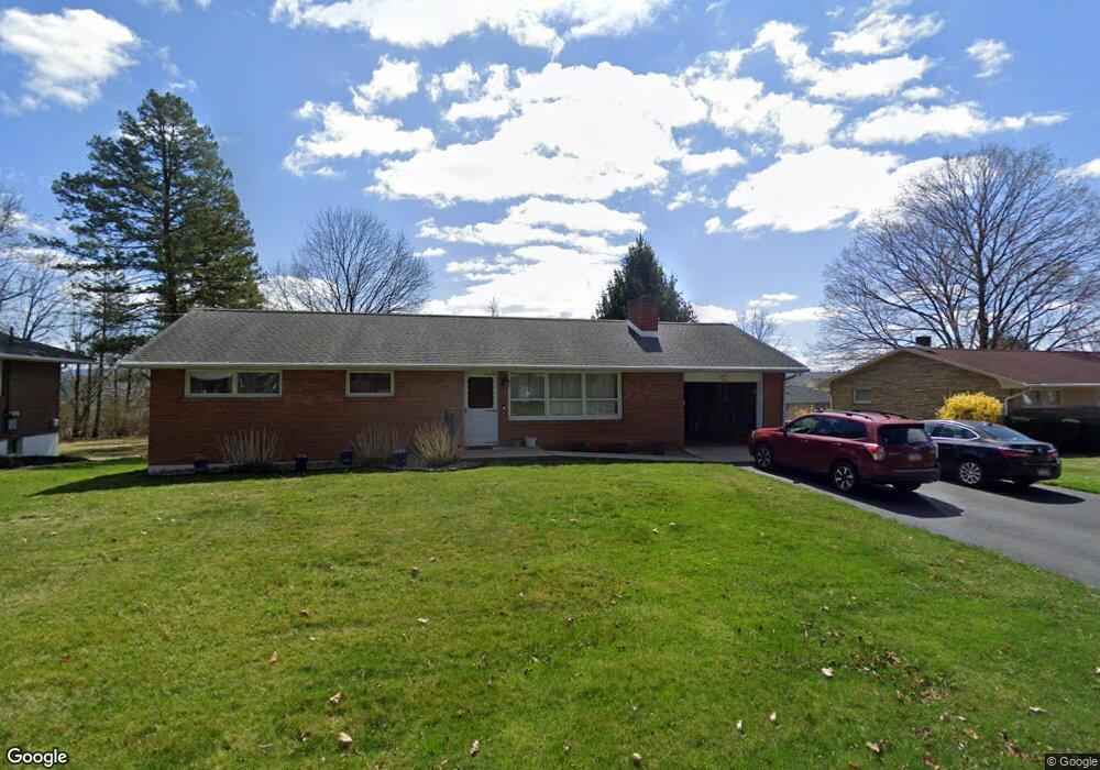
130 W Clearview Ave State College, PA 16803
Patton NeighborhoodEstimated Value: $273,000 - $489,000
3
Beds
1
Bath
1,150
Sq Ft
$299/Sq Ft
Est. Value
About This Home
This home is located at 130 W Clearview Ave, State College, PA 16803 and is currently estimated at $343,437, approximately $298 per square foot. 130 W Clearview Ave is a home located in Centre County with nearby schools including Park Forest Elementary School, Park Forest Middle School, and State College Area High School.
Ownership History
Date
Name
Owned For
Owner Type
Purchase Details
Closed on
Jun 13, 2018
Sold by
Troup Jeanette
Bought by
Troup Jason P and Troup Tana E
Current Estimated Value
Home Financials for this Owner
Home Financials are based on the most recent Mortgage that was taken out on this home.
Original Mortgage
$174,500
Outstanding Balance
$150,913
Interest Rate
4.5%
Mortgage Type
New Conventional
Estimated Equity
$192,524
Purchase Details
Closed on
Sep 28, 1965
Bought by
Troup Lavern and Troup Jeanette
Create a Home Valuation Report for This Property
The Home Valuation Report is an in-depth analysis detailing your home's value as well as a comparison with similar homes in the area
Home Values in the Area
Average Home Value in this Area
Purchase History
| Date | Buyer | Sale Price | Title Company |
|---|---|---|---|
| Troup Jason P | $237,000 | None Available | |
| Troup Lavern | $19,500 | -- |
Source: Public Records
Mortgage History
| Date | Status | Borrower | Loan Amount |
|---|---|---|---|
| Open | Troup Jason P | $174,500 |
Source: Public Records
Tax History Compared to Growth
Tax History
| Year | Tax Paid | Tax Assessment Tax Assessment Total Assessment is a certain percentage of the fair market value that is determined by local assessors to be the total taxable value of land and additions on the property. | Land | Improvement |
|---|---|---|---|---|
| 2025 | $2,894 | $41,545 | $7,425 | $34,120 |
| 2024 | $2,700 | $41,545 | $7,425 | $34,120 |
| 2023 | $2,700 | $41,545 | $7,425 | $34,120 |
| 2022 | $2,635 | $41,545 | $7,425 | $34,120 |
| 2021 | $2,635 | $41,545 | $7,425 | $34,120 |
| 2020 | $2,635 | $41,545 | $7,425 | $34,120 |
| 2019 | $1,806 | $41,545 | $7,425 | $34,120 |
| 2018 | $2,554 | $41,545 | $7,425 | $34,120 |
| 2017 | $2,526 | $41,545 | $7,425 | $34,120 |
| 2016 | -- | $41,545 | $7,425 | $34,120 |
| 2015 | -- | $41,545 | $7,425 | $34,120 |
| 2014 | -- | $41,545 | $7,425 | $34,120 |
Source: Public Records
Map
Nearby Homes
- 1832 Waddle Rd
- 159 Bolton Ave
- 1918 Weaver St Unit 1
- 257 Oakwood Ave
- 2074 Mary Ellen Ln
- 658 -A Oakwood Ave
- 652 B Oakwood Ave
- 1121 W Aaron Dr Unit C
- 174 Dean's Way
- Bayberry Plan at Honors Crossing II
- Dartmouth Plan at Honors Crossing II
- Newport Plan at Honors Crossing II
- Crestmont Plan at Honors Crossing II
- Wyndham Plan at Honors Crossing II
- Aspen Plan at Honors Crossing II
- Greenwood Plan at Honors Crossing II
- 613 Wiltshire Dr
- 1635 Princeton Dr
- 1952 Highland Dr
- 137 Deans Way
- 120 W Clearview Ave
- 136 W Clearview Ave
- 243 Bolton Ave
- 231 Bolton Ave
- 116 W Clearview Ave
- 142 W Clearview Ave
- 223 Bolton Ave
- 125 W Clearview Ave
- 123 W Clearview Ave
- 135 W Clearview Ave
- 117 W Clearview Ave
- 253 Bolton Ave
- 145 W Clearview Ave
- 148 W Clearview Ave
- 232 Bolton Ave Unit 23
- 232 Bolton Ave
- 205 Bolton Ave
- 240 Bolton Ave
- 102 W Clearview Ave
- 111 W Clearview Ave