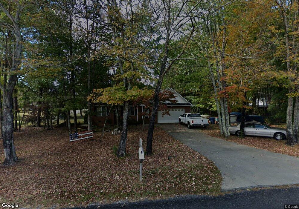
130 Walt Wilson Rd Mocksville, NC 27028
Estimated Value: $277,000 - $321,000
3
Beds
2
Baths
1,508
Sq Ft
$197/Sq Ft
Est. Value
About This Home
This home is located at 130 Walt Wilson Rd, Mocksville, NC 27028 and is currently estimated at $297,418, approximately $197 per square foot. 130 Walt Wilson Rd is a home located in Davie County with nearby schools including Cornatzer Elementary School, William Ellis Middle School, and Davie County High School.
Ownership History
Date
Name
Owned For
Owner Type
Purchase Details
Closed on
Jan 10, 2017
Sold by
Osborne Edgar Britt and Osborne Rebecca W
Bought by
Reasner Daniel J and Reasner Tammy
Current Estimated Value
Home Financials for this Owner
Home Financials are based on the most recent Mortgage that was taken out on this home.
Original Mortgage
$151,010
Outstanding Balance
$124,588
Interest Rate
4.16%
Mortgage Type
New Conventional
Estimated Equity
$172,830
Purchase Details
Closed on
Apr 22, 2014
Sold by
Osborne Brittin S
Bought by
Osborne Edgar Britt and Osborne Rebecca W
Purchase Details
Closed on
Mar 1, 1998
Purchase Details
Closed on
Mar 1, 1995
Create a Home Valuation Report for This Property
The Home Valuation Report is an in-depth analysis detailing your home's value as well as a comparison with similar homes in the area
Home Values in the Area
Average Home Value in this Area
Purchase History
| Date | Buyer | Sale Price | Title Company |
|---|---|---|---|
| Reasner Daniel J | $149,500 | None Available | |
| Osborne Edgar Britt | $136,000 | None Available | |
| -- | $119,000 | -- | |
| -- | $11,500 | -- |
Source: Public Records
Mortgage History
| Date | Status | Borrower | Loan Amount |
|---|---|---|---|
| Open | Reasner Daniel J | $151,010 |
Source: Public Records
Tax History Compared to Growth
Tax History
| Year | Tax Paid | Tax Assessment Tax Assessment Total Assessment is a certain percentage of the fair market value that is determined by local assessors to be the total taxable value of land and additions on the property. | Land | Improvement |
|---|---|---|---|---|
| 2025 | $2,029 | $294,650 | $56,000 | $238,650 |
| 2024 | $1,193 | $154,290 | $22,000 | $132,290 |
| 2023 | $1,193 | $154,290 | $22,000 | $132,290 |
| 2022 | $1,193 | $154,290 | $22,000 | $132,290 |
| 2021 | $1,193 | $154,290 | $22,000 | $132,290 |
| 2020 | $1,126 | $144,780 | $22,000 | $122,780 |
| 2019 | $1,126 | $144,780 | $22,000 | $122,780 |
| 2018 | $1,126 | $144,780 | $22,000 | $122,780 |
| 2017 | $1,112 | $144,780 | $0 | $0 |
| 2016 | $1,138 | $148,120 | $0 | $0 |
| 2015 | $1,138 | $148,120 | $0 | $0 |
| 2014 | $978 | $148,120 | $0 | $0 |
| 2013 | -- | $148,120 | $0 | $0 |
Source: Public Records
Map
Nearby Homes
- 124 E Chinaberry Ct
- 232 Walt Wilson Rd
- 130 Turrentine Church Rd
- 157 Twin Cedars Dr Unit 3
- 157 Twin Cedars Golf Rd
- 718 Deadmon Rd
- 876 Deadmon Rd
- 882 Deadmon Rd
- 890 Deadmon Rd
- 898 Deadmon Rd
- 906 Deadmon Rd
- 916 Deadmon Rd
- LOT 35 Rhode Island Ct
- LOT 34 Rhode Island Ct
- LOT 33 Rhode Island Ct
- LOT 37 Rhode Island Ct
- LOT 31 Rhode Island Ct
- LOT 30 Rhode Island Ct
- LOT 27 Rhode Island Ct
- LOT 26 Rhode Island Ct
- 140 Walt Wilson Rd
- 140 Walt Wilson Rd Unit 11
- 312 Deadmon Rd
- 125 E Chinaberry Ct
- 304 Deadmon Rd
- 131 Walt Wilson Rd
- 296 Deadmon Rd
- 117 E Chinaberry Ct
- 288 Deadmon Rd
- 328 Deadmon Rd
- 109 E Chinaberry Ct
- 110 E Chinaberry Ct
- 280 Deadmon Rd
- 16 S Arbor Rd
- 21 S Arbor Rd
- 17 S Arbor Rd
- 13 S Arbor Rd
- 15 S Arbor Rd
- 20 S Arbor Rd
- 0 S Arbor Rd