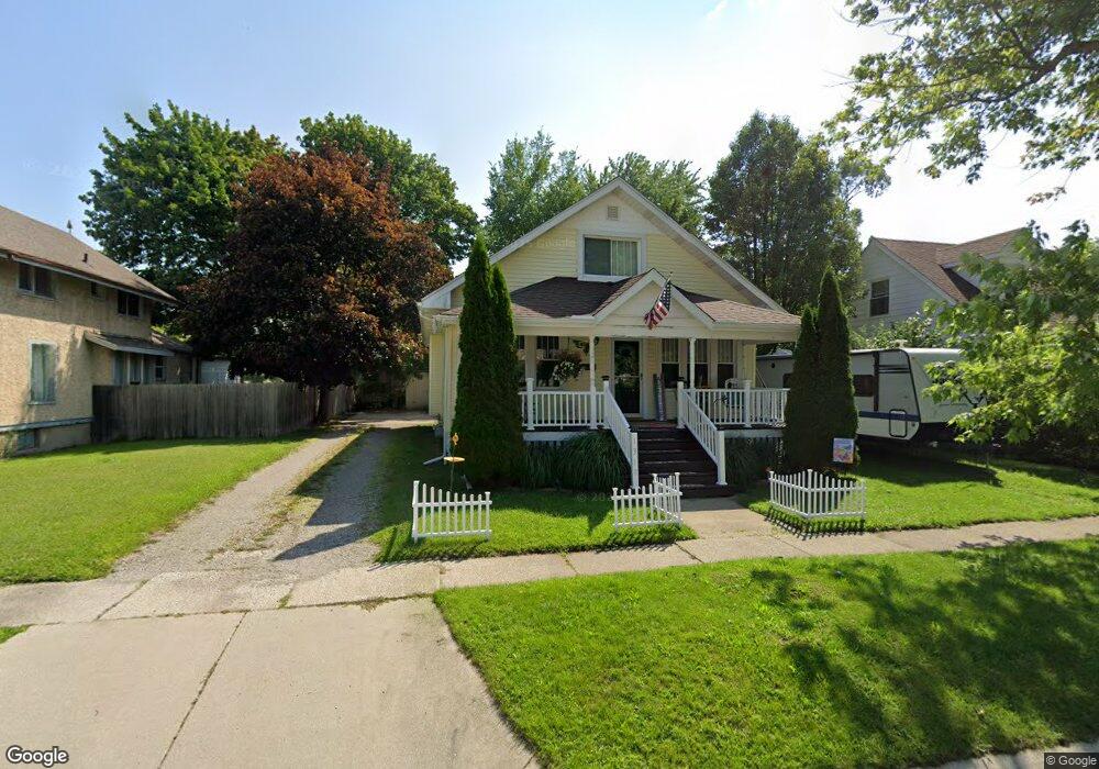
1300 12th St Port Huron, MI 48060
Estimated Value: $61,000 - $203,000
--
Bed
--
Bath
--
Sq Ft
6,621
Sq Ft Lot
About This Home
This home is located at 1300 12th St, Port Huron, MI 48060 and is currently estimated at $143,333. 1300 12th St is a home located in St. Clair County with nearby schools including Woodrow Wilson Elementary School, Central Middle School, and Port Huron High School.
Ownership History
Date
Name
Owned For
Owner Type
Purchase Details
Closed on
Sep 29, 2023
Sold by
Ikera John Kenneth
Bought by
Patriot Rei Port Huron Llc
Current Estimated Value
Purchase Details
Closed on
Dec 2, 2022
Sold by
Ikera John K
Bought by
Ikera John K
Create a Home Valuation Report for This Property
The Home Valuation Report is an in-depth analysis detailing your home's value as well as a comparison with similar homes in the area
Home Values in the Area
Average Home Value in this Area
Purchase History
| Date | Buyer | Sale Price | Title Company |
|---|---|---|---|
| Patriot Rei Port Huron Llc | $288,000 | None Listed On Document | |
| Ikera John K | -- | -- | |
| Ikera John K | -- | None Listed On Document |
Source: Public Records
Tax History Compared to Growth
Tax History
| Year | Tax Paid | Tax Assessment Tax Assessment Total Assessment is a certain percentage of the fair market value that is determined by local assessors to be the total taxable value of land and additions on the property. | Land | Improvement |
|---|---|---|---|---|
| 2025 | $186 | $2,700 | $0 | $0 |
| 2024 | $174 | $3,100 | $0 | $0 |
| 2023 | $158 | $3,400 | $0 | $0 |
| 2022 | $169 | $2,700 | $0 | $0 |
| 2021 | $167 | $2,700 | $0 | $0 |
| 2020 | $170 | $2,700 | $2,700 | $0 |
| 2019 | $170 | $3,400 | $0 | $0 |
| 2018 | $208 | $3,400 | $0 | $0 |
| 2017 | $191 | $3,400 | $0 | $0 |
| 2016 | $173 | $3,400 | $0 | $0 |
| 2015 | $172 | $3,200 | $3,200 | $0 |
| 2014 | $172 | $3,200 | $3,200 | $0 |
| 2013 | -- | $3,200 | $0 | $0 |
Source: Public Records
Map
Nearby Homes
- 1300 12th St
- 1300/1314 12th St Unit Vacant Lot 12th Ave
- 1314 12th St
- 1128 Union St
- 1136 Union St
- 1322 12th St
- 1326 12th St
- 1304 12th St
- 1123 Chestnut St
- 1129 Chestnut St
- 1311 12th St
- 1117 Chestnut St
- 1133 Chestnut St
- 1319 12th St
- 1303 12th St
- 1113 Chestnut St
- 1120 Union St
- 1325 12th St
- 1315 11th St
- 1230 12th St