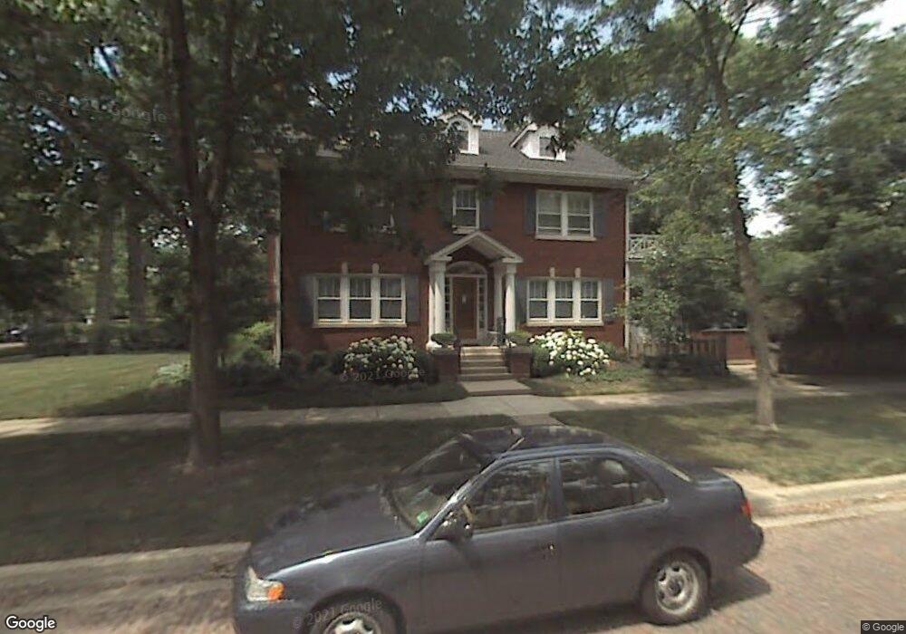
1300 Ashland Ave Wilmette, IL 60091
Estimated Value: $1,818,000 - $2,039,000
5
Beds
4
Baths
2,860
Sq Ft
$678/Sq Ft
Est. Value
About This Home
This home is located at 1300 Ashland Ave, Wilmette, IL 60091 and is currently estimated at $1,938,567, approximately $677 per square foot. 1300 Ashland Ave is a home located in Cook County with nearby schools including Central Elementary School, Highcrest Middle School, and Wilmette Junior High School.
Ownership History
Date
Name
Owned For
Owner Type
Purchase Details
Closed on
Jul 21, 1998
Sold by
Wiscomb Thomas T and Wiscomb Eloise P
Bought by
Stone David I and Stone Laura B
Current Estimated Value
Home Financials for this Owner
Home Financials are based on the most recent Mortgage that was taken out on this home.
Original Mortgage
$227,150
Outstanding Balance
$46,606
Interest Rate
7.03%
Estimated Equity
$1,891,961
Create a Home Valuation Report for This Property
The Home Valuation Report is an in-depth analysis detailing your home's value as well as a comparison with similar homes in the area
Home Values in the Area
Average Home Value in this Area
Purchase History
| Date | Buyer | Sale Price | Title Company |
|---|---|---|---|
| Stone David I | $750,000 | -- |
Source: Public Records
Mortgage History
| Date | Status | Borrower | Loan Amount |
|---|---|---|---|
| Open | Stone David I | $227,150 |
Source: Public Records
Tax History Compared to Growth
Tax History
| Year | Tax Paid | Tax Assessment Tax Assessment Total Assessment is a certain percentage of the fair market value that is determined by local assessors to be the total taxable value of land and additions on the property. | Land | Improvement |
|---|---|---|---|---|
| 2024 | $26,209 | $121,469 | $24,200 | $97,269 |
| 2023 | $28,396 | $138,371 | $24,200 | $114,171 |
| 2022 | $28,396 | $138,371 | $24,200 | $114,171 |
| 2021 | $19,763 | $82,067 | $21,120 | $60,947 |
| 2020 | $22,876 | $92,620 | $21,120 | $71,500 |
| 2019 | $23,615 | $106,949 | $21,120 | $85,829 |
| 2018 | $22,047 | $96,107 | $17,600 | $78,507 |
| 2017 | $21,451 | $96,107 | $17,600 | $78,507 |
| 2016 | $22,517 | $106,088 | $17,600 | $88,488 |
| 2015 | $20,867 | $86,678 | $14,520 | $72,158 |
| 2014 | $22,483 | $94,600 | $14,520 | $80,080 |
| 2013 | $21,457 | $94,600 | $14,520 | $80,080 |
Source: Public Records
Map
Nearby Homes
- 1120 Chestnut Ave
- 1245 Richmond Ln
- 330 Abbotsford Rd
- 1241 Forest Ave
- 1118 Forest Ave
- 159 Abingdon Ave
- 1227 16th St
- 145 Oxford Rd
- 924 Chestnut Ave
- 321 Leicester Rd
- 507 Kenilworth Ave
- 1606 Forest Ave
- 111 Oxford Rd
- 621 Green Bay Rd
- 724 12th St Unit 105
- 830 Chestnut Ave
- 1617 Forest Ave
- 517 Cumnor Rd
- 149 Kenilworth Ave
- 219 Sheridan Rd
- 1306 Ashland Ave
- 1310 Ashland Ave
- 1238 Ashland Ave
- 1314 Ashland Ave
- 1316 Ashland Ave
- 1301 Chestnut Ave
- 1234 Ashland Ave
- 1307 Chestnut Ave
- 1251 Chestnut Ave
- 1320 Ashland Ave
- 1315 Chestnut Ave
- 1301 Ashland Ave
- 1307 Ashland Ave
- 1311 Ashland Ave
- 1226 Ashland Ave
- 1247 Chestnut Ave
- 1319 Chestnut Ave
- 1241 Ashland Ave
- 1315 Ashland Ave
- 1326 Ashland Ave