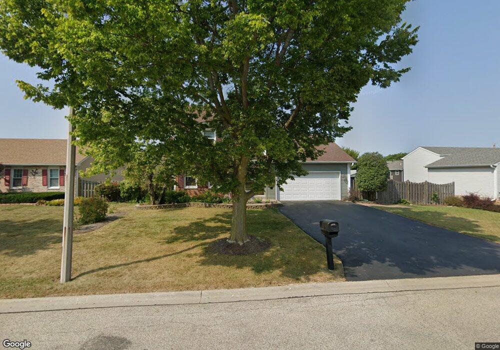
1300 Butterfield Ln Zion, IL 60099
West Zion NeighborhoodEstimated Value: $303,000 - $325,000
3
Beds
3
Baths
1,590
Sq Ft
$196/Sq Ft
Est. Value
About This Home
This home is located at 1300 Butterfield Ln, Zion, IL 60099 and is currently estimated at $311,147, approximately $195 per square foot. 1300 Butterfield Ln is a home located in Lake County with nearby schools including Newport Elementary School, Beach Park Middle School, and Zion-Benton Township High School.
Ownership History
Date
Name
Owned For
Owner Type
Purchase Details
Closed on
Jul 2, 2003
Sold by
Luppino Frank and Luppino Katherine A
Bought by
Jakaitis Lawrence and Jakaitis Susan
Current Estimated Value
Home Financials for this Owner
Home Financials are based on the most recent Mortgage that was taken out on this home.
Original Mortgage
$110,000
Outstanding Balance
$46,907
Interest Rate
5.3%
Mortgage Type
Unknown
Estimated Equity
$264,240
Purchase Details
Closed on
Jul 15, 1995
Sold by
Beverly Trust Company
Bought by
Luppino Frank and Luppino Katherine A
Home Financials for this Owner
Home Financials are based on the most recent Mortgage that was taken out on this home.
Original Mortgage
$144,377
Interest Rate
7.5%
Mortgage Type
FHA
Create a Home Valuation Report for This Property
The Home Valuation Report is an in-depth analysis detailing your home's value as well as a comparison with similar homes in the area
Home Values in the Area
Average Home Value in this Area
Purchase History
| Date | Buyer | Sale Price | Title Company |
|---|---|---|---|
| Jakaitis Lawrence | $190,000 | Matc | |
| Luppino Frank | $148,000 | Chicago Title Insurance Co |
Source: Public Records
Mortgage History
| Date | Status | Borrower | Loan Amount |
|---|---|---|---|
| Open | Jakaitis Lawrence | $110,000 | |
| Previous Owner | Luppino Frank | $144,377 |
Source: Public Records
Tax History Compared to Growth
Tax History
| Year | Tax Paid | Tax Assessment Tax Assessment Total Assessment is a certain percentage of the fair market value that is determined by local assessors to be the total taxable value of land and additions on the property. | Land | Improvement |
|---|---|---|---|---|
| 2024 | $6,016 | $70,756 | $9,938 | $60,818 |
| 2023 | $6,016 | $63,085 | $8,861 | $54,224 |
| 2022 | $6,894 | $63,840 | $7,270 | $56,570 |
| 2021 | $6,740 | $59,888 | $6,820 | $53,068 |
| 2020 | $6,445 | $56,328 | $6,415 | $49,913 |
| 2019 | $6,214 | $52,472 | $5,976 | $46,496 |
| 2018 | $5,676 | $48,466 | $5,420 | $43,046 |
| 2017 | $5,526 | $44,959 | $5,028 | $39,931 |
| 2016 | $5,017 | $40,812 | $4,564 | $36,248 |
| 2015 | $4,699 | $37,031 | $4,141 | $32,890 |
| 2014 | $5,340 | $36,305 | $4,000 | $32,305 |
| 2012 | $5,786 | $38,664 | $4,260 | $34,404 |
Source: Public Records
Map
Nearby Homes
- 1302 Lorelei Dr
- 1304 Lorelei Dr
- 1417 Westside Trail
- 4014 Ridge Rd
- 3717 Willow Crest Dr
- 908 Countrywood Dr
- 3707 Willow Crest Dr
- 0 9th St
- 4539 Illinois 173
- 4533 Illinois 173
- 1304 Pelican Ct
- 41320 N Green Bay Rd
- 1916 Sunshine Ct
- 2010 Sunset Ct
- 1531 Southport Ct
- 1521 Southport Ct
- 1405 Lewis Ave
- 42334 N Heritage Lot 7 Trail
- 12434 W Van Ct
- 1817 Joppa Ave
- 1216 Butterfield Ln
- 1302 Butterfield Ln
- 1301 Reed Rd
- 1235 Pheasant Run
- 1214 Butterfield Ln
- 3800 Tickseed Dr
- 1304 Butterfield Ln
- 4210 Highland Rd
- 4211 Highland Rd
- 1237 Pheasant Run
- 1303 Reed Rd
- 1215 Butterfield Ln
- 1306 Butterfield Ln
- 4208 Highland Rd
- 3802 Tickseed Dr
- 1239 Pheasant Run
- 4209 Highland Rd
- 4210 Heather Ct
- 1305 Reed Rd
- 1227 Pheasant Run