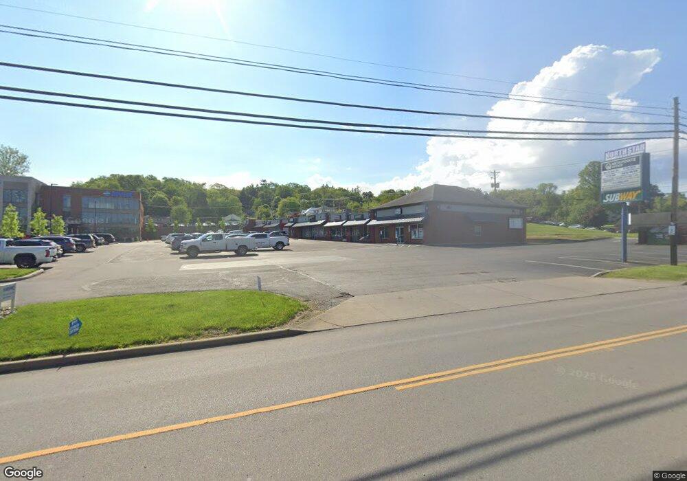
1300 Clark St Unit 1 Cambridge, OH 43725
Estimated Value: $2,179,122
--
Bed
--
Bath
2,128
Sq Ft
$1,024/Sq Ft
Est. Value
About This Home
This home is located at 1300 Clark St Unit 1, Cambridge, OH 43725 and is currently estimated at $2,179,122, approximately $1,024 per square foot. 1300 Clark St Unit 1 is a home located in Guernsey County with nearby schools including Cambridge High School and St. Benedict Elementary School.
Ownership History
Date
Name
Owned For
Owner Type
Purchase Details
Closed on
Dec 20, 2022
Sold by
Lehotay Thomas Michael and Lehotay Michelle Lynn
Bought by
Northstar Suites Llc
Current Estimated Value
Purchase Details
Closed on
Sep 7, 2022
Sold by
Northstar Investments Llc
Bought by
Lehotay Thomas Michael and Lehotay Michelle Lynn
Home Financials for this Owner
Home Financials are based on the most recent Mortgage that was taken out on this home.
Original Mortgage
$1,275,000
Interest Rate
5.3%
Mortgage Type
New Conventional
Purchase Details
Closed on
Aug 18, 2017
Sold by
Northstar Investments Llc
Bought by
Muskingum Valley Health Centers
Create a Home Valuation Report for This Property
The Home Valuation Report is an in-depth analysis detailing your home's value as well as a comparison with similar homes in the area
Home Values in the Area
Average Home Value in this Area
Purchase History
| Date | Buyer | Sale Price | Title Company |
|---|---|---|---|
| Northstar Suites Llc | -- | -- | |
| Lehotay Thomas Michael | $1,800,000 | None Listed On Document | |
| Lehotay Thomas Michael | $1,800,000 | None Listed On Document | |
| Muskingum Valley Health Centers | $500,000 | S E D Title Agency |
Source: Public Records
Mortgage History
| Date | Status | Borrower | Loan Amount |
|---|---|---|---|
| Previous Owner | Lehotay Thomas Michael | $1,275,000 |
Source: Public Records
Tax History Compared to Growth
Tax History
| Year | Tax Paid | Tax Assessment Tax Assessment Total Assessment is a certain percentage of the fair market value that is determined by local assessors to be the total taxable value of land and additions on the property. | Land | Improvement |
|---|---|---|---|---|
| 2024 | $13,555 | $222,161 | $47,315 | $174,846 |
| 2023 | $13,555 | $215,285 | $40,439 | $174,846 |
| 2022 | $12,895 | $215,290 | $40,440 | $174,850 |
| 2021 | $12,782 | $215,290 | $40,440 | $174,850 |
| 2020 | $12,059 | $197,110 | $36,760 | $160,350 |
| 2019 | $11,989 | $197,110 | $36,760 | $160,350 |
| 2018 | $13,028 | $197,110 | $36,760 | $160,350 |
| 2017 | $14,669 | $246,670 | $86,320 | $160,350 |
| 2016 | $14,695 | $246,670 | $86,320 | $160,350 |
| 2015 | $14,695 | $246,670 | $86,320 | $160,350 |
| 2014 | -- | $227,620 | $75,060 | $152,560 |
| 2013 | $13,564 | $220,490 | $75,060 | $145,430 |
Source: Public Records
Map
Nearby Homes
- 1121 Clark St
- 1355 Highland Ave
- 818 Highland Ave
- 808 N 12th St
- 812 N 12th St
- 1616 Quail Hollow Dr
- 1515 Stewart Ave
- 439 Oakland Blvd
- 548 Highland Ave
- 1206 Foster Ave
- 1408 Stewart Ave
- 614 N 11th St
- 614 N North 11th St
- 807 Harrison Ave
- 632 N 9th St
- 620 N 9th St
- 1306 Beatty Ave
- VL Greenwood Ave
- 1243 Gomber Ave
- 1236 Gomber Ave
- 1300 Clark St
- 1300 Clark St Unit 4
- 1250 Clark St
- 1244 Clark St
- 1838 Maple Rd
- 1844 Maple Rd
- 1901 Maple Rd
- 1520 Maple Dr
- 1320 Mcfarland Rd
- 1320 Mcfarland Rd Unit C
- 1216 Neal Dr
- 1340 Mcfarland Rd
- 1340 Mcfarland Rd Unit 1
- 1340 Mcfarland Rd Unit 3
- 1340 Mcfarland Rd Unit 2
- 1302 Neal Dr
- 1125 N 18th St
- 1304 Neal Dr
- 1516 Maple Dr
- 1121 N 18th St