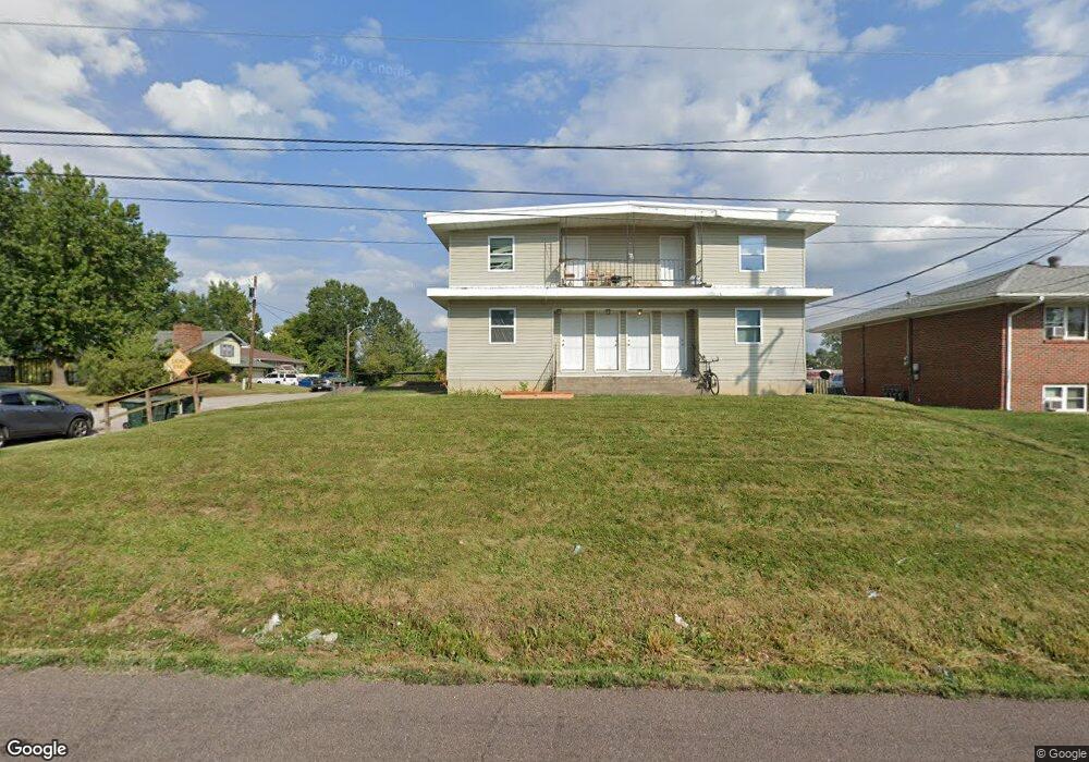
1300 Cote Sans Dessein Rd Fulton, MO 65251
Estimated Value: $191,000 - $201,000
--
Bed
1
Bath
3,962
Sq Ft
$49/Sq Ft
Est. Value
About This Home
This home is located at 1300 Cote Sans Dessein Rd, Fulton, MO 65251 and is currently estimated at $196,000, approximately $49 per square foot. 1300 Cote Sans Dessein Rd is a home located in Callaway County with nearby schools including Fulton Senior High School, Kingdom Christian Academy, and St. Peter Catholic School.
Ownership History
Date
Name
Owned For
Owner Type
Purchase Details
Closed on
Jan 18, 2023
Sold by
Bacon Dennis and Bacon Angela
Bought by
Ajd Rentals Llc
Current Estimated Value
Home Financials for this Owner
Home Financials are based on the most recent Mortgage that was taken out on this home.
Original Mortgage
$280,000
Interest Rate
7.03%
Mortgage Type
Credit Line Revolving
Purchase Details
Closed on
Sep 25, 2017
Sold by
Albion 4600 Llc
Bought by
Bacon Dennis and Bacon Angela
Home Financials for this Owner
Home Financials are based on the most recent Mortgage that was taken out on this home.
Original Mortgage
$87,250
Interest Rate
3.86%
Mortgage Type
Unknown
Create a Home Valuation Report for This Property
The Home Valuation Report is an in-depth analysis detailing your home's value as well as a comparison with similar homes in the area
Home Values in the Area
Average Home Value in this Area
Purchase History
| Date | Buyer | Sale Price | Title Company |
|---|---|---|---|
| Ajd Rentals Llc | -- | None Listed On Document | |
| Bacon Dennis | -- | None Available |
Source: Public Records
Mortgage History
| Date | Status | Borrower | Loan Amount |
|---|---|---|---|
| Previous Owner | Ajd Rentals Llc | $280,000 | |
| Previous Owner | Bacon Dennis | $87,250 |
Source: Public Records
Tax History Compared to Growth
Tax History
| Year | Tax Paid | Tax Assessment Tax Assessment Total Assessment is a certain percentage of the fair market value that is determined by local assessors to be the total taxable value of land and additions on the property. | Land | Improvement |
|---|---|---|---|---|
| 2024 | $1,353 | $21,892 | $0 | $0 |
| 2023 | $1,354 | $21,417 | $0 | $0 |
| 2022 | $1,318 | $21,417 | $1,853 | $19,564 |
| 2021 | $1,317 | $21,417 | $1,853 | $19,564 |
| 2020 | $1,335 | $21,417 | $1,853 | $19,564 |
| 2019 | $1,292 | $21,417 | $1,853 | $19,564 |
| 2018 | $687 | $11,017 | $1,853 | $9,164 |
| 2017 | $838 | $15,111 | $1,853 | $13,258 |
| 2016 | $1,320 | $22,810 | $0 | $0 |
| 2015 | $1,291 | $22,810 | $0 | $0 |
| 2014 | -- | $24,440 | $0 | $0 |
Source: Public Records
Map
Nearby Homes
- 1311 Cote Sans Dessein Rd
- 1400 Marbrooke Dr
- 537 Kinleigh Dr
- 528 Kinleigh Dr
- 1205 Parkridge Dr
- 6309 Shale Ct
- 0 Callaway Dr
- 509 S Business 54
- 3.69 ACRES Tennyson Rd
- 1950 S Business 54
- 5084 Red Maple Ln Unit 5084
- 106 Schultze St
- 2946 Missouri F
- 250 Tennyson Rd
- 710 Hollyhock Dr
- 612 Airway Dr
- 308 E 6th St
- 801 Court St
- 703 Bluff St
- 314 W 9th St
- 1302 Cote Sans Dessein Rd
- 1216 Cote Sans Dessein Rd
- 1303 Cote Sans Dessein Rd
- 1305 Cote Sans Dessein Rd
- 1 Arrow St
- 1301 Cote Sans Dessein Rd
- 1214 Cote Sans Dessein Rd
- 1309 Cote Sans Dessein Rd
- 1212 Cote Sans Dessein Rd
- 1304 Randall Ln
- 3 Arrow St
- 1302 Randall Ln
- 1306 Randall Ln
- 1211 Cote Sans Dessein Rd
- 1210 Cote Sans Dessein Rd
- 1209 Ashton Cir W
- 1300 Randall Ln
- 1313 Cote Sans Dessein Rd
- 1210 Randall Ln
- 1209 Cote Sans Dessein Rd