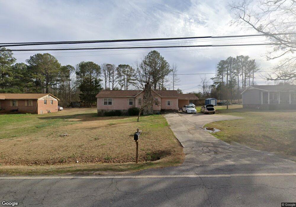
1300 E Mcintosh Rd Griffin, GA 30223
Spalding County NeighborhoodEstimated Value: $177,851 - $215,000
3
Beds
2
Baths
1,312
Sq Ft
$146/Sq Ft
Est. Value
About This Home
This home is located at 1300 E Mcintosh Rd, Griffin, GA 30223 and is currently estimated at $191,463, approximately $145 per square foot. 1300 E Mcintosh Rd is a home located in Spalding County with nearby schools including Atkinson Elementary School, Cowan Road Middle School, and Spalding High School.
Ownership History
Date
Name
Owned For
Owner Type
Purchase Details
Closed on
Jan 6, 1986
Sold by
First Federal Savings & Loan Assn
Bought by
Brown Robert L and Brown Bobbie A
Current Estimated Value
Purchase Details
Closed on
Dec 6, 1983
Sold by
Bradford Robert Lee and Bradford Frances K
Bought by
First Federal Savings & Loan Assn
Purchase Details
Closed on
Sep 5, 1980
Sold by
Hammond H D
Bought by
Bradford Robert Lee and Bradford Frances K
Purchase Details
Closed on
Jun 16, 1980
Sold by
Cotton Inc
Bought by
Hammond H D
Purchase Details
Closed on
Oct 15, 1977
Sold by
Smith Fred Tim Furlow and Ken Fletcher
Bought by
Cotton Inc
Purchase Details
Closed on
Dec 16, 1975
Sold by
Smith Dan J and Smith Fred
Bought by
Smith Fred Tim Furlow and Ken Fletch
Create a Home Valuation Report for This Property
The Home Valuation Report is an in-depth analysis detailing your home's value as well as a comparison with similar homes in the area
Home Values in the Area
Average Home Value in this Area
Purchase History
| Date | Buyer | Sale Price | Title Company |
|---|---|---|---|
| Brown Robert L | $34,000 | -- | |
| First Federal Savings & Loan Assn | $36,800 | -- | |
| Bradford Robert Lee | $36,000 | -- | |
| Hammond H D | $6,000 | -- | |
| Cotton Inc | $28,000 | -- | |
| Smith Fred Tim Furlow | -- | -- |
Source: Public Records
Tax History Compared to Growth
Tax History
| Year | Tax Paid | Tax Assessment Tax Assessment Total Assessment is a certain percentage of the fair market value that is determined by local assessors to be the total taxable value of land and additions on the property. | Land | Improvement |
|---|---|---|---|---|
| 2024 | $1,588 | $44,381 | $6,160 | $38,221 |
| 2023 | $1,588 | $44,381 | $6,160 | $38,221 |
| 2022 | $1,333 | $36,659 | $3,520 | $33,139 |
| 2021 | $1,202 | $33,051 | $3,520 | $29,531 |
| 2020 | $1,206 | $33,051 | $3,520 | $29,531 |
| 2019 | $1,230 | $33,051 | $3,520 | $29,531 |
| 2018 | $1,164 | $30,458 | $3,520 | $26,938 |
| 2017 | $1,132 | $30,458 | $3,520 | $26,938 |
| 2016 | $117 | $30,458 | $3,520 | $26,938 |
| 2015 | $134 | $30,458 | $3,520 | $26,938 |
| 2014 | $134 | $30,458 | $3,520 | $26,938 |
Source: Public Records
Map
Nearby Homes
- 204 Custer Cir
- 1517 Cabin Creek Trail
- 1110 N 2nd St
- 103 Cabin Creek Cir
- 1881 E Mcintosh Rd
- 583 Hamil Rd
- 0 Hamil Rd Unit 6.21 AC 10578337
- 126 Callie Rd
- 127 Kennedy Rd
- 0 Short St Unit 10555372
- 0 Short St Unit 7572526
- 1621 N Hill St
- 811 Dusky Sap Ct
- 1416 Spellman Ave
- 506 Orchid Lights Ct
- 55 Smoak Rd
- 1324 Spellman Ave
- 802 Dusky Sap Ct
- 113 Crape Myrtle Dr
- 607 Lakewood Dr
- 1290 E Mcintosh Rd
- 1320 E Mcintosh Rd
- 1330 E Mcintosh Rd
- 1280 E Mcintosh Rd
- 1301 E Mcintosh Rd
- 1319 E Mcintosh Rd
- 1291 E Mcintosh Rd
- 1352 E Mcintosh Rd
- 1270 E Mcintosh Rd
- 1260 E Mcintosh Rd
- 1351 E Mcintosh Rd
- 1374 E Mcintosh Rd
- 1250 E Mcintosh Rd
- 1369 E Mcintosh Rd
- 1240 E Mcintosh Rd Unit 2
- 1240 E Mcintosh Rd
- 1419 E Mcintosh Rd
- 1230 E Mcintosh Rd
- 1423 E Mcintosh Rd
- 1410 E Mcintosh Rd