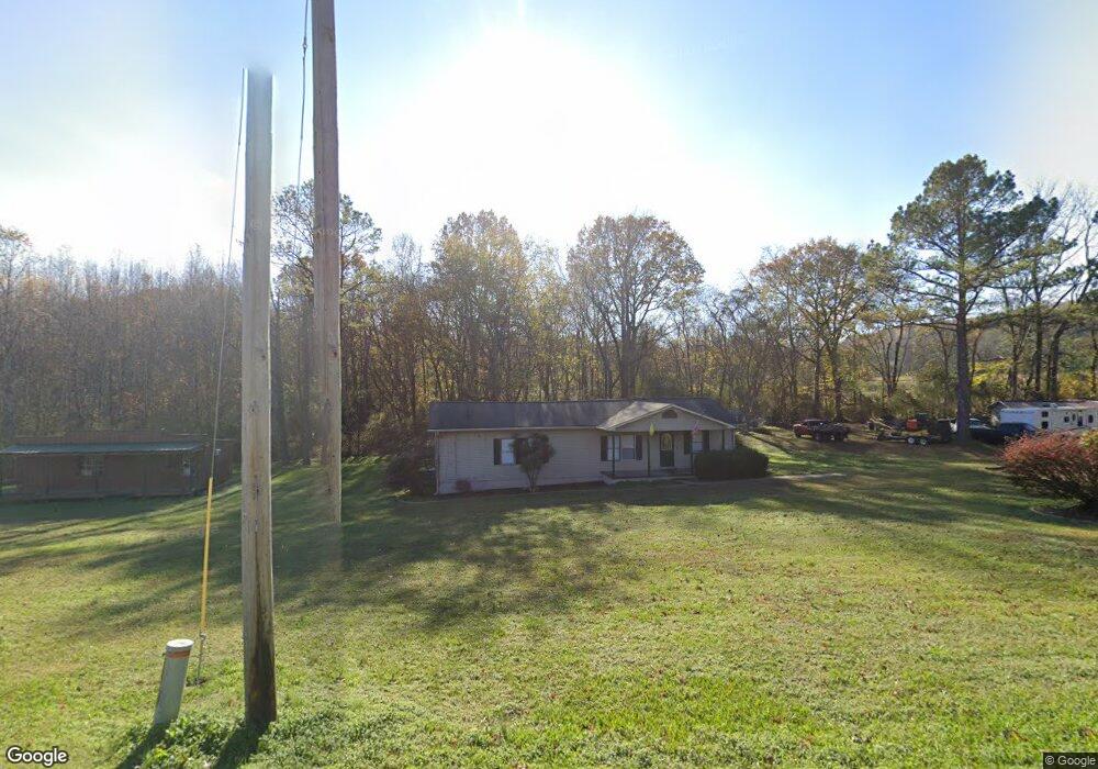
1300 Hurricane Rd New Market, AL 35761
Estimated Value: $174,000 - $259,000
3
Beds
2
Baths
1,333
Sq Ft
$155/Sq Ft
Est. Value
About This Home
This home is located at 1300 Hurricane Rd, New Market, AL 35761 and is currently estimated at $206,568, approximately $154 per square foot. 1300 Hurricane Rd is a home located in Madison County with nearby schools including New Market School, Buckhorn Middle School, and Buckhorn High School.
Ownership History
Date
Name
Owned For
Owner Type
Purchase Details
Closed on
Nov 30, 2022
Sold by
Scott Timothy R
Bought by
Marlar Sydney W and Marlar Richard E
Current Estimated Value
Home Financials for this Owner
Home Financials are based on the most recent Mortgage that was taken out on this home.
Original Mortgage
$123,250
Outstanding Balance
$119,552
Interest Rate
6.95%
Mortgage Type
Balloon
Estimated Equity
$87,016
Purchase Details
Closed on
Nov 2, 2007
Sold by
Secretary Of Hud
Bought by
Scott Timothy R
Purchase Details
Closed on
Feb 7, 2005
Sold by
Southard Timothy Ray and Southard Vickie
Bought by
Taylor Thomas Shane
Home Financials for this Owner
Home Financials are based on the most recent Mortgage that was taken out on this home.
Original Mortgage
$73,644
Interest Rate
5.66%
Mortgage Type
FHA
Create a Home Valuation Report for This Property
The Home Valuation Report is an in-depth analysis detailing your home's value as well as a comparison with similar homes in the area
Home Values in the Area
Average Home Value in this Area
Purchase History
| Date | Buyer | Sale Price | Title Company |
|---|---|---|---|
| Marlar Sydney W | $145,000 | -- | |
| Scott Timothy R | $100 | -- | |
| Taylor Thomas Shane | -- | -- |
Source: Public Records
Mortgage History
| Date | Status | Borrower | Loan Amount |
|---|---|---|---|
| Open | Marlar Sydney W | $123,250 | |
| Previous Owner | Taylor Thomas Shane | $73,644 |
Source: Public Records
Tax History Compared to Growth
Tax History
| Year | Tax Paid | Tax Assessment Tax Assessment Total Assessment is a certain percentage of the fair market value that is determined by local assessors to be the total taxable value of land and additions on the property. | Land | Improvement |
|---|---|---|---|---|
| 2024 | $511 | $29,320 | $4,960 | $24,360 |
| 2023 | $528 | $29,360 | $5,000 | $24,360 |
| 2022 | $876 | $24,200 | $2,500 | $21,700 |
| 2021 | $764 | $21,140 | $2,500 | $18,640 |
| 2020 | $717 | $19,840 | $2,500 | $17,340 |
| 2019 | $693 | $19,200 | $2,500 | $16,700 |
| 2018 | $619 | $17,080 | $0 | $0 |
| 2017 | $619 | $17,080 | $0 | $0 |
| 2016 | $619 | $17,080 | $0 | $0 |
| 2015 | $619 | $17,080 | $0 | $0 |
| 2014 | $612 | $16,900 | $0 | $0 |
Source: Public Records
Map
Nearby Homes
- 274 Billy Smith Rd
- 1495 Hurricane Rd
- 45 acres Marvaline Dr
- 1004 Hurricane Rd
- 985 Hurricane Rd
- 973 Hurricane Rd
- 819 & 0 Hurricane Rd
- 2155 Hurricane Rd
- 504 Hurricane Rd
- 2282 Hurricane Rd
- 5 Acres Hurricane Rd
- 119 Davis Rd
- 1144 Upper Hurricane Rd
- 5148 Winchester Rd
- 593 Sharps Hollow Rd
- 5148-B Winchester Rd
- 260 Deertrace Pkwy
- 278 Deertrace Pkwy
- 125 Larkin St
- 1 AC Winchester Rd
- 1315 Hurricane Rd
- 1291 Hurricane Rd
- 1265 Hurricane Rd
- 1237 Hurricane Rd
- 1247 Hurricane Rd
- 1351 Hurricane Rd
- 1385 Hurricane Rd
- 191 Billy Smith Dr
- 1196 Hurricane Rd
- 1425 Hurricane Rd
- 1195 Hurricane Rd
- 165 Billy Smith Dr
- 1185 Hurricane Rd
- 153 Billy Smith Dr
- 1435 Hurricane Rd
- 276 Billy Smith Dr
- 186 Billy Smith Dr
- 109 Billy Smith Dr
- 00 Marvaline Dr
- 140 Billy Smith Dr