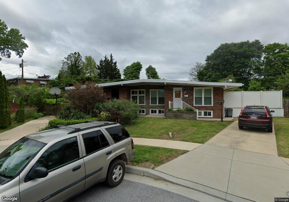
1300 Kensal Ct Baltimore, MD 21239
Estimated Value: $230,000 - $317,000
--
Bed
1
Bath
1,234
Sq Ft
$220/Sq Ft
Est. Value
About This Home
This home is located at 1300 Kensal Ct, Baltimore, MD 21239 and is currently estimated at $271,683, approximately $220 per square foot. 1300 Kensal Ct is a home located in Baltimore County with nearby schools including Halstead Academy, Loch Raven Technical Academy, and Towson High Law & Public Policy.
Ownership History
Date
Name
Owned For
Owner Type
Purchase Details
Closed on
Feb 24, 2014
Sold by
Dabrowski Boguslaw W and Dabrowska Renata M
Bought by
Dabrowski Boguslaw W and Dabrowska Renata M
Current Estimated Value
Home Financials for this Owner
Home Financials are based on the most recent Mortgage that was taken out on this home.
Original Mortgage
$163,300
Outstanding Balance
$48,198
Interest Rate
4.39%
Mortgage Type
New Conventional
Estimated Equity
$223,485
Purchase Details
Closed on
Jun 11, 2003
Sold by
Ariosa Jay A
Bought by
Dabroski Boguslaw and Drabrowska Ranata
Purchase Details
Closed on
Dec 13, 1985
Sold by
Culotta Carolyn J
Bought by
Ariosa Jay A
Create a Home Valuation Report for This Property
The Home Valuation Report is an in-depth analysis detailing your home's value as well as a comparison with similar homes in the area
Home Values in the Area
Average Home Value in this Area
Purchase History
| Date | Buyer | Sale Price | Title Company |
|---|---|---|---|
| Dabrowski Boguslaw W | -- | First American Title Ins Co | |
| Dabroski Boguslaw | $98,500 | -- | |
| Ariosa Jay A | $84,000 | -- |
Source: Public Records
Mortgage History
| Date | Status | Borrower | Loan Amount |
|---|---|---|---|
| Open | Dabrowski Boguslaw W | $163,300 |
Source: Public Records
Tax History Compared to Growth
Tax History
| Year | Tax Paid | Tax Assessment Tax Assessment Total Assessment is a certain percentage of the fair market value that is determined by local assessors to be the total taxable value of land and additions on the property. | Land | Improvement |
|---|---|---|---|---|
| 2025 | $2,987 | $196,400 | $80,000 | $116,400 |
| 2024 | $2,987 | $188,367 | $0 | $0 |
| 2023 | $1,454 | $180,333 | $0 | $0 |
| 2022 | $2,744 | $172,300 | $80,000 | $92,300 |
| 2021 | $2,614 | $167,767 | $0 | $0 |
| 2020 | $2,614 | $163,233 | $0 | $0 |
| 2019 | $2,529 | $158,700 | $80,000 | $78,700 |
| 2018 | $2,343 | $154,333 | $0 | $0 |
| 2017 | $2,732 | $149,967 | $0 | $0 |
| 2016 | $2,073 | $145,600 | $0 | $0 |
| 2015 | $2,073 | $145,600 | $0 | $0 |
| 2014 | $2,073 | $145,600 | $0 | $0 |
Source: Public Records
Map
Nearby Homes
- 1204 Saint Andrews Way
- 6702 Queens Ferry Rd
- 703 Hillen Rd
- 701 Hillen Rd
- 1108 Litchfield Rd
- 6931 Summit Cir
- 6923 Summit Cir
- 908 Stevenson Ln
- 1602 Glen Keith Blvd
- 1641 Cottage Ln
- 1211 Dalton Rd
- 12 Stone Ridge Ct
- 1304 Dartmouth Ave
- 1405 Putty Hill Ave
- 8217 Pleasant Plains Rd
- 1552 Cottage Ln
- 28 Stone Ridge Ct
- 1316 Dartmouth Ave
- 6415 Falkirk Rd
- 1331 Dalton Rd
- 1302 Kensal Ct
- 1309 Glenmont Rd
- 1303 Ablett Rd
- 1311 Glenmont Rd
- 1301 Ablett Rd
- 1305 Ablett Rd
- 1303 Kensal Ct
- 1313 Glenmont Rd
- 1307 Ablett Rd
- 1315 Glenmont Rd
- 6836 Queens Ferry Rd
- 1301 Kensal Ct
- 6834 Queens Ferry Rd
- 6838 Queens Ferry Rd
- 6844 Queens Ferry Rd
- 1307 Glenmont Rd
- 6840 Queens Ferry Rd
- 6832 Queens Ferry Rd
- 6846 Queens Ferry Rd
- 6848 Queens Ferry Rd