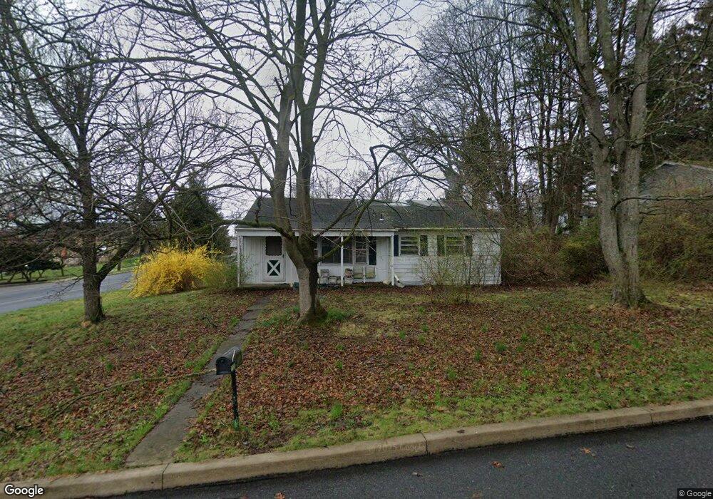
1300 Linn St State College, PA 16803
Estimated Value: $259,000 - $380,000
3
Beds
2
Baths
1,120
Sq Ft
$295/Sq Ft
Est. Value
About This Home
This home is located at 1300 Linn St, State College, PA 16803 and is currently estimated at $330,744, approximately $295 per square foot. 1300 Linn St is a home located in Centre County with nearby schools including Radio Park Elementary School, Park Forest Middle School, and State College Area High School.
Ownership History
Date
Name
Owned For
Owner Type
Purchase Details
Closed on
Oct 6, 2011
Sold by
Estate Of Jay A Fritzinger
Bought by
Fellows Amber Marie
Current Estimated Value
Home Financials for this Owner
Home Financials are based on the most recent Mortgage that was taken out on this home.
Original Mortgage
$101,400
Outstanding Balance
$69,491
Interest Rate
4.2%
Mortgage Type
VA
Estimated Equity
$261,253
Purchase Details
Closed on
Sep 7, 2007
Sold by
Fritzinger Jay A and Estate Of Ruth Ann Askey
Bought by
Fritzinger Jay A and Wakefield Debra A
Create a Home Valuation Report for This Property
The Home Valuation Report is an in-depth analysis detailing your home's value as well as a comparison with similar homes in the area
Home Values in the Area
Average Home Value in this Area
Purchase History
| Date | Buyer | Sale Price | Title Company |
|---|---|---|---|
| Fellows Amber Marie | $100,000 | None Available | |
| Fritzinger Jay A | -- | None Available |
Source: Public Records
Mortgage History
| Date | Status | Borrower | Loan Amount |
|---|---|---|---|
| Open | Fellows Amber Marie | $101,400 |
Source: Public Records
Tax History Compared to Growth
Tax History
| Year | Tax Paid | Tax Assessment Tax Assessment Total Assessment is a certain percentage of the fair market value that is determined by local assessors to be the total taxable value of land and additions on the property. | Land | Improvement |
|---|---|---|---|---|
| 2025 | $2,454 | $39,630 | $6,220 | $33,410 |
| 2024 | $2,295 | $39,630 | $6,220 | $33,410 |
| 2023 | $2,295 | $39,630 | $6,220 | $33,410 |
| 2022 | $2,233 | $39,630 | $6,220 | $33,410 |
| 2021 | $2,233 | $39,630 | $6,220 | $33,410 |
| 2020 | $2,233 | $39,630 | $6,220 | $33,410 |
| 2019 | $1,933 | $39,630 | $6,220 | $33,410 |
| 2018 | $2,156 | $39,630 | $6,220 | $33,410 |
| 2017 | $2,130 | $39,630 | $6,220 | $33,410 |
| 2016 | -- | $39,630 | $6,220 | $33,410 |
| 2015 | -- | $39,630 | $6,220 | $33,410 |
| 2014 | -- | $39,630 | $6,220 | $33,410 |
Source: Public Records
Map
Nearby Homes
- 861 Willard St
- 936 Taylor St
- 465 Hillcrest Ave
- 505 Hillcrest Ave
- 619 Mckee St
- 157 Hartswick Ave
- 125 W Park Ave
- 441 Ridge Ave
- 320 Hartswick Ave
- 159 Bolton Ave
- 439 W Park Ave
- 1121 W Aaron Dr Unit C
- 715 W Park Ave
- 1832 Waddle Rd
- 1635 Princeton Dr
- 1918 Weaver St Unit 1
- 658 -A Oakwood Ave
- 652 B Oakwood Ave
- 257 Oakwood Ave
- 2074 Mary Ellen Ln