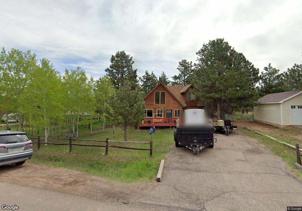
1300 Michael Ln Woodland Park, CO 80863
Estimated Value: $411,406 - $551,000
3
Beds
3
Baths
1,038
Sq Ft
$466/Sq Ft
Est. Value
About This Home
This home is located at 1300 Michael Ln, Woodland Park, CO 80863 and is currently estimated at $483,852, approximately $466 per square foot. 1300 Michael Ln is a home located in Teller County with nearby schools including Merit Academy, Woodland Park Junior/Senior High School, and Colorado Springs Christian School.
Ownership History
Date
Name
Owned For
Owner Type
Purchase Details
Closed on
Jul 31, 2014
Sold by
Bennett Ronald M
Bought by
Shea Michael Francis O
Current Estimated Value
Home Financials for this Owner
Home Financials are based on the most recent Mortgage that was taken out on this home.
Original Mortgage
$163,980
Outstanding Balance
$125,314
Interest Rate
4.17%
Mortgage Type
New Conventional
Estimated Equity
$358,538
Purchase Details
Closed on
Oct 11, 1991
Bought by
O'Shea Michael Francis
Purchase Details
Closed on
Jun 19, 1985
Bought by
O'Shea Michael Francis
Purchase Details
Closed on
Jan 21, 1985
Bought by
O'Shea Michael Francis
Create a Home Valuation Report for This Property
The Home Valuation Report is an in-depth analysis detailing your home's value as well as a comparison with similar homes in the area
Home Values in the Area
Average Home Value in this Area
Purchase History
| Date | Buyer | Sale Price | Title Company |
|---|---|---|---|
| Shea Michael Francis O | $204,975 | Unified Title Company | |
| O'Shea Michael Francis | $80,000 | -- | |
| O'Shea Michael Francis | $70,500 | -- | |
| O'Shea Michael Francis | $11,300 | -- |
Source: Public Records
Mortgage History
| Date | Status | Borrower | Loan Amount |
|---|---|---|---|
| Open | Shea Michael Francis O | $163,980 |
Source: Public Records
Tax History Compared to Growth
Tax History
| Year | Tax Paid | Tax Assessment Tax Assessment Total Assessment is a certain percentage of the fair market value that is determined by local assessors to be the total taxable value of land and additions on the property. | Land | Improvement |
|---|---|---|---|---|
| 2024 | $2,145 | $27,090 | $3,506 | $23,584 |
| 2023 | $2,145 | $27,090 | $3,510 | $23,580 |
| 2022 | $1,846 | $22,720 | $3,530 | $19,190 |
| 2021 | $1,890 | $23,370 | $3,630 | $19,740 |
| 2020 | $1,665 | $21,070 | $3,370 | $17,700 |
| 2019 | $1,654 | $21,070 | $0 | $0 |
| 2018 | $1,163 | $14,500 | $0 | $0 |
| 2017 | $1,165 | $14,500 | $0 | $0 |
| 2016 | $1,201 | $14,900 | $0 | $0 |
| 2015 | $1,303 | $14,900 | $0 | $0 |
| 2014 | $1,168 | $13,220 | $0 | $0 |
Source: Public Records
Map
Nearby Homes
- 1300 Thomas Cir
- 1279 Firestone Dr
- 1313 Stone Ridge Dr
- 1290 Firestone Dr
- 0 Firestone Dr
- 1127 Michael Ln
- 1322 Firestone Dr
- 1136 Ptarmigan Dr
- 1163 Ptarmigan Dr
- 1145 Ptarmigan Dr
- 1149 Ptarmigan Dr
- 828 Northwoods Dr E
- 718 Misty Pines Cir
- 220 Wildrose Ct
- 1378 Millstone Ln
- 1260 Sundance St
- 0 Colorado 67
- Tract 36 Colorado 67
- 780 W Kelley's Rd
- 780 Columbine Village Dr Unit C
- 1310 Michael Ln
- 1280 Michael Ln
- 1305 Michael Ln
- 1305 Thomas Cir
- 1320 Michael Ln
- 1485 Northwoods Dr
- 1315 Thomas Cir
- 1240 Michael Ln
- 1220 Michael Ln
- 1330 Michael Ln
- 1325 Thomas Cir
- 1255 Michael Ln
- 1200 Michael Ln
- 1335 Thomas Cir
- 1247 Michael Ln
- 1310 Thomas Cir
- 1445 Northwoods Dr
- 1335 Michael Ln
- 1420 Northwoods Dr
- 1180 Michael Ln