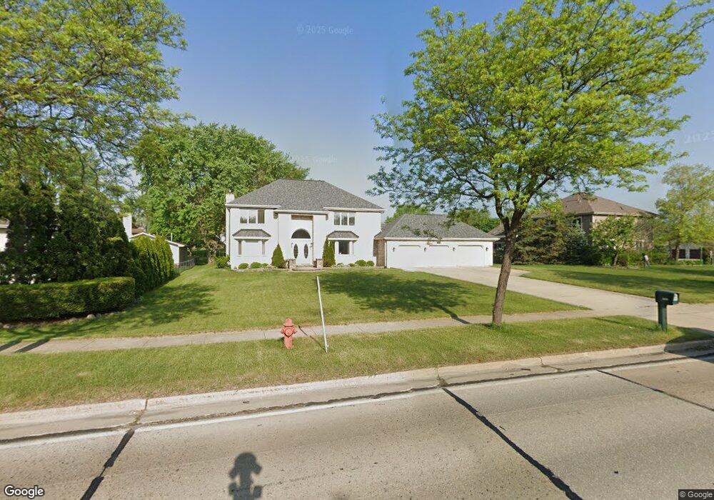
1300 S Roselle Rd Schaumburg, IL 60193
South Schaumburg NeighborhoodEstimated Value: $605,000 - $773,000
4
Beds
3
Baths
3,139
Sq Ft
$216/Sq Ft
Est. Value
About This Home
This home is located at 1300 S Roselle Rd, Schaumburg, IL 60193 and is currently estimated at $676,872, approximately $215 per square foot. 1300 S Roselle Rd is a home located in Cook County with nearby schools including Edwin Aldrin Elementary School, Robert Frost Junior High School, and J B Conant High School.
Ownership History
Date
Name
Owned For
Owner Type
Purchase Details
Closed on
Jan 17, 2020
Sold by
Patel Bharat M and Patel Manisha B
Bought by
Patel Manisha
Current Estimated Value
Purchase Details
Closed on
May 31, 2001
Sold by
Patel Trushar and Patel Nila
Bought by
Patel Manisha B and Patel Bharat M
Home Financials for this Owner
Home Financials are based on the most recent Mortgage that was taken out on this home.
Original Mortgage
$306,000
Outstanding Balance
$116,391
Interest Rate
7.12%
Estimated Equity
$560,481
Purchase Details
Closed on
Feb 9, 1995
Sold by
Hordorwich Christopher Paul and Hordorwich Judith Ann
Bought by
Patel Nila and Patel Trushar
Home Financials for this Owner
Home Financials are based on the most recent Mortgage that was taken out on this home.
Original Mortgage
$31,500
Interest Rate
9.21%
Create a Home Valuation Report for This Property
The Home Valuation Report is an in-depth analysis detailing your home's value as well as a comparison with similar homes in the area
Home Values in the Area
Average Home Value in this Area
Purchase History
| Date | Buyer | Sale Price | Title Company |
|---|---|---|---|
| Patel Manisha | -- | None Available | |
| Patel Manisha B | $383,000 | -- | |
| Patel Nila | $63,000 | Attorneys Natl Title Network |
Source: Public Records
Mortgage History
| Date | Status | Borrower | Loan Amount |
|---|---|---|---|
| Open | Patel Manisha B | $306,000 | |
| Closed | Patel Nila | $31,500 |
Source: Public Records
Tax History Compared to Growth
Tax History
| Year | Tax Paid | Tax Assessment Tax Assessment Total Assessment is a certain percentage of the fair market value that is determined by local assessors to be the total taxable value of land and additions on the property. | Land | Improvement |
|---|---|---|---|---|
| 2024 | $13,372 | $51,051 | $8,000 | $43,051 |
| 2023 | $14,283 | $51,051 | $8,000 | $43,051 |
| 2022 | $14,283 | $56,000 | $8,000 | $48,000 |
| 2021 | $11,379 | $40,873 | $22,500 | $18,373 |
| 2020 | $11,251 | $40,873 | $22,500 | $18,373 |
| 2019 | $11,254 | $45,415 | $22,500 | $22,915 |
| 2018 | $11,294 | $41,067 | $19,000 | $22,067 |
| 2017 | $11,133 | $41,067 | $19,000 | $22,067 |
| 2016 | $11,877 | $45,493 | $19,000 | $26,493 |
| 2015 | $10,078 | $36,309 | $16,000 | $20,309 |
| 2014 | $9,983 | $36,309 | $16,000 | $20,309 |
| 2013 | $10,977 | $40,704 | $16,000 | $24,704 |
Source: Public Records
Map
Nearby Homes
- 13 W Monterey Ave
- 1323 S Roselle Rd
- 1420 Indian Hill Dr
- 134 Lunt Ave
- 211 Steeple Bush Ln Unit 10343
- 205 Steeple Bush Ln Unit 10444
- 1205 Laurel Ln
- 1531 Marion St
- 1342 Lunt Ct Unit 56
- 120 Pratt Blvd
- 1630 Myrtle Park St
- 1630 Myrtle Park St
- 1630 Myrtle Park St
- 357 Lucille Ln Unit 30
- 286 Nantucket Harbor Unit 601
- 1705 Seward St
- 415 Laconia Ln
- 1078 Newport Harbor Unit 6101
- 421 E Wise Rd
- 1100 Boston Harbor Unit 7004
- 5 W Niagara Ave
- 6 W Monterey Ave
- 15 W Niagara Ave
- 12 W Monterey Ave
- 2 E Monterey Ave
- 21 W Niagara Ave
- 18 W Monterey Ave
- 5 W Monterey Ave
- 1233 S Roselle Rd
- 8 W Niagara Ave
- 8 E Monterey Ave
- 14 W Niagara Ave
- 25 W Niagara Ave
- 7 E Monterey Ave
- 24 W Monterey Ave
- 20 W Niagara Ave
- 1223 S Roselle Rd
- 1324 S Roselle Rd
- 19 W Monterey Ave
- 24 W Niagara Ave