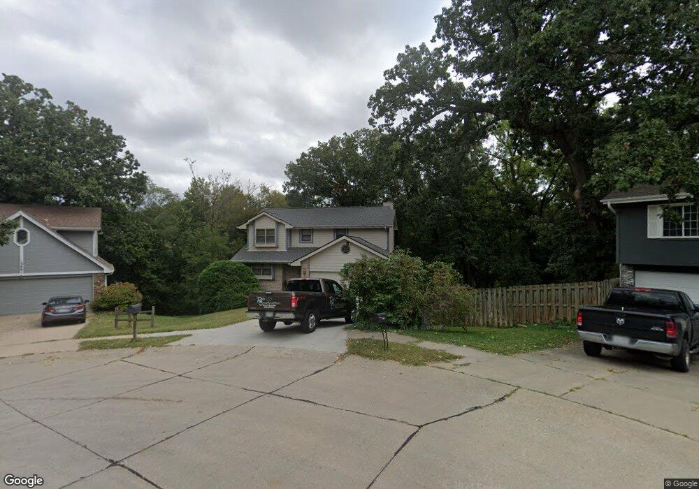
13005 Woodridge Cir Bellevue, NE 68123
Estimated Value: $301,000 - $324,000
3
Beds
5
Baths
2,201
Sq Ft
$143/Sq Ft
Est. Value
About This Home
This home is located at 13005 Woodridge Cir, Bellevue, NE 68123 and is currently estimated at $313,651, approximately $142 per square foot. 13005 Woodridge Cir is a home located in Sarpy County with nearby schools including Bellevue Elementary School, Lewis & Clark Middle School, and Bellevue West High School.
Ownership History
Date
Name
Owned For
Owner Type
Purchase Details
Closed on
Sep 14, 1999
Sold by
Tarver Sr Carlton M and Tarver Elizabeth
Bought by
Lassek Ben G and Lassek Christine
Current Estimated Value
Home Financials for this Owner
Home Financials are based on the most recent Mortgage that was taken out on this home.
Original Mortgage
$109,600
Interest Rate
8.02%
Create a Home Valuation Report for This Property
The Home Valuation Report is an in-depth analysis detailing your home's value as well as a comparison with similar homes in the area
Home Values in the Area
Average Home Value in this Area
Purchase History
| Date | Buyer | Sale Price | Title Company |
|---|---|---|---|
| Lassek Ben G | $137,000 | -- |
Source: Public Records
Mortgage History
| Date | Status | Borrower | Loan Amount |
|---|---|---|---|
| Closed | Lassek Ben G | $109,600 |
Source: Public Records
Tax History Compared to Growth
Tax History
| Year | Tax Paid | Tax Assessment Tax Assessment Total Assessment is a certain percentage of the fair market value that is determined by local assessors to be the total taxable value of land and additions on the property. | Land | Improvement |
|---|---|---|---|---|
| 2025 | $4,400 | $263,899 | $46,000 | $217,899 |
| 2024 | $5,067 | $253,439 | $43,000 | $210,439 |
| 2023 | $5,067 | $239,969 | $39,000 | $200,969 |
| 2022 | $4,526 | $210,315 | $34,000 | $176,315 |
| 2021 | $4,145 | $190,577 | $34,000 | $156,577 |
| 2020 | $4,160 | $190,635 | $34,000 | $156,635 |
| 2019 | $3,908 | $180,219 | $32,000 | $148,219 |
| 2018 | $3,728 | $176,531 | $29,000 | $147,531 |
| 2017 | $3,533 | $166,154 | $29,000 | $137,154 |
| 2016 | $3,454 | $166,016 | $27,000 | $139,016 |
| 2015 | $3,410 | $164,870 | $27,000 | $137,870 |
| 2014 | $3,354 | $161,092 | $27,000 | $134,092 |
| 2012 | -- | $156,914 | $25,000 | $131,914 |
Source: Public Records
Map
Nearby Homes
- 3506 Lynnwood Dr
- 3738 Falcon Dr
- 12750 Forestdale Dr
- 3728 Schuemann Dr
- 12741 Ridgeview Cir
- 4411 Schilling Dr
- 3716 Lookingglass Dr
- 3504 Sheridan Cir
- 3508 Jason Cir
- 3309 Lookingglass Dr
- 3108 Mirror Cir
- 13069 S 42nd Ave Unit Lot 49
- 13065 S 42nd Ave Unit Lot 50
- 13061 S 42nd Ave Unit Lot 51
- 3105 Leawood Dr
- 13057 S 42nd Ave Unit Lot 52
- 3105 Mirror Cir
- 13602 S 36th St
- 2940 Leawood Dr
- 4369 Lookingglass Dr
- 13009 Woodridge Cir
- 13001 Woodridge Cir
- 13002 Woodridge Cir
- 13059 Brookside Dr
- 13006 Woodridge Cir
- 13010 Woodridge Cir
- 13004 S 36th St
- 13052 Brookside Dr
- 13056 Brookside Dr
- 12916 S 36th St
- 3701 Lynnwood Dr
- 13063 Brookside Dr
- 12914 S 36th St
- 12912 S 36th St
- 3706 Lynnwood Dr
- 3703 Lawnwood Dr
- 3704 Pinehill Rd
- 3703 Lawnwood Dr
- 12910 S 36th St
- 3705 Lynnwood Dr