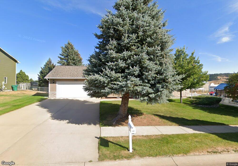
1301 1st Ave Sturgis, SD 57785
Estimated Value: $386,000 - $470,267
4
Beds
3
Baths
--
Sq Ft
10,454
Sq Ft
About This Home
This home is located at 1301 1st Ave, Sturgis, SD 57785 and is currently estimated at $439,067. 1301 1st Ave is a home located in Meade County with nearby schools including Sturgis Brown High School - 01.
Ownership History
Date
Name
Owned For
Owner Type
Purchase Details
Closed on
Aug 15, 2012
Sold by
Lorman E Lange And Donna J Lange Trust
Bought by
Johnson Dale A and Johnson Debra L
Current Estimated Value
Home Financials for this Owner
Home Financials are based on the most recent Mortgage that was taken out on this home.
Original Mortgage
$215,000
Outstanding Balance
$145,995
Interest Rate
3.48%
Mortgage Type
VA
Estimated Equity
$293,072
Purchase Details
Closed on
May 10, 2010
Sold by
Lange Lorman E and Lange Donna J
Bought by
Lorman E Lange & Donna J Lange Trust
Create a Home Valuation Report for This Property
The Home Valuation Report is an in-depth analysis detailing your home's value as well as a comparison with similar homes in the area
Home Values in the Area
Average Home Value in this Area
Purchase History
| Date | Buyer | Sale Price | Title Company |
|---|---|---|---|
| Johnson Dale A | -- | -- | |
| Lorman E Lange & Donna J Lange Trust | -- | -- |
Source: Public Records
Mortgage History
| Date | Status | Borrower | Loan Amount |
|---|---|---|---|
| Open | Johnson Dale A | $215,000 |
Source: Public Records
Tax History
| Year | Tax Paid | Tax Assessment Tax Assessment Total Assessment is a certain percentage of the fair market value that is determined by local assessors to be the total taxable value of land and additions on the property. | Land | Improvement |
|---|---|---|---|---|
| 2025 | $5,128 | $418,626 | $62,376 | $356,250 |
| 2024 | $5,128 | $386,240 | $62,376 | $323,864 |
| 2023 | $3,247 | $386,240 | $62,376 | $323,864 |
| 2022 | $2,200 | $301,106 | $51,980 | $249,126 |
| 2021 | $3,889 | $268,611 | $51,980 | $216,631 |
| 2020 | $3,980 | $230,175 | $40,181 | $189,994 |
| 2019 | $3,940 | $230,175 | $40,181 | $189,994 |
| 2018 | $3,537 | $230,175 | $40,181 | $189,994 |
| 2017 | $3,716 | $201,647 | $33,484 | $168,163 |
| 2016 | $0 | $183,315 | $0 | $0 |
| 2015 | $3,563 | $183,315 | $30,440 | $152,875 |
| 2013 | -- | $183,315 | $30,440 | $152,875 |
Source: Public Records
Map
Nearby Homes
- 2914 Greenwood Trail
- 21301 Vanocker Canyon Rd
- 3049 Trailhead Loop
- 2407 Fox Rd
- 1613 Elk Ct
- 3408 Davenport Loop
- 3461 Joseph Ct
- 3530 Joseph Ct
- 3523 Joseph Ct
- 3524 Joseph Ct
- 3505 Joseph Ct
- 3520 Joseph Ct
- 3534 Joseph Ct
- 3515 Joseph Ct
- 3491 Joseph Ct
- 3468 Davenport Loop
- 2329 S Baldwin St
- 3546 Davenport Loop
- 2211 Split Rock Dr
- 2234 Split Rock Dr
- 1301 1st Ave Unit 1301 First Avemue
- 1305 1st Ave
- 1304 1st Ave
- 1309 1st Ave
- 2901 1st Ave S
- 1308 Greenwood Trail
- 2910 Greenwood Trail
- 1217 1st Ave
- 2903 1st Ave S
- 2900 1st Ave
- 1313 1st Ave
- 2907 Greenwood Trail
- 1215 1st Ave
- 2911 Greenwood Trail
- 2905 1st Ave S
- 2905 SW 1st Ave
- 1210 1st Ave
- 1317 1st Ave
- 9 Otter Rd
- 1213 1st Ave
Your Personal Tour Guide
Ask me questions while you tour the home.