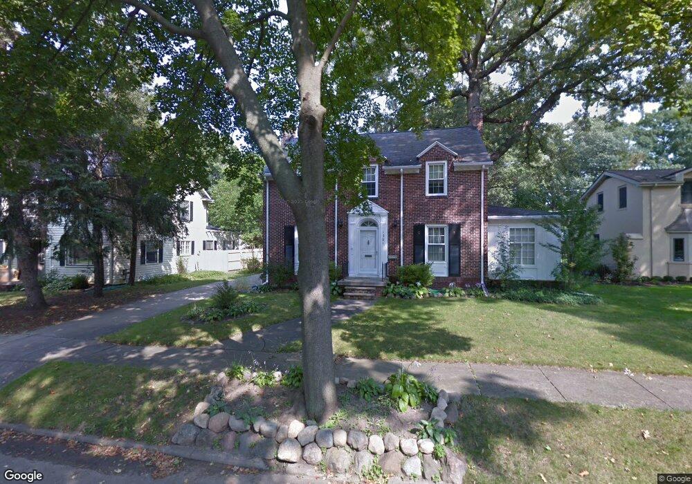
1301 Beard St Flint, MI 48503
College Cultural Neighborhood NeighborhoodEstimated Value: $181,228 - $203,000
3
Beds
2
Baths
1,845
Sq Ft
$105/Sq Ft
Est. Value
About This Home
This home is located at 1301 Beard St, Flint, MI 48503 and is currently estimated at $193,807, approximately $105 per square foot. 1301 Beard St is a home located in Genesee County with nearby schools including Pierce Elementary School, Flint Southwestern Classical Academy, and Flint Cultural Center Academy.
Ownership History
Date
Name
Owned For
Owner Type
Purchase Details
Closed on
Nov 21, 2008
Sold by
Prieur Thomas M and Prieur Karen L
Bought by
Kondrashin Peter V and Kondrashin Elena V
Current Estimated Value
Purchase Details
Closed on
May 14, 1999
Sold by
Bloom E Bloom C and Bloom P P
Bought by
Prieur Thomas M and Prieur Karen L
Home Financials for this Owner
Home Financials are based on the most recent Mortgage that was taken out on this home.
Original Mortgage
$104,000
Interest Rate
6.99%
Mortgage Type
Purchase Money Mortgage
Create a Home Valuation Report for This Property
The Home Valuation Report is an in-depth analysis detailing your home's value as well as a comparison with similar homes in the area
Home Values in the Area
Average Home Value in this Area
Purchase History
| Date | Buyer | Sale Price | Title Company |
|---|---|---|---|
| Kondrashin Peter V | $83,500 | Guaranty Title Company | |
| Prieur Thomas M | $130,000 | First American Title |
Source: Public Records
Mortgage History
| Date | Status | Borrower | Loan Amount |
|---|---|---|---|
| Previous Owner | Prieur Thomas M | $104,000 |
Source: Public Records
Tax History
| Year | Tax Paid | Tax Assessment Tax Assessment Total Assessment is a certain percentage of the fair market value that is determined by local assessors to be the total taxable value of land and additions on the property. | Land | Improvement |
|---|---|---|---|---|
| 2025 | $1,721 | $79,700 | $0 | $0 |
| 2024 | $1,534 | $76,000 | $0 | $0 |
| 2023 | $1,492 | $63,100 | $0 | $0 |
| 2022 | $0 | $53,000 | $0 | $0 |
| 2021 | $1,568 | $50,300 | $0 | $0 |
| 2020 | $1,388 | $47,500 | $0 | $0 |
| 2019 | $1,336 | $36,100 | $0 | $0 |
| 2018 | $1,392 | $27,600 | $0 | $0 |
| 2017 | $1,347 | $0 | $0 | $0 |
| 2016 | $1,337 | $0 | $0 | $0 |
| 2015 | -- | $0 | $0 | $0 |
| 2014 | -- | $0 | $0 | $0 |
| 2012 | -- | $29,800 | $0 | $0 |
Source: Public Records
Map
Nearby Homes
- 1210 Blanchard Ave
- 1510 S Franklin Ave
- 915 E 8th St
- 1114 W Vernon Dr
- 2013 E Court St
- 915 E Court #206 St Unit 206
- 915 E Court St
- 1701 Park St
- 2119 Mountain Ave
- 1720 Park St
- 1851 Seymour Ave
- 710 Pierson St
- 2010 Crocker Ave
- 621 Pierson St
- 605 S Lynch St
- 2029 Winans Ave
- 1814 Mcphail St
- 410 E 4th St
- 1840 Mcphail St
- 2050 Ferris Ave
- 1319 Beard St
- 1313 Beard St
- 1325 Beard St
- 1218 Maxine St
- 1219 Beard St
- 1312 Maxine St
- 1160 Woodside Dr
- 1316 Beard St
- 1214 Maxine St
- 1320 Beard St
- 1331 Beard St
- 1326 Beard St
- 1318 Maxine St
- 1206 Maxine St
- 1220 Beard St
- 1150 Woodside Dr
- 1213 Beard St
- 1507 Linwood Ave
- 1417 Linwood Ave
- 1321 Woodlawn Park Dr
Your Personal Tour Guide
Ask me questions while you tour the home.