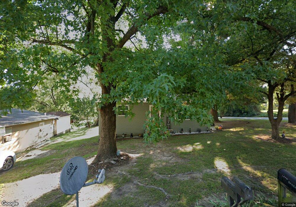
1301 Carlie St Neosho, MO 64850
Estimated Value: $95,183 - $140,000
2
Beds
--
Bath
832
Sq Ft
$147/Sq Ft
Est. Value
About This Home
This home is located at 1301 Carlie St, Neosho, MO 64850 and is currently estimated at $122,046, approximately $146 per square foot. 1301 Carlie St is a home with nearby schools including Neosho High School, Ozark Christian Academy, and Neosho Christian Schools.
Ownership History
Date
Name
Owned For
Owner Type
Purchase Details
Closed on
Aug 19, 2021
Sold by
Schneider Keith A and Schneider Theresa L
Bought by
Crumpton Lori A and Guynn Christopher J
Current Estimated Value
Home Financials for this Owner
Home Financials are based on the most recent Mortgage that was taken out on this home.
Original Mortgage
$94,444
Outstanding Balance
$85,879
Interest Rate
2.9%
Mortgage Type
New Conventional
Estimated Equity
$36,167
Create a Home Valuation Report for This Property
The Home Valuation Report is an in-depth analysis detailing your home's value as well as a comparison with similar homes in the area
Home Values in the Area
Average Home Value in this Area
Purchase History
| Date | Buyer | Sale Price | Title Company |
|---|---|---|---|
| Crumpton Lori A | $125,610 | None Listed On Document | |
| Crumpton Lori A | -- | None Listed On Document |
Source: Public Records
Mortgage History
| Date | Status | Borrower | Loan Amount |
|---|---|---|---|
| Open | Crumpton Lori A | $94,444 | |
| Closed | Crumpton Lori A | $94,444 |
Source: Public Records
Tax History
| Year | Tax Paid | Tax Assessment Tax Assessment Total Assessment is a certain percentage of the fair market value that is determined by local assessors to be the total taxable value of land and additions on the property. | Land | Improvement |
|---|---|---|---|---|
| 2024 | $321 | $5,850 | -- | -- |
| 2023 | $321 | $5,850 | $323 | $5,527 |
| 2022 | $321 | $5,740 | -- | -- |
| 2021 | $315 | $5,740 | $0 | $0 |
| 2020 | $233 | $4,270 | $0 | $0 |
| 2019 | $213 | $4,270 | $0 | $0 |
| 2018 | $214 | $4,270 | $0 | $0 |
| 2017 | $213 | $4,270 | $0 | $0 |
| 2016 | $213 | $4,240 | $0 | $0 |
| 2015 | -- | $4,070 | $0 | $0 |
| 2014 | -- | $4,070 | $0 | $0 |
Source: Public Records
Map
Nearby Homes
- 501 Washington Ave
- 527 Morrow St
- 515 & 527 Morrow St
- 515 Morrow St
- 1310 Reid Rd
- 508 Major Ln
- 15772 Parrot Rd
- 619 W Brook St
- 315 W Coler St
- 15363 Kentucky Rd
- 13673 Oakwood Trail - Tract 4 Rd
- 13673 Oakwood Trail - Tract 2 Rd
- 13673 Oakwood Trail - Tract 6 Rd
- TBD N Bus 49 & Reid Rd
- Tbd-B State Highway 86
- TBD N Business 49
- 1121 Skyline Dr
- 1094 N Business 49
- 1211 Northwest Blvd
- 525 W Harmony St
- 1303 Carlie St
- 1307 Carlie St
- 1302 Carlie St
- 1308 Carlie St
- 1322 Carlie St
- 811 Benham Ave Unit 1
- 811 Benham Ave
- 1315 Carlie St
- 712 Benham Ave
- 1312 Carlie St
- 1317 Carlie St
- 1325 Carlie St
- 1209 N Hickory Ave
- 725 Sherman Ave
- 1324 Carlie St
- 720 Washington Ave
- 721 Sherman Ave
- 717 Sherman Ave
- 1313 Oak St
- 1207 N Hickory Ave
Your Personal Tour Guide
Ask me questions while you tour the home.