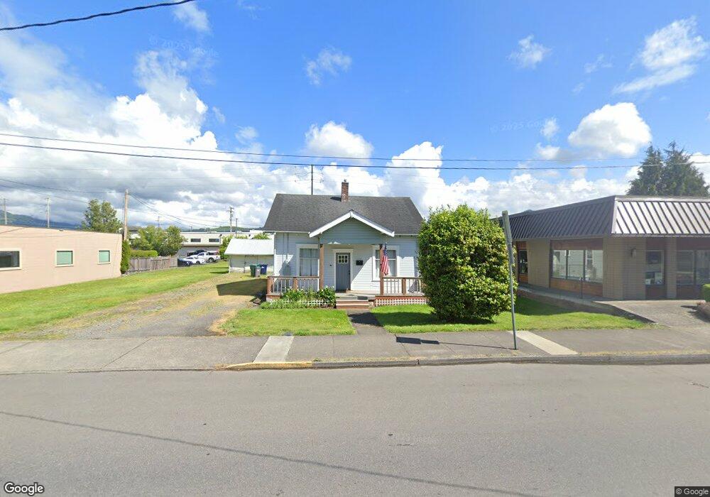
1301 Cole St Enumclaw, WA 98022
Estimated Value: $473,000 - $515,000
3
Beds
1
Bath
1,130
Sq Ft
$436/Sq Ft
Est. Value
About This Home
This home is located at 1301 Cole St, Enumclaw, WA 98022 and is currently estimated at $492,730, approximately $436 per square foot. 1301 Cole St is a home located in King County with nearby schools including Byron Kibler Elementary School, Enumclaw Middle School, and Enumclaw Senior High School.
Ownership History
Date
Name
Owned For
Owner Type
Purchase Details
Closed on
Jun 28, 2025
Sold by
Albach Lauren Ashley
Bought by
Albach Ryan
Current Estimated Value
Home Financials for this Owner
Home Financials are based on the most recent Mortgage that was taken out on this home.
Original Mortgage
$375,000
Outstanding Balance
$374,360
Interest Rate
6.81%
Mortgage Type
New Conventional
Estimated Equity
$118,370
Purchase Details
Closed on
Jun 27, 2025
Sold by
Babbitt David J
Bought by
Albach Ryan
Home Financials for this Owner
Home Financials are based on the most recent Mortgage that was taken out on this home.
Original Mortgage
$375,000
Outstanding Balance
$374,360
Interest Rate
6.81%
Mortgage Type
New Conventional
Estimated Equity
$118,370
Purchase Details
Closed on
Apr 28, 2010
Sold by
Riggle James C and Riggle Debera
Bought by
Hanken James C and Hanken Mary Alice
Purchase Details
Closed on
Jul 5, 1989
Sold by
Klappsa Lola B
Bought by
Hanken James C and Mary A+
Create a Home Valuation Report for This Property
The Home Valuation Report is an in-depth analysis detailing your home's value as well as a comparison with similar homes in the area
Home Values in the Area
Average Home Value in this Area
Purchase History
| Date | Buyer | Sale Price | Title Company |
|---|---|---|---|
| Albach Ryan | $313 | Chicago Title | |
| Albach Ryan | $500,000 | Chicago Title | |
| Hanken James C | $100,000 | First American | |
| Hanken James C | $110,000 | -- |
Source: Public Records
Mortgage History
| Date | Status | Borrower | Loan Amount |
|---|---|---|---|
| Open | Albach Ryan | $375,000 |
Source: Public Records
Tax History
| Year | Tax Paid | Tax Assessment Tax Assessment Total Assessment is a certain percentage of the fair market value that is determined by local assessors to be the total taxable value of land and additions on the property. | Land | Improvement |
|---|---|---|---|---|
| 2024 | $3,391 | $353,000 | $181,000 | $172,000 |
| 2023 | $3,149 | $303,000 | $156,000 | $147,000 |
| 2022 | $2,822 | $346,000 | $179,000 | $167,000 |
| 2021 | $2,591 | $281,000 | $155,000 | $126,000 |
| 2020 | $2,367 | $235,000 | $120,000 | $115,000 |
| 2018 | $2,061 | $217,000 | $110,000 | $107,000 |
| 2017 | $1,831 | $168,000 | $100,000 | $68,000 |
| 2016 | $1,799 | $154,000 | $92,000 | $62,000 |
| 2015 | $1,703 | $149,000 | $87,000 | $62,000 |
| 2014 | -- | $135,000 | $86,000 | $49,000 |
| 2013 | -- | $118,000 | $69,000 | $49,000 |
Source: Public Records
Map
Nearby Homes
- 1107 Griffin Ave
- 2054 Roosevelt Ave
- 1318 Lafromboise St
- 1137 Spruce Dr
- 1170 Cedar Dr
- 823 Cottonwood Dr
- 806 Pine Dr
- 431 Rainier Ave
- 915 Mountain Villa Dr
- 930 Mountain Villa Dr
- 936 Mountain Villa Dr
- 1705 Marshall Ave
- 520 Willow Dr Unit 111
- 607 Bathke Ave
- 525 Grand Fir Dr
- 1722 Harding St
- 1730 Hillcrest Ave
- 272 Grand Fir Dr Unit 26
- 587 Thompson (Lot 10) Dr
- 673 Thompson (Lot 9) Dr
- 0 Bordeaux Unit 7719383-11555526
- 0 Bordeaux Unit 7719383-11509386
- 1325 Cole St
- 1308 Railroad St
- 1335 Cole St
- 1302 Railroad St
- 1340 Railroad St
- 1302 Cole St
- 1343 Cole St
- 1343 Cole St Unit 1
- 1361 Cole St
- 1323 Wells St
- 1110 Stevenson Ave Unit 100
- 1110 Stevenson Ave
- 1110 Stevenson Ave
- 1040 Stevenson Ave Unit J
- 1087 Okerlund (Lot 4) Dr
- 1152 Cole St
- 1145 Cole St
- 1155 Wells St
Your Personal Tour Guide
Ask me questions while you tour the home.