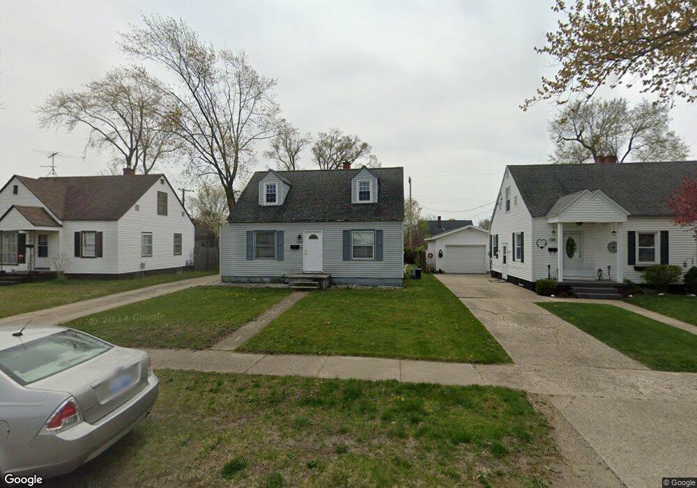
1301 Cornell Rd Muskegon, MI 49441
Roosevelt Park NeighborhoodEstimated Value: $185,759 - $206,000
3
Beds
1
Bath
1,094
Sq Ft
$176/Sq Ft
Est. Value
About This Home
This home is located at 1301 Cornell Rd, Muskegon, MI 49441 and is currently estimated at $192,940, approximately $176 per square foot. 1301 Cornell Rd is a home located in Muskegon County with nearby schools including Mona Shores High School, Dr. Martin Luther King Academy, and West Shore Lutheran School.
Ownership History
Date
Name
Owned For
Owner Type
Purchase Details
Closed on
Jun 30, 2006
Sold by
Whalen Ruth M
Bought by
Mckibbin Brian K
Current Estimated Value
Home Financials for this Owner
Home Financials are based on the most recent Mortgage that was taken out on this home.
Original Mortgage
$61,600
Outstanding Balance
$36,712
Interest Rate
6.72%
Mortgage Type
Unknown
Estimated Equity
$156,228
Purchase Details
Closed on
Nov 30, 2004
Sold by
Hepler Kelli J
Bought by
Whalen Ruth M
Home Financials for this Owner
Home Financials are based on the most recent Mortgage that was taken out on this home.
Original Mortgage
$92,530
Interest Rate
6.12%
Mortgage Type
Unknown
Create a Home Valuation Report for This Property
The Home Valuation Report is an in-depth analysis detailing your home's value as well as a comparison with similar homes in the area
Home Values in the Area
Average Home Value in this Area
Purchase History
| Date | Buyer | Sale Price | Title Company |
|---|---|---|---|
| Mckibbin Brian K | $77,000 | Harbor Title | |
| Whalen Ruth M | -- | Harbor Title |
Source: Public Records
Mortgage History
| Date | Status | Borrower | Loan Amount |
|---|---|---|---|
| Open | Mckibbin Brian K | $61,600 | |
| Previous Owner | Whalen Ruth M | $92,530 |
Source: Public Records
Tax History Compared to Growth
Tax History
| Year | Tax Paid | Tax Assessment Tax Assessment Total Assessment is a certain percentage of the fair market value that is determined by local assessors to be the total taxable value of land and additions on the property. | Land | Improvement |
|---|---|---|---|---|
| 2025 | $1,892 | $82,000 | $0 | $0 |
| 2024 | $726 | $72,100 | $0 | $0 |
| 2023 | $694 | $64,900 | $0 | $0 |
| 2022 | $1,725 | $56,500 | $0 | $0 |
| 2021 | $1,643 | $51,400 | $0 | $0 |
| 2020 | $1,624 | $48,800 | $0 | $0 |
| 2019 | $1,594 | $44,800 | $0 | $0 |
| 2018 | $1,557 | $42,200 | $0 | $0 |
| 2017 | $1,521 | $41,200 | $0 | $0 |
| 2016 | $578 | $36,700 | $0 | $0 |
| 2015 | -- | $31,600 | $0 | $0 |
| 2014 | -- | $34,600 | $0 | $0 |
| 2013 | -- | $32,400 | $0 | $0 |
Source: Public Records
Map
Nearby Homes
- 1377 Princeton Rd
- 1521 Cornell Rd
- 1059 W Summit Ave
- 2881 Cornell Ct
- 1448 Marlboro Rd
- 1480 Marlboro Rd
- 1650 Bonneville Dr
- 1405 Winchester Dr
- 1582 Haverhill Rd
- 3246 Royal Oak Rd
- 1689 Bonneville Dr
- 893 Post Rd
- 1564 Montague Ave
- 868 Post Rd
- 2552 Wickham Dr
- 3320 Davis Rd
- 1543 Randolph Ave
- 1752 Bonneville Dr
- 1408 Lexington Ave
- 1705 Montague Ave
- 1293 Cornell Rd
- 1307 Cornell Rd
- 1287 Cornell Rd
- 1315 Cornell Rd
- 1302 W Summit Ave
- 1308 W Summit Ave
- 1294 W Summit Ave
- 1316 W Summit Ave
- 1279 Cornell Rd
- 1288 W Summit Ave
- 1302 Cornell Rd
- 1294 Cornell Rd
- 1308 Cornell Rd
- 1322 W Summit Ave
- 1280 W Summit Ave
- 1288 Cornell Rd
- 1316 Cornell Rd
- 1273 Cornell Rd
- 1329 Cornell Rd
- 1330 W Summit Ave