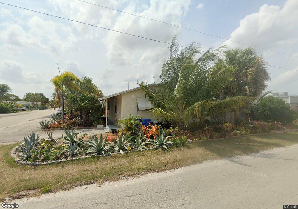
1301 Date Palm Dr Lantana, FL 33462
Southwinds NeighborhoodEstimated Value: $362,490 - $462,000
--
Bed
2
Baths
1,120
Sq Ft
$353/Sq Ft
Est. Value
About This Home
This home is located at 1301 Date Palm Dr, Lantana, FL 33462 and is currently estimated at $395,830, approximately $353 per square foot. 1301 Date Palm Dr is a home located in Palm Beach County with nearby schools including Barton Elementary School, Lake Worth High School, and Lantana Middle School.
Ownership History
Date
Name
Owned For
Owner Type
Purchase Details
Closed on
Aug 3, 2009
Sold by
Lsf6 Mercury Reo Investments Llc
Bought by
Ramiccio Thomas M and Ramiccio Carol
Current Estimated Value
Purchase Details
Closed on
Nov 13, 2008
Sold by
Wilson Andrew P and Wilson Charito E
Bought by
Lsf6 Mercury Reo Investments Llc
Purchase Details
Closed on
Nov 15, 2005
Sold by
Marietta John A and Marietta Ann M
Bought by
Wilson Andrew P
Home Financials for this Owner
Home Financials are based on the most recent Mortgage that was taken out on this home.
Original Mortgage
$189,000
Interest Rate
7.25%
Mortgage Type
Fannie Mae Freddie Mac
Purchase Details
Closed on
Jan 24, 1995
Sold by
Bonehill Gary T and Bonehill Catherine
Bought by
Marletta John A and Marletta Ann M
Home Financials for this Owner
Home Financials are based on the most recent Mortgage that was taken out on this home.
Original Mortgage
$36,800
Interest Rate
9.24%
Create a Home Valuation Report for This Property
The Home Valuation Report is an in-depth analysis detailing your home's value as well as a comparison with similar homes in the area
Home Values in the Area
Average Home Value in this Area
Purchase History
| Date | Buyer | Sale Price | Title Company |
|---|---|---|---|
| Ramiccio Thomas M | $46,500 | Paramount Title Corporation | |
| Lsf6 Mercury Reo Investments Llc | $300 | None Available | |
| Wilson Andrew P | $210,000 | Mitchell Land & Title Inc | |
| Marletta John A | $46,000 | -- |
Source: Public Records
Mortgage History
| Date | Status | Borrower | Loan Amount |
|---|---|---|---|
| Previous Owner | Wilson Andrew P | $189,000 | |
| Previous Owner | Marletta John A | $36,800 |
Source: Public Records
Tax History Compared to Growth
Tax History
| Year | Tax Paid | Tax Assessment Tax Assessment Total Assessment is a certain percentage of the fair market value that is determined by local assessors to be the total taxable value of land and additions on the property. | Land | Improvement |
|---|---|---|---|---|
| 2024 | $5,186 | $186,275 | -- | -- |
| 2023 | $4,808 | $169,341 | $0 | $0 |
| 2022 | $4,737 | $153,946 | $0 | $0 |
| 2021 | $3,778 | $148,234 | $74,000 | $74,234 |
| 2020 | $3,717 | $163,126 | $85,100 | $78,026 |
| 2019 | $3,451 | $144,626 | $66,600 | $78,026 |
| 2018 | $3,175 | $139,327 | $73,600 | $65,727 |
| 2017 | $2,838 | $126,740 | $64,000 | $62,740 |
| 2016 | $2,648 | $86,898 | $0 | $0 |
| 2015 | $2,335 | $78,998 | $0 | $0 |
| 2014 | $2,595 | $90,100 | $0 | $0 |
Source: Public Records
Map
Nearby Homes
- 1307 Flamingo Dr
- 1331 Gateway Dr
- 815 Andrew Redding Rd Unit 401
- 803 Ridge Rd Unit 7
- 728 Ridge Rd Unit 35
- 1320 Ontario Dr
- 1319 Lake Erie Dr
- 1716 Barton Ct
- 1438 Cindy Dr
- 1445 Cindy Dr
- 1413 S C Terrace
- 1407 Ontario Dr
- 1707 High Ridge Rd
- 1426 Hillcrest Dr
- 1314 S B St
- 1501 Lee Ct
- 1222 14th Ct S
- 1319 Crest Dr
- 1503 Shirley Ct
- 1409 W Ocean Ave
- 1307 Date Palm Dr
- 1302 Gateway Dr
- 1304 Gateway Dr Unit F2
- 1300 Gateway Dr Unit F4
- 1306 Gateway Dr Unit F1
- 1308 Gateway Dr Unit E4
- 1311 Date Palm Dr
- 1310 Gateway Dr Unit E3
- 1312 Gateway Dr Unit E2
- 1300 Date Palm Dr
- 1306 Date Palm Dr
- 1314 Gateway Dr
- 1303 Gateway Dr Unit G3
- 1301 Gateway Dr Unit G4
- 1305 Gateway Dr Unit G2
- 1309 Gateway Dr Unit H-4
- 1309 Gateway Dr Unit 1309
- 1307 Gateway Dr Unit G1
- 1307 Gateway Dr Unit 1307
- 1315 Date Palm Dr