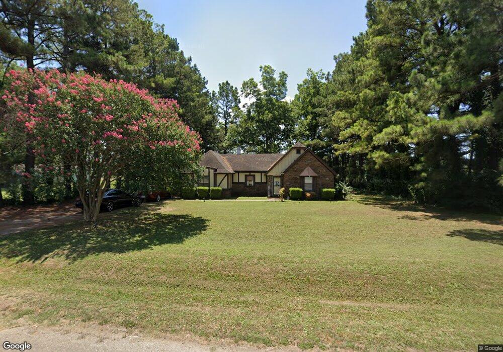
1301 Dogwood Rd Blytheville, AR 72315
Estimated Value: $130,000 - $184,000
--
Bed
--
Bath
2,120
Sq Ft
$70/Sq Ft
Est. Value
About This Home
This home is located at 1301 Dogwood Rd, Blytheville, AR 72315 and is currently estimated at $148,557, approximately $70 per square foot. 1301 Dogwood Rd is a home located in Mississippi County with nearby schools including Blytheville Primary School, Blytheville Elementary School, and Blytheville Middle School.
Ownership History
Date
Name
Owned For
Owner Type
Purchase Details
Closed on
Jan 2, 2015
Sold by
State Land Comm/Hester
Bought by
Hester Lovie Denise
Current Estimated Value
Purchase Details
Closed on
Jan 1, 2015
Sold by
State Land Comm/Hester
Bought by
Hester Lovie Denise
Purchase Details
Closed on
Jan 2, 2013
Sold by
Green Joseph Carl
Bought by
Hester Lovie Denise
Purchase Details
Closed on
Jan 1, 2013
Sold by
Green Joseph Carl
Bought by
Hester Lovie Denise
Purchase Details
Closed on
Jan 2, 2008
Sold by
Hester Lovie
Bought by
Green Joseph Carl
Purchase Details
Closed on
Jan 1, 2008
Sold by
Hester Lovie
Bought by
Green Joseph Carl
Purchase Details
Closed on
Jan 2, 1978
Bought by
Hester Lovie
Purchase Details
Closed on
Jan 1, 1978
Bought by
Hester Lovie
Create a Home Valuation Report for This Property
The Home Valuation Report is an in-depth analysis detailing your home's value as well as a comparison with similar homes in the area
Home Values in the Area
Average Home Value in this Area
Purchase History
| Date | Buyer | Sale Price | Title Company |
|---|---|---|---|
| Hester Lovie Denise | -- | -- | |
| Hester Lovie Denise | -- | -- | |
| Hester Lovie Denise | -- | -- | |
| Hester Lovie Denise | -- | -- | |
| Green Joseph Carl | -- | -- | |
| Green Joseph Carl | -- | -- | |
| Hester Lovie | -- | -- | |
| Hester Lovie | -- | -- |
Source: Public Records
Tax History Compared to Growth
Tax History
| Year | Tax Paid | Tax Assessment Tax Assessment Total Assessment is a certain percentage of the fair market value that is determined by local assessors to be the total taxable value of land and additions on the property. | Land | Improvement |
|---|---|---|---|---|
| 2025 | $1,054 | $19,441 | $2,000 | $17,441 |
| 2024 | $915 | $19,441 | $2,000 | $17,441 |
| 2023 | $915 | $19,441 | $2,000 | $17,441 |
| 2022 | $915 | $19,441 | $2,000 | $17,441 |
| 2021 | $1,113 | $18,358 | $2,000 | $16,358 |
| 2020 | -- | $18,358 | $2,000 | $16,358 |
| 2019 | -- | -- | $2,000 | $16,358 |
| 2018 | -- | -- | $2,000 | $16,358 |
| 2017 | -- | -- | $2,000 | $18,592 |
| 2015 | -- | -- | $2,000 | $17,273 |
| 2013 | -- | -- | $2,000 | $18,593 |
Source: Public Records
Map
Nearby Homes
- 3315 S Division St
- 00 Trent Rd
- 1252 S 10th St
- 1603 Basin St
- 707 Henderson St
- 3649 N State Highway 239
- 1810 Stuart St
- 1810 Stewart St
- .62 acre S 16th St
- 3137 U S 61
- 916 S 21st St
- 1702 S Ruddle Rd
- 1610 Harmon St
- TBD S Highway 61
- 1005 S Franklin St
- 2411 Carolyn St
- 413 S 21st St
- 1005 S Lilly St
- 411 S Lilly St
- 1704 W Main St
- 1305 Dogwood Rd
- 3801 S Division St
- 1225 Dogwood Rd
- 3101 S Division St
- 3475 S Division St
- 2980 N Us Highway 61
- 3140 S Division St
- 2960 N Us Highway 61
- 3140 N Us Highway 61
- 3575 S Division St
- 1528 Parco Rd
- 1300 Kari Ln
- 1300 Kari Ln Unit 1300-1310 Kari Lane
- 1595 Dogwood Rd
- 1320 Kari Ln Unit 1300-1310
- 1320 Kari Ln
- 1320 Kari Ln
- 1220 Kari Ln
- 1210 Kari Ln
- 1400 Kari Ln