Estimated Value: $302,956 - $343,000
3
Beds
3
Baths
1,706
Sq Ft
$185/Sq Ft
Est. Value
About This Home
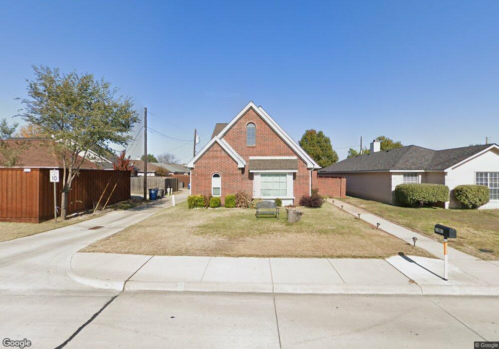
This home is located at 1301 E Brown St, Wylie, TX 75098 and is currently estimated at $315,989, approximately $185 per square foot. 1301 E Brown St is a home located in Collin County with nearby schools including P M Akin Elementary School, AB Harrison Intermediate School, and Grady Burnett J High School.
Ownership History
Date
Name
Owned For
Owner Type
Purchase Details
Closed on
May 14, 2012
Sold by
Hashim Janan Ponti and Prothro Janan H
Bought by
Zerom Genet T
Current Estimated Value
Home Financials for this Owner
Home Financials are based on the most recent Mortgage that was taken out on this home.
Original Mortgage
$104,080
Outstanding Balance
$73,118
Interest Rate
4.2%
Mortgage Type
FHA
Estimated Equity
$242,871
Purchase Details
Closed on
Mar 12, 1994
Sold by
Prothro Benjamin F
Bought by
Hashim Janan Ponti
Create a Home Valuation Report for This Property
The Home Valuation Report is an in-depth analysis detailing your home's value as well as a comparison with similar homes in the area
Home Values in the Area
Average Home Value in this Area
Purchase History
| Date | Buyer | Sale Price | Title Company |
|---|---|---|---|
| Zerom Genet T | -- | Lawyers Title | |
| Hashim Janan Ponti | -- | -- |
Source: Public Records
Mortgage History
| Date | Status | Borrower | Loan Amount |
|---|---|---|---|
| Open | Zerom Genet T | $104,080 |
Source: Public Records
Tax History Compared to Growth
Tax History
| Year | Tax Paid | Tax Assessment Tax Assessment Total Assessment is a certain percentage of the fair market value that is determined by local assessors to be the total taxable value of land and additions on the property. | Land | Improvement |
|---|---|---|---|---|
| 2025 | $4,166 | $261,126 | $65,025 | $196,101 |
| 2024 | $4,166 | $275,702 | $65,025 | $225,948 |
| 2023 | $4,166 | $250,638 | $65,025 | $186,894 |
| 2022 | $4,999 | $227,853 | $53,550 | $190,334 |
| 2021 | $4,874 | $207,139 | $42,075 | $165,064 |
| 2020 | $4,850 | $204,821 | $34,425 | $170,396 |
| 2019 | $4,667 | $177,584 | $34,425 | $146,272 |
| 2018 | $4,348 | $161,440 | $34,425 | $144,750 |
| 2017 | $3,952 | $146,764 | $30,600 | $116,164 |
| 2016 | $3,894 | $140,160 | $22,950 | $117,210 |
| 2015 | $3,088 | $125,771 | $22,950 | $102,821 |
Source: Public Records
Map
Nearby Homes
- 1308 London Dr
- 1312 Wyndham Dr
- 107 Windy Knoll Ln
- 205 Duck Blind Ave
- 209 Duck Blind Ave
- 1056 Fairview Dr
- 1115 Nighthawk Dr
- 213 N West A Allen Blvd
- 2801-3 N State Highway 78
- 2801-1 N State Highway 78
- 2800 Gold Hill Dr
- 211 Rutherford Ave
- 1209 Surrey Cir
- 312 Maltese Cir
- 407 Sparrow Dr
- 508 Weston St
- 207 Gatwick Ct
- 306 Foxwood Ct
- 702 Lynda Ln
- 310 Hawthorn Dr
- 1303 E Brown St
- 1305 E Brown St
- 200 Piccadilly Cir
- 202 Piccadilly Cir
- 204 Piccadilly Cir
- 1307 E Brown St
- 206 Piccadilly Cir
- 1309 E Brown St
- 201 Parliament Dr
- 208 Piccadilly Cir
- 203 Parliament Dr
- 1311 E Brown St
- 210 Piccadilly Cir
- 1313 E Brown St
- 212 Piccadilly Cir
- 203 Piccadilly Cir
- 205 Piccadilly Cir
- 214 Piccadilly Cir
- 1315 E Brown St
- 205 Parliament Dr