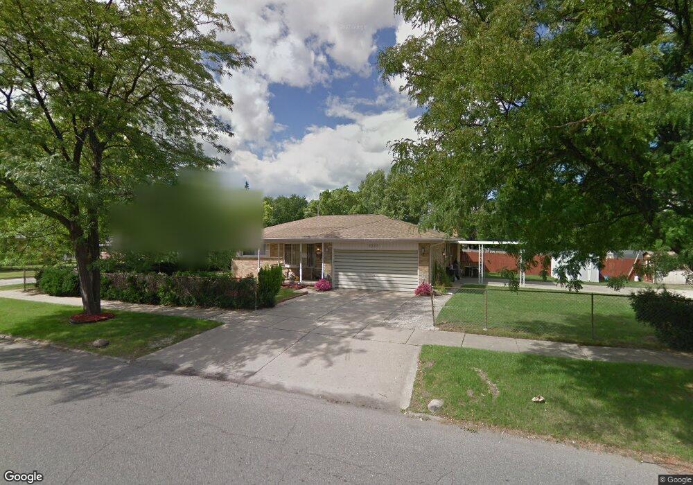
1301 Eldon Baker Dr Flint, MI 48507
Circle Neighborhood NeighborhoodEstimated Value: $72,000 - $130,680
3
Beds
2
Baths
1,387
Sq Ft
$71/Sq Ft
Est. Value
About This Home
This home is located at 1301 Eldon Baker Dr, Flint, MI 48507 and is currently estimated at $98,170, approximately $70 per square foot. 1301 Eldon Baker Dr is a home located in Genesee County with nearby schools including Freeman Elementary School, Flint Southwestern Classical Academy, and Burton Glen Charter Academy.
Ownership History
Date
Name
Owned For
Owner Type
Purchase Details
Closed on
Jan 28, 2008
Sold by
Kelley Vivian
Bought by
Kelley Vivian and Kelley April Denise
Current Estimated Value
Purchase Details
Closed on
Aug 10, 2001
Sold by
Friesen Herbert A and Friesen Louise A
Bought by
Kelley Vivian
Home Financials for this Owner
Home Financials are based on the most recent Mortgage that was taken out on this home.
Original Mortgage
$61,600
Interest Rate
6.99%
Create a Home Valuation Report for This Property
The Home Valuation Report is an in-depth analysis detailing your home's value as well as a comparison with similar homes in the area
Home Values in the Area
Average Home Value in this Area
Purchase History
| Date | Buyer | Sale Price | Title Company |
|---|---|---|---|
| Kelley Vivian | -- | None Available | |
| Kelley Vivian | $51,000 | Stewart Title Guaranty Compa |
Source: Public Records
Mortgage History
| Date | Status | Borrower | Loan Amount |
|---|---|---|---|
| Previous Owner | Kelley Vivian | $61,600 |
Source: Public Records
Tax History
| Year | Tax Paid | Tax Assessment Tax Assessment Total Assessment is a certain percentage of the fair market value that is determined by local assessors to be the total taxable value of land and additions on the property. | Land | Improvement |
|---|---|---|---|---|
| 2025 | $1,215 | $50,500 | $0 | $0 |
| 2024 | $1,093 | $44,400 | $0 | $0 |
| 2023 | $1,069 | $34,900 | $0 | $0 |
| 2022 | $0 | $25,400 | $0 | $0 |
| 2021 | $1,116 | $22,800 | $0 | $0 |
| 2020 | $999 | $20,800 | $0 | $0 |
| 2019 | $968 | $20,700 | $0 | $0 |
| 2018 | $985 | $20,200 | $0 | $0 |
| 2017 | $956 | $0 | $0 | $0 |
| 2016 | $949 | $0 | $0 | $0 |
| 2015 | -- | $0 | $0 | $0 |
| 2014 | -- | $0 | $0 | $0 |
| 2012 | -- | $19,000 | $0 | $0 |
Source: Public Records
Map
Nearby Homes
- 3209 Shawnee Ave
- 2910 Shawnee Ave
- 3505 Comanche Ave
- 3222 Chambers St
- 3115 Circle Dr
- 3056 Shaw St
- 630 Buckingham Ave
- 1111 Lochhead Ave
- 621 Burroughs Ave
- 3128 Ludwig St
- 3277 Sayre Ct
- 4424 Cheyenne Ave
- 621 Lochhead Ave
- 818 Dell Ave
- 2210 S Term St
- 802 McKeighan Ave
- 617 McKeighan Ave
- 416 Burroughs Ave
- 361 Buckingham Ave
- 4127 Custer Ave
- 3209 Menominee Ave
- 3205 Menominee Ave
- 3201 Menominee Ave
- 3208 S Dort Hwy
- 1217 Eldon Baker Dr
- 3210 Menominee Ave
- 3206 Menominee Ave
- 3117 Menominee Ave
- 3124 S Dort Hwy
- 3124 S Dort Hwy Unit 3208 South Dort High
- 3202 Menominee Ave
- 3113 Menominee Ave
- 3118 Menominee Ave
- 1201 Eldon Baker Dr
- 3209 Cheyenne Ave
- 3255 S Dort Hwy
- 3210 S Dort Hwy
- 3118 S Dort Hwy
- 3109 Menominee Ave
- 3114 Menominee Ave
Your Personal Tour Guide
Ask me questions while you tour the home.