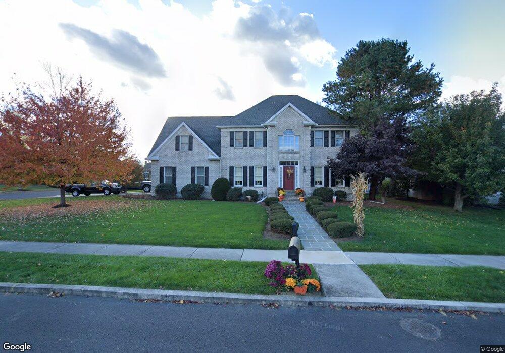
1301 Georgetown Cir Carlisle, PA 17013
Estimated Value: $504,000 - $560,818
4
Beds
3
Baths
2,744
Sq Ft
$196/Sq Ft
Est. Value
About This Home
This home is located at 1301 Georgetown Cir, Carlisle, PA 17013 and is currently estimated at $538,205, approximately $196 per square foot. 1301 Georgetown Cir is a home located in Cumberland County with nearby schools including Mooreland Elementary School, Lamberton Middle School, and Carlisle Area High School.
Ownership History
Date
Name
Owned For
Owner Type
Purchase Details
Closed on
Oct 16, 2000
Sold by
Cross Dale L
Bought by
Martin John R
Current Estimated Value
Home Financials for this Owner
Home Financials are based on the most recent Mortgage that was taken out on this home.
Original Mortgage
$170,000
Outstanding Balance
$61,864
Interest Rate
7.89%
Estimated Equity
$476,341
Create a Home Valuation Report for This Property
The Home Valuation Report is an in-depth analysis detailing your home's value as well as a comparison with similar homes in the area
Home Values in the Area
Average Home Value in this Area
Purchase History
| Date | Buyer | Sale Price | Title Company |
|---|---|---|---|
| Martin John R | $290,000 | -- |
Source: Public Records
Mortgage History
| Date | Status | Borrower | Loan Amount |
|---|---|---|---|
| Open | Martin John R | $170,000 |
Source: Public Records
Tax History Compared to Growth
Tax History
| Year | Tax Paid | Tax Assessment Tax Assessment Total Assessment is a certain percentage of the fair market value that is determined by local assessors to be the total taxable value of land and additions on the property. | Land | Improvement |
|---|---|---|---|---|
| 2025 | $8,513 | $361,500 | $91,600 | $269,900 |
| 2024 | $8,268 | $361,500 | $91,600 | $269,900 |
| 2023 | $7,891 | $361,500 | $91,600 | $269,900 |
| 2022 | $7,778 | $361,500 | $91,600 | $269,900 |
| 2021 | $7,667 | $361,500 | $91,600 | $269,900 |
| 2020 | $7,505 | $361,500 | $91,600 | $269,900 |
| 2019 | $7,348 | $361,500 | $91,600 | $269,900 |
| 2018 | $7,191 | $361,500 | $91,600 | $269,900 |
| 2017 | $7,048 | $361,500 | $91,600 | $269,900 |
| 2016 | -- | $361,500 | $91,600 | $269,900 |
| 2015 | -- | $361,500 | $91,600 | $269,900 |
| 2014 | -- | $361,500 | $91,600 | $269,900 |
Source: Public Records
Map
Nearby Homes
- 1215 Georgetown Cir
- 3 Baird Ct
- 1339 Georgetown Cir
- 911 Walnut St
- 808 Walnut Ln
- 628 Yorkshire Dr
- 500 Belvedere St
- 628 Belvedere St
- 901 Stratford Dr
- 808 Wellington Dr
- 13 Shillington Ln
- 1514 Terrace Ave
- 670 W Louther St
- 944 W North St
- 250 Mooreland Ave
- 124 Conway St
- 412 W South St
- Carter Plan at Grange - Single Family
- Corby Plan at Grange - Single Family
- Arundel Plan at Grange - Single Family
- 1309 Georgetown Cir
- 1303 White Birch Ln
- 1221 Georgetown Cir
- 207 Taunton Dr
- 1236 White Birch Ln
- 1302 Georgetown Cir
- 1304 Georgetown Cir
- 205 Taunton Dr
- 1306 Georgetown Cir
- 1315 Georgetown Cir
- 1308 Georgetown Cir
- 1310 Georgetown Cir
- 1219 Georgetown Cir
- 1312 Georgetown Cir
- 203 Taunton Dr
- 1314 Georgetown Cir
- 206 Taunton Dr
- 1234 White Birch Ln
- 204 Taunton Dr
- 1214 Georgetown Cir