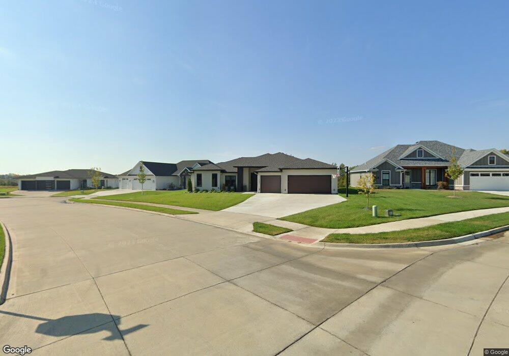
1301 Haxby Ct Columbia, MO 65201
Estimated Value: $481,000 - $565,000
4
Beds
3
Baths
2,061
Sq Ft
$251/Sq Ft
Est. Value
About This Home
This home is located at 1301 Haxby Ct, Columbia, MO 65201 and is currently estimated at $516,591, approximately $250 per square foot. 1301 Haxby Ct is a home with nearby schools including Cedar Ridge Elementary School, Oakland Middle School, and Muriel W. Battle High School.
Ownership History
Date
Name
Owned For
Owner Type
Purchase Details
Closed on
Aug 26, 2021
Sold by
Sgor Llc
Bought by
Laurence Bowers and Laurence Wintana Bowers
Current Estimated Value
Home Financials for this Owner
Home Financials are based on the most recent Mortgage that was taken out on this home.
Original Mortgage
$403,568
Outstanding Balance
$367,217
Interest Rate
2.8%
Mortgage Type
New Conventional
Estimated Equity
$149,374
Purchase Details
Closed on
Jan 4, 2021
Sold by
Brooks At Columbia Llc
Bought by
Sgor Llc
Home Financials for this Owner
Home Financials are based on the most recent Mortgage that was taken out on this home.
Original Mortgage
$346,375
Interest Rate
2.7%
Mortgage Type
Future Advance Clause Open End Mortgage
Create a Home Valuation Report for This Property
The Home Valuation Report is an in-depth analysis detailing your home's value as well as a comparison with similar homes in the area
Home Values in the Area
Average Home Value in this Area
Purchase History
| Date | Buyer | Sale Price | Title Company |
|---|---|---|---|
| Laurence Bowers | -- | Boone Central Title Company | |
| Sgor Llc | -- | Boone Central Title Company |
Source: Public Records
Mortgage History
| Date | Status | Borrower | Loan Amount |
|---|---|---|---|
| Open | Laurence Bowers | $403,568 | |
| Previous Owner | Sgor Llc | $346,375 |
Source: Public Records
Tax History Compared to Growth
Tax History
| Year | Tax Paid | Tax Assessment Tax Assessment Total Assessment is a certain percentage of the fair market value that is determined by local assessors to be the total taxable value of land and additions on the property. | Land | Improvement |
|---|---|---|---|---|
| 2025 | $4,825 | $78,964 | $11,780 | $67,184 |
| 2024 | $4,825 | $68,970 | $11,780 | $57,190 |
| 2023 | $4,787 | $68,970 | $11,780 | $57,190 |
| 2022 | $4,782 | $68,970 | $11,780 | $57,190 |
| 2021 | $454 | $6,536 | $6,536 | $0 |
| 2020 | $482 | $6,536 | $6,536 | $0 |
| 2019 | $482 | $6,536 | $6,536 | $0 |
Source: Public Records
Map
Nearby Homes
- 5012 Kenora Dr
- 1108 Shore Acres Loop
- 1050 Shore Acres Loop
- 4917 Longbow Dr
- 1108 Shadow Hawk Ct
- 4720 Kenora Dr
- 1104 Shadow Hawk Ct
- 1459 Spring Mountain Dr
- 4801 Hoylake Cir
- 4805 Hoylake Cir
- 5004 Stone Mountain Pkwy
- 4910 Stone Mountain Pkwy
- 4903 Stone Mountain Pkwy
- 4813 Hoylake Cir
- 2001 Stone Mountain Pkwy
- 913 Spyglass Ct
- 909 Spyglass Ct
- 1303 Morning Dove Dr
- 1620 S Berkley Dr
- 4725 Stayton Ferry Cir
- 1305 Haxby Ct
- 4932 Kenora Dr
- 4928 Kenora Dr
- 1309 Haxby Ct
- 4931 Kenora Dr
- 4924 Kenora Dr
- 4927 Kenora Dr
- 1304 Haxby Ct
- 5000 Kenora Dr
- 5003 Kenora Dr
- 4920 Kenora Dr
- 4923 Kenora Dr
- 5004 Kenora Dr
- 1134 Shore Acres Loop
- 4919 Kenora Dr
- 1130 Shore Acres Loop
- 4916 Kenora Dr
- 5008 Kenora Dr
- 1142 Shore Acres Loop
- 4913 Kenora Dr