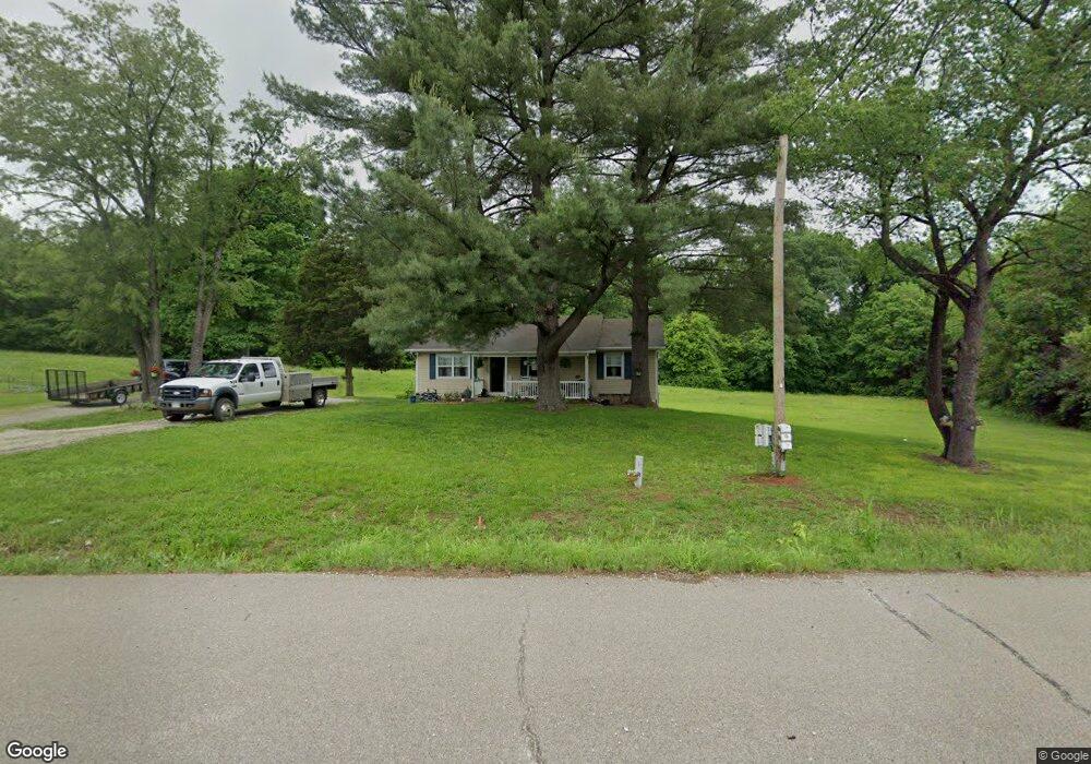
1301 Highway at Villa Ridge, MO 63089
Estimated Value: $197,000 - $269,000
2
Beds
1
Bath
1,204
Sq Ft
$194/Sq Ft
Est. Value
About This Home
This home is located at 1301 Highway at, Villa Ridge, MO 63089 and is currently estimated at $234,111, approximately $194 per square foot. 1301 Highway at is a home located in Franklin County with nearby schools including Washington High School and Crosspoint Christian School.
Ownership History
Date
Name
Owned For
Owner Type
Purchase Details
Closed on
Apr 26, 2017
Sold by
Scott Terry and Scott Joan
Bought by
Scott Trust
Current Estimated Value
Purchase Details
Closed on
Mar 16, 2010
Sold by
Marrocco Jacob F and Marrocco Laura L
Bought by
Winchester Daniel A and Winchester Gretchen K
Home Financials for this Owner
Home Financials are based on the most recent Mortgage that was taken out on this home.
Original Mortgage
$140,714
Interest Rate
4.95%
Mortgage Type
New Conventional
Create a Home Valuation Report for This Property
The Home Valuation Report is an in-depth analysis detailing your home's value as well as a comparison with similar homes in the area
Home Values in the Area
Average Home Value in this Area
Purchase History
| Date | Buyer | Sale Price | Title Company |
|---|---|---|---|
| Scott Trust | -- | -- | |
| Winchester Daniel A | -- | None Available |
Source: Public Records
Mortgage History
| Date | Status | Borrower | Loan Amount |
|---|---|---|---|
| Previous Owner | Winchester Daniel A | $140,714 |
Source: Public Records
Tax History Compared to Growth
Tax History
| Year | Tax Paid | Tax Assessment Tax Assessment Total Assessment is a certain percentage of the fair market value that is determined by local assessors to be the total taxable value of land and additions on the property. | Land | Improvement |
|---|---|---|---|---|
| 2024 | $2,100 | $30,687 | $0 | $0 |
| 2023 | $2,100 | $30,687 | $0 | $0 |
| 2022 | $1,928 | $29,684 | $0 | $0 |
| 2021 | $1,944 | $29,684 | $0 | $0 |
| 2020 | $1,853 | $27,107 | $0 | $0 |
| 2019 | $1,852 | $27,107 | $0 | $0 |
| 2018 | $1,809 | $26,344 | $0 | $0 |
| 2017 | $1,807 | $26,344 | $0 | $0 |
| 2016 | $1,666 | $24,662 | $0 | $0 |
| 2015 | $1,579 | $24,662 | $0 | $0 |
| 2014 | $1,566 | $24,867 | $0 | $0 |
Source: Public Records
Map
Nearby Homes
- 618 Carolee Ct
- 156 Old Highway O
- 0 Hwy at Unit 23020913
- 254 Highway M
- 972 Sunny Ridge View
- 126 Rainbow Lake Dr
- 732 American Inn Rd
- 000 Shawneetown Ford Spur Lot 4
- 405 Highway M
- 730 Silo Ln
- 000 Shawneetown Ford Spur Lot 2
- 000 Shawneetown Ford Spur Tract C
- 575 E Villa Ridge Rd
- 000 Shawneetown Ford Spur Tract A
- 475 White Oak Ct
- 000 Shawneetown Ford Spur Lot 3
- 000 Shawneetown Ford Spur Tract D
- 5989 Gildehaus Rd
- 000 Shawneetown Ford Spur Tract B
- 456 Highway M
- 1302 State Highway at
- 1302 Highway at
- 11 Vineyard Hills Dr Ln
- 11 Vineyard Hills Dr 34 32ac Ln
- 1266 Highway at
- 1266 Highway at
- 427 Highway at
- 0 Vineyard Hills Unit 13011337
- 12661262 Highway at
- 1333 Highway at
- 6434 Hilltop Rd
- 6408 Hilltop Rd
- 1259 Highway at
- 6410 Hilltop Rd
- 1244 Highway at
- 457475 Highway at
- 1263 Vineyard Hills
- 1144 Highway at
- 6388 Hilltop Rd
- 1243 Highway at