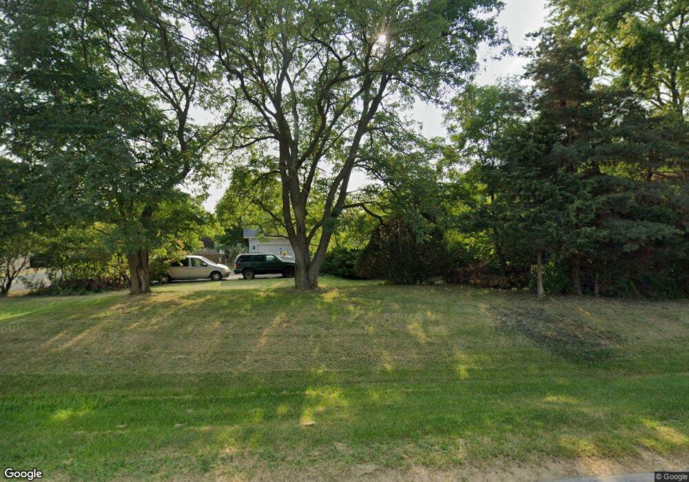
1301 Kenosha Rd Zion, IL 60099
West Zion NeighborhoodEstimated Value: $287,000 - $318,000
3
Beds
2
Baths
1,404
Sq Ft
$216/Sq Ft
Est. Value
About This Home
This home is located at 1301 Kenosha Rd, Zion, IL 60099 and is currently estimated at $303,624, approximately $216 per square foot. 1301 Kenosha Rd is a home located in Lake County with nearby schools including Kenneth Murphy School, Beach Park Middle School, and Zion-Benton Township High School.
Ownership History
Date
Name
Owned For
Owner Type
Purchase Details
Closed on
Mar 28, 2025
Sold by
Guidish Melodie S and Rodbro Jessica S
Bought by
Guidish Melodie S
Current Estimated Value
Purchase Details
Closed on
Apr 25, 2020
Sold by
Guidish Steven J and Guidish Melodie S
Bought by
Guidish Steven J
Home Financials for this Owner
Home Financials are based on the most recent Mortgage that was taken out on this home.
Original Mortgage
$136,800
Interest Rate
3.3%
Mortgage Type
VA
Purchase Details
Closed on
Dec 5, 2001
Sold by
Davis Freddie W
Bought by
Guidish Steven J and Guidish Melodie S
Purchase Details
Closed on
Jan 7, 2000
Sold by
Rhode Thomas and Rhode Teresa
Bought by
Davis Freddie W
Home Financials for this Owner
Home Financials are based on the most recent Mortgage that was taken out on this home.
Original Mortgage
$153,985
Interest Rate
7.89%
Mortgage Type
VA
Create a Home Valuation Report for This Property
The Home Valuation Report is an in-depth analysis detailing your home's value as well as a comparison with similar homes in the area
Home Values in the Area
Average Home Value in this Area
Purchase History
| Date | Buyer | Sale Price | Title Company |
|---|---|---|---|
| Guidish Melodie S | -- | None Listed On Document | |
| Guidish Steven J | -- | Attorney | |
| Guidish Steven J | -- | -- | |
| Davis Freddie W | $149,500 | -- |
Source: Public Records
Mortgage History
| Date | Status | Borrower | Loan Amount |
|---|---|---|---|
| Previous Owner | Guidish Steven J | $136,800 | |
| Previous Owner | Davis Freddie W | $159,433 | |
| Previous Owner | Davis Freddie W | $153,985 |
Source: Public Records
Tax History Compared to Growth
Tax History
| Year | Tax Paid | Tax Assessment Tax Assessment Total Assessment is a certain percentage of the fair market value that is determined by local assessors to be the total taxable value of land and additions on the property. | Land | Improvement |
|---|---|---|---|---|
| 2024 | $8,083 | $79,932 | $16,142 | $63,790 |
| 2023 | $7,598 | $71,266 | $14,392 | $56,874 |
| 2022 | $7,598 | $64,235 | $11,858 | $52,377 |
| 2021 | $7,480 | $60,258 | $11,124 | $49,134 |
| 2020 | $7,205 | $56,676 | $10,463 | $46,213 |
| 2019 | $6,999 | $52,796 | $9,747 | $43,049 |
| 2018 | $5,931 | $44,934 | $8,764 | $36,170 |
| 2017 | $5,807 | $41,683 | $8,130 | $33,553 |
| 2016 | $5,358 | $37,838 | $7,380 | $30,458 |
| 2015 | $5,114 | $34,332 | $6,696 | $27,636 |
| 2014 | $5,169 | $35,326 | $6,533 | $28,793 |
| 2012 | $5,637 | $37,621 | $6,957 | $30,664 |
Source: Public Records
Map
Nearby Homes
- 1304 Pelican Ct
- 3707 Willow Crest Dr
- 3717 Willow Crest Dr
- 1531 Southport Ct
- 4014 Ridge Rd
- 1417 Westside Trail
- 1521 Southport Ct
- 1302 Lorelei Dr
- 1405 Lewis Ave
- 0 9th St
- 908 Countrywood Dr
- 1817 Joppa Ave
- 1814 Jethro Ave
- 1703 Hermon Ave
- 1807 Horeb Ave
- 4539 Illinois 173
- 4533 Illinois 173
- 42908 N Lewis Ave
- 2004 Joanna Ave
- 1701 Galilee Ave
- 1308 Pelican Ct
- 1306 Pelican Ct
- 42023 N Kenosha Rd
- 1315 Kenosha Rd
- 618 Kakos Ct
- 616 Kakos Ct
- 620 Kakos Ct
- 614 Kakos Ct
- 622 Kakos Ct
- 617 Kakos Ct
- 1310 Pelican Ct
- 619 Kakos Ct
- 615 Kakos Ct
- 624 Kakos Ct
- 1302 Pelican Ct
- 234 Willow Crest Dr
- 238 Willow Crest Dr
- 3512 Portsmouth Dr
- 3510 Portsmouth Dr
- 626 Kakos Ct
