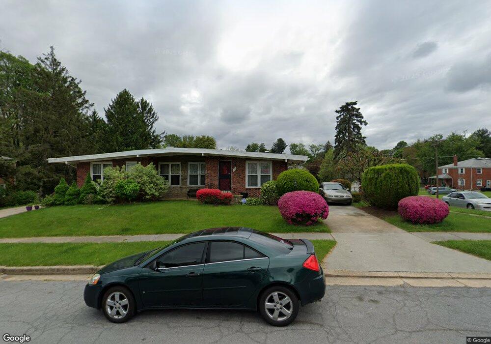
1301 Knightswood Rd Baltimore, MD 21239
Estimated Value: $210,013 - $342,000
Studio
2
Baths
1,234
Sq Ft
$228/Sq Ft
Est. Value
About This Home
This home is located at 1301 Knightswood Rd, Baltimore, MD 21239 and is currently estimated at $281,503, approximately $228 per square foot. 1301 Knightswood Rd is a home located in Baltimore County with nearby schools including Halstead Academy, Loch Raven Technical Academy, and Towson High Law & Public Policy.
Ownership History
Date
Name
Owned For
Owner Type
Purchase Details
Closed on
Feb 21, 2007
Sold by
Lee Yu Ting Lee Den Toy
Bought by
Lee Yu Ting Lee Den Toy and Lee Sik Yue Lee Sik Kueng
Current Estimated Value
Purchase Details
Closed on
Nov 9, 2006
Sold by
Lee Yu Ting Lee Den Toy
Bought by
Lee Yu Ting Lee Den Toy and Lee Sik Yue Lee Sik Kehng
Purchase Details
Closed on
Nov 7, 2006
Sold by
Lee Yu Ting Lee Den Toy
Bought by
Lee Yu Ting Lee Den Toy and Lee Sik Yue Lee Sik Kueng
Purchase Details
Closed on
Nov 18, 1994
Sold by
Compisi Samuel A
Bought by
Lee Yu Ting
Create a Home Valuation Report for This Property
The Home Valuation Report is an in-depth analysis detailing your home's value as well as a comparison with similar homes in the area
Home Values in the Area
Average Home Value in this Area
Purchase History
| Date | Buyer | Sale Price | Title Company |
|---|---|---|---|
| Lee Yu Ting Lee Den Toy | -- | -- | |
| Lee Yu Ting Lee Den Toy | -- | -- | |
| Lee Yu Ting Lee Den Toy | -- | -- | |
| Lee Yu Ting Lee Den Toy | -- | -- | |
| Lee Yu Ting | $89,000 | -- |
Source: Public Records
Tax History
| Year | Tax Paid | Tax Assessment Tax Assessment Total Assessment is a certain percentage of the fair market value that is determined by local assessors to be the total taxable value of land and additions on the property. | Land | Improvement |
|---|---|---|---|---|
| 2025 | $3,081 | $205,900 | $80,000 | $125,900 |
| 2024 | $3,081 | $197,267 | $0 | $0 |
| 2023 | $1,477 | $188,633 | $0 | $0 |
| 2022 | $2,837 | $180,000 | $80,000 | $100,000 |
| 2021 | $2,634 | $175,167 | $0 | $0 |
| 2020 | $2,634 | $170,333 | $0 | $0 |
| 2019 | $2,541 | $165,500 | $80,000 | $85,500 |
| 2018 | $2,394 | $161,633 | $0 | $0 |
| 2017 | $2,230 | $157,767 | $0 | $0 |
| 2016 | $2,194 | $153,900 | $0 | $0 |
| 2015 | $2,194 | $153,900 | $0 | $0 |
| 2014 | $2,194 | $153,900 | $0 | $0 |
Source: Public Records
Map
Nearby Homes
- 1306 Brixton Rd
- 1211 Brixton Rd
- 1302 Glenmont Rd
- 1311 Glenmont Rd
- 1204 Saint Andrews Way
- 6750 Glenkirk Rd
- 6702 Queens Ferry Rd
- 1413 Glendale Rd
- 6701 Loch Raven Blvd
- 1417 Glendale Rd
- 6923 Summit Cir
- 922 Fairway Dr
- 701 Hillen Rd
- 49 Ashlar Hill Ct
- 19 Ashlar Hill Ct
- 935 Litchfield Rd
- 12 Stone Ridge Ct
- 6580 Loch Raven Blvd
- 6504 Crestwood Rd
- 310 Worthington Rd
- 1303 Knightswood Rd
- 1305 Knightswood Rd
- 1300 Brixton Rd
- 1244 Knightswood Rd
- 1302 Brixton Rd
- 1304 Brixton Rd
- 1307 Knightswood Rd
- 1216 Brixton Rd
- 1146 Glendale Rd
- 1242 Knightswood Rd
- 1214 Brixton Rd
- 1144 Glendale Rd
- 1308 Brixton Rd
- 6822 Barnett Rd
- 1141 Glendale Rd
- 1212 Brixton Rd
- 1143 Glendale Rd
- 1240 Knightswood Rd
- 6824 Barnett Rd
- 1310 Brixton Rd
Your Personal Tour Guide
Ask me questions while you tour the home.