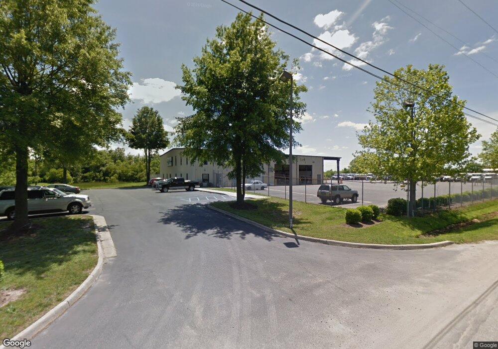
1301 Mccloud Rd Chesapeake, VA 23320
South Norfolk Neighborhood
--
Bed
--
Bath
9,030
Sq Ft
8.46
Acres
About This Home
This home is located at 1301 Mccloud Rd, Chesapeake, VA 23320. 1301 Mccloud Rd is a home located in Chesapeake City with nearby schools including B.M. Williams Primary School, Crestwood Intermediate School, and Crestwood Middle School.
Ownership History
Date
Name
Owned For
Owner Type
Purchase Details
Closed on
Jul 24, 2001
Sold by
Eagle Tranport Corporatio
Bought by
Ads Investment Llc
Purchase Details
Closed on
Mar 9, 2000
Sold by
Weaver Fertilizer Co
Bought by
Eagle Transport Corp
Home Financials for this Owner
Home Financials are based on the most recent Mortgage that was taken out on this home.
Original Mortgage
$892,161
Interest Rate
8.18%
Mortgage Type
Commercial
Create a Home Valuation Report for This Property
The Home Valuation Report is an in-depth analysis detailing your home's value as well as a comparison with similar homes in the area
Home Values in the Area
Average Home Value in this Area
Purchase History
| Date | Buyer | Sale Price | Title Company |
|---|---|---|---|
| Ads Investment Llc | $420,000 | -- | |
| Eagle Transport Corp | $412,000 | -- |
Source: Public Records
Mortgage History
| Date | Status | Borrower | Loan Amount |
|---|---|---|---|
| Previous Owner | Eagle Transport Corp | $892,161 |
Source: Public Records
Tax History Compared to Growth
Tax History
| Year | Tax Paid | Tax Assessment Tax Assessment Total Assessment is a certain percentage of the fair market value that is determined by local assessors to be the total taxable value of land and additions on the property. | Land | Improvement |
|---|---|---|---|---|
| 2025 | $20,582 | $2,116,200 | $1,116,500 | $999,700 |
| 2024 | $20,582 | $2,037,800 | $1,033,900 | $1,003,900 |
| 2023 | $19,678 | $2,097,200 | $930,900 | $1,166,300 |
| 2022 | $19,425 | $1,923,300 | $930,900 | $992,400 |
| 2021 | $18,681 | $1,779,100 | $930,900 | $848,200 |
| 2020 | $18,538 | $1,765,500 | $930,900 | $834,600 |
| 2019 | $15,307 | $1,457,800 | $930,900 | $526,900 |
| 2018 | $14,418 | $1,207,900 | $677,000 | $530,900 |
| 2017 | $14,419 | $1,373,200 | $846,300 | $526,900 |
| 2016 | $13,530 | $1,288,600 | $761,700 | $526,900 |
| 2015 | $12,683 | $1,207,900 | $677,000 | $530,900 |
| 2014 | $12,683 | $1,207,900 | $677,000 | $530,900 |
Source: Public Records
Map
Nearby Homes
- 112 Grant St
- 301 Lincoln Rd
- 1212 Saul Dr
- 4319 Salt Marsh Ln
- 4348 Alvah Martin Way
- 4317 Alvah Martin Way
- 612 River Creek Rd
- 602 Brickell Chase
- 5004 Bainbridge Blvd
- 1105 Maryview Ave
- 1225 Keats Station
- 1114 Railroad Ave
- 806 Wadena Rd
- 4136 2nd St
- 0.21AC Freeman Ave
- 427 Freeman Ave
- 4138 3rd St
- 4130 3rd St
- 407 Harbour North Dr
- 405 Harbour North Dr
- 1312 Mccloud Rd
- 4505 Bainbridge Blvd
- 4513 Bainbridge Blvd
- 4501 Bainbridge Blvd
- 4437 Bainbridge Blvd
- 4517 Bainbridge Blvd
- 4515 Bainbridge Blvd
- 4511 Bainbridge Blvd
- 4521 Bainbridge Blvd
- 1225 Mccloud Rd
- 4509 Bainbridge Blvd
- 4523 Bainbridge Blvd
- 1224 Mccloud Rd
- 4435 Bainbridge Blvd
- 1221 Mccloud Rd
- 1217 Mccloud Rd
- 4429 Bainbridge Blvd
- 4433 Bainbridge Blvd
- 1213 Mccloud Rd
- 4535 Bainbridge Blvd