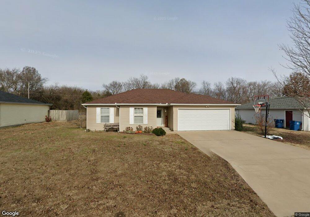
1301 Meadow Ridge Carl Junction, MO 64834
Estimated Value: $171,863 - $204,000
Studio
2
Baths
1,267
Sq Ft
$149/Sq Ft
Est. Value
About This Home
This home is located at 1301 Meadow Ridge, Carl Junction, MO 64834 and is currently estimated at $189,216, approximately $149 per square foot. 1301 Meadow Ridge is a home with nearby schools including Carl Junction Primary School (K-1), Carl Junction Intermediate School, and Carl Junction Primary School (2-3).
Ownership History
Date
Name
Owned For
Owner Type
Purchase Details
Closed on
Sep 10, 2010
Sold by
Huntley Brian P and Huntley Kendra A
Bought by
Read David C and Read Jessica C
Current Estimated Value
Home Financials for this Owner
Home Financials are based on the most recent Mortgage that was taken out on this home.
Original Mortgage
$83,870
Outstanding Balance
$55,474
Interest Rate
4.55%
Mortgage Type
FHA
Estimated Equity
$133,742
Purchase Details
Closed on
Jun 1, 2004
Sold by
Shanks Scott A and Shanks Kelsee
Bought by
Huntley Brian P and Huntley Kendra A
Create a Home Valuation Report for This Property
The Home Valuation Report is an in-depth analysis detailing your home's value as well as a comparison with similar homes in the area
Purchase History
| Date | Buyer | Sale Price | Title Company |
|---|---|---|---|
| Read David C | -- | Abbey | |
| Huntley Brian P | -- | -- |
Source: Public Records
Mortgage History
| Date | Status | Borrower | Loan Amount |
|---|---|---|---|
| Open | Read David C | $83,870 |
Source: Public Records
Tax History
| Year | Tax Paid | Tax Assessment Tax Assessment Total Assessment is a certain percentage of the fair market value that is determined by local assessors to be the total taxable value of land and additions on the property. | Land | Improvement |
|---|---|---|---|---|
| 2025 | $861 | $16,580 | $2,100 | $14,480 |
| 2024 | $867 | $14,720 | $2,100 | $12,620 |
| 2023 | $867 | $14,720 | $2,100 | $12,620 |
| 2022 | $871 | $14,750 | $2,100 | $12,650 |
| 2021 | $747 | $14,750 | $2,100 | $12,650 |
| 2020 | $702 | $13,620 | $2,100 | $11,520 |
| 2019 | $666 | $13,620 | $2,100 | $11,520 |
| 2018 | $735 | $15,070 | $0 | $0 |
| 2017 | $737 | $15,070 | $0 | $0 |
| 2016 | $745 | $15,370 | $0 | $0 |
Source: Public Records
Map
Nearby Homes
- 1210 Bob White Ln
- 29923 Ivy Rd
- 310 N Grimes St
- 104 Cambridge Dr
- TBD Temple St
- 720 Sheridan Ave
- 120 Concord St
- 307 Ashmore St
- 1308 York St
- 805 Aberdeen Ave
- 407 Hodge Dr
- 903 Aberdeen Ave
- 403 Ashmore Dr
- 905 Aberdeen Ave
- 907 Aberdeen Ave
- 900 Aberdeen Ave
- 909 Aberdeen Ave
- 1001 Aberdeen Ave
- 804 Aberdeen Ave
- 806 Aberdeen Ave
- 1211 Meadow Ridge Unit 1
- 1211 Meadow Ridge
- 1303 Meadow Ridge
- 1305 Meadow Ridge
- 1302 Meadow Ridge
- 1209 Meadow Ridge
- 1210 Meadow Ridge
- 1207 Meadow Ridge
- 1208 Meadow Ridge
- 1307 Covey Dr
- 1306 Covey Rd
- 1206 Meadow Ridge
- 1205 Meadow Ridge
- 1205 Meadow Ridge Unit 1
- 1204 Meadow Ridge
- 1309 Covey Rd
- 1211 Bob White Ln
- 1303 Bob White Ln
- 1311 Covey Dr
- 1209 Bob White Ln
Your Personal Tour Guide
Ask me questions while you tour the home.