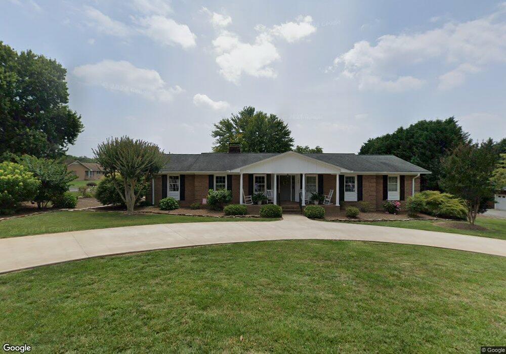
1301 Merrimont Ave Kings Mountain, NC 28086
Estimated Value: $411,996 - $474,000
3
Beds
3
Baths
2,521
Sq Ft
$172/Sq Ft
Est. Value
About This Home
This home is located at 1301 Merrimont Ave, Kings Mountain, NC 28086 and is currently estimated at $433,749, approximately $172 per square foot. 1301 Merrimont Ave is a home located in Cleveland County with nearby schools including North Elementary School, Kings Mountain Intermediate School, and Kings Mountain Middle.
Ownership History
Date
Name
Owned For
Owner Type
Purchase Details
Closed on
Mar 9, 2017
Sold by
Hamrick Florrie P and Hamrick Larry
Bought by
Dilling David T and Dilling Mary H
Current Estimated Value
Home Financials for this Owner
Home Financials are based on the most recent Mortgage that was taken out on this home.
Original Mortgage
$152,000
Outstanding Balance
$126,047
Interest Rate
4.17%
Mortgage Type
New Conventional
Estimated Equity
$307,702
Purchase Details
Closed on
Aug 22, 2016
Sold by
Pulley Joanne Elizabeth
Bought by
Hamrick Florrie P and Rogers Sandra P
Create a Home Valuation Report for This Property
The Home Valuation Report is an in-depth analysis detailing your home's value as well as a comparison with similar homes in the area
Home Values in the Area
Average Home Value in this Area
Purchase History
| Date | Buyer | Sale Price | Title Company |
|---|---|---|---|
| Dilling David T | $190,000 | None Available | |
| Hamrick Florrie P | $13,000 | Attorney |
Source: Public Records
Mortgage History
| Date | Status | Borrower | Loan Amount |
|---|---|---|---|
| Open | Dilling David T | $152,000 |
Source: Public Records
Tax History Compared to Growth
Tax History
| Year | Tax Paid | Tax Assessment Tax Assessment Total Assessment is a certain percentage of the fair market value that is determined by local assessors to be the total taxable value of land and additions on the property. | Land | Improvement |
|---|---|---|---|---|
| 2025 | $4,395 | $428,803 | $43,775 | $385,028 |
| 2024 | $2,788 | $236,630 | $35,020 | $201,610 |
| 2023 | $2,774 | $236,630 | $35,020 | $201,610 |
| 2022 | $2,656 | $236,630 | $35,020 | $201,610 |
| 2021 | $2,669 | $236,630 | $35,020 | $201,610 |
| 2020 | $2,002 | $172,152 | $28,856 | $143,296 |
| 2019 | $2,002 | $172,152 | $28,856 | $143,296 |
| 2018 | $2,001 | $172,152 | $28,856 | $143,296 |
| 2017 | $1,991 | $172,152 | $28,856 | $143,296 |
| 2016 | $1,998 | $172,152 | $28,856 | $143,296 |
| 2015 | $2,096 | $185,486 | $28,016 | $157,470 |
| 2014 | $2,096 | $185,486 | $28,016 | $157,470 |
Source: Public Records
Map
Nearby Homes
- 117 Parker Claire Ln
- 111 Parker Claire Ln
- 213 Parker Claire Ln
- 208 Victoria Cir
- 1301 Shelby Rd
- 1417 Merrimont Ave
- 521 Coman Ln
- 1500 Shelby Rd
- 442 Phifer Rd
- 417 Phifer Rd
- 1610 Shelby Rd
- 1427 Merrimont Ave
- 155 Patterson Rd
- 430 Fulton Dr
- 811 W Gold St Unit 26
- 167 Patterson Rd
- 104 Edison St
- Plan 2338 at Cottages at Clovis Point
- Plan 2723 at Cottages at Clovis Point
- Plan 2539 at Cottages at Clovis Point
- 1303 Merrimont Ave
- 301 Garrison Dr
- 311 Garrison Dr
- 1302 Merrimont Ave
- 299 Garrison Dr
- 300 Garrison Dr
- 302 Garrison Dr
- 1305 Merrimont Ave
- 306 Liberty Ct
- 304 Liberty Ct
- 1304 Merrimont Ave
- 302 Liberty Ct
- 304 Garrison Dr
- 112 Independence Ct
- 113 Independence Ct
- 315 Garrison Dr
- 1307 Merrimont Ave
- 303 Liberty Ct
- 1302 Brandonwood Dr
- 1306 Merrimont Ave