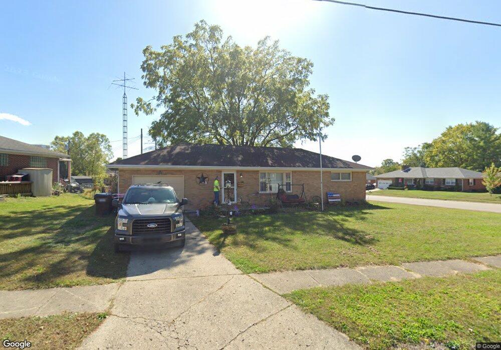
1301 Midland Rd Springfield, OH 45503
Estimated Value: $184,704 - $212,000
2
Beds
1
Bath
1,125
Sq Ft
$173/Sq Ft
Est. Value
About This Home
This home is located at 1301 Midland Rd, Springfield, OH 45503 and is currently estimated at $194,426, approximately $172 per square foot. 1301 Midland Rd is a home located in Clark County with nearby schools including Northridge Elementary School, Kenton Ridge Middle & High School, and Emmanuel Christian Academy.
Ownership History
Date
Name
Owned For
Owner Type
Purchase Details
Closed on
Apr 27, 2000
Sold by
Fogle Gladys M
Bought by
Tyson Kurtis L and Tyson Sheri A
Current Estimated Value
Home Financials for this Owner
Home Financials are based on the most recent Mortgage that was taken out on this home.
Original Mortgage
$87,300
Interest Rate
8.24%
Mortgage Type
Balloon
Create a Home Valuation Report for This Property
The Home Valuation Report is an in-depth analysis detailing your home's value as well as a comparison with similar homes in the area
Home Values in the Area
Average Home Value in this Area
Purchase History
| Date | Buyer | Sale Price | Title Company |
|---|---|---|---|
| Tyson Kurtis L | $87,300 | -- |
Source: Public Records
Mortgage History
| Date | Status | Borrower | Loan Amount |
|---|---|---|---|
| Closed | Tyson Kurtis L | $87,300 |
Source: Public Records
Tax History
| Year | Tax Paid | Tax Assessment Tax Assessment Total Assessment is a certain percentage of the fair market value that is determined by local assessors to be the total taxable value of land and additions on the property. | Land | Improvement |
|---|---|---|---|---|
| 2025 | $1,928 | $57,490 | $13,460 | $44,030 |
| 2024 | $1,864 | $44,090 | $12,390 | $31,700 |
| 2023 | $1,864 | $44,090 | $12,390 | $31,700 |
| 2022 | $1,871 | $44,090 | $12,390 | $31,700 |
| 2021 | $1,812 | $36,190 | $9,240 | $26,950 |
| 2020 | $1,814 | $36,190 | $9,240 | $26,950 |
| 2019 | $1,849 | $36,190 | $9,240 | $26,950 |
| 2018 | $1,790 | $33,630 | $10,260 | $23,370 |
| 2017 | $1,534 | $35,473 | $10,255 | $25,218 |
| 2016 | $1,523 | $35,473 | $10,255 | $25,218 |
| 2015 | $1,664 | $35,473 | $10,255 | $25,218 |
| 2014 | $1,663 | $35,473 | $10,255 | $25,218 |
| 2013 | $1,625 | $35,473 | $10,255 | $25,218 |
Source: Public Records
Map
Nearby Homes
- 4741 Cullen Ave
- 1709 Thomas Dr
- 5564 Ridgewood Rd W
- 1033 Westmont Cir
- 5564 Ridgewood Rd E Unit 7
- 1707 Berwick Dr
- 5722 Victorian Way Unit 31
- 862 Brendle Trace Unit 20
- 4652 Reno Ln Unit 15
- 4446 Ridgewood Rd E Unit 3
- 1836 Dunseth Ln
- 4343 Burchill St
- 937 Willow Rd
- 1325 Northfield Ct
- Pendleton Plan at
- Holcombe Plan at
- Newcastle Plan at
- Chatham Plan at
- 4256 Midfield St Unit 9
- 1470 Oldham Dr Unit 12
- 1303 Midland Rd
- 5108 W Ridgewood Rd
- 5108 Ridgewood Rd W
- 5128 Ridgewood Rd W
- 1315 Midland Rd
- 5117 Ridgewood Rd W
- 5117 Ridgwood Rd W
- 5111 Ridgewood Rd W
- 5100 Ridgewood Rd W
- 1304 Midland Rd
- 1308 Waltin Ln
- 5131 Ridgewood Rd W
- 1308 Midland Rd
- 5140 Ridgewood Rd W
- 5105 Ridgewood Rd W
- 1319 Midland Rd
- 1316 Midland Rd
- 5137 Ridgewood Rd W
- 5137 W Ridgewood Rd
- 5049 W Ridgewood Rd
Your Personal Tour Guide
Ask me questions while you tour the home.