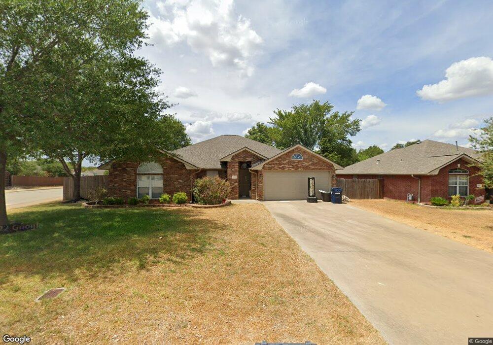
1301 Mullins Loop S College Station, TX 77845
Estimated Value: $338,990 - $381,000
4
Beds
2
Baths
2,054
Sq Ft
$171/Sq Ft
Est. Value
About This Home
This home is located at 1301 Mullins Loop S, College Station, TX 77845 and is currently estimated at $352,248, approximately $171 per square foot. 1301 Mullins Loop S is a home located in Brazos County with nearby schools including Creek View Elementary School, Cypress Grove Intermediate School, and College Station Middle School.
Ownership History
Date
Name
Owned For
Owner Type
Purchase Details
Closed on
Oct 26, 2009
Sold by
Swenson Jack R and Swenson Ruth E
Bought by
Perry Robyn E and Perry Cody W
Current Estimated Value
Home Financials for this Owner
Home Financials are based on the most recent Mortgage that was taken out on this home.
Original Mortgage
$165,000
Outstanding Balance
$108,014
Interest Rate
5.05%
Mortgage Type
Seller Take Back
Estimated Equity
$244,234
Purchase Details
Closed on
Jul 31, 2009
Sold by
Gunnels Todd and Gunnels Christine
Bought by
Swenson Jack R and Swenson Ruth E
Home Financials for this Owner
Home Financials are based on the most recent Mortgage that was taken out on this home.
Original Mortgage
$60,000
Interest Rate
5.41%
Mortgage Type
Seller Take Back
Create a Home Valuation Report for This Property
The Home Valuation Report is an in-depth analysis detailing your home's value as well as a comparison with similar homes in the area
Home Values in the Area
Average Home Value in this Area
Purchase History
| Date | Buyer | Sale Price | Title Company |
|---|---|---|---|
| Perry Robyn E | -- | University Title Company | |
| Swenson Jack R | -- | University Title Company |
Source: Public Records
Mortgage History
| Date | Status | Borrower | Loan Amount |
|---|---|---|---|
| Open | Perry Robyn E | $165,000 | |
| Previous Owner | Swenson Jack R | $60,000 |
Source: Public Records
Tax History Compared to Growth
Tax History
| Year | Tax Paid | Tax Assessment Tax Assessment Total Assessment is a certain percentage of the fair market value that is determined by local assessors to be the total taxable value of land and additions on the property. | Land | Improvement |
|---|---|---|---|---|
| 2025 | $4,883 | $282,879 | $55,800 | $227,079 |
| 2024 | $4,883 | $311,505 | $53,570 | $257,935 |
| 2023 | $4,883 | $288,646 | $0 | $0 |
| 2022 | $5,595 | $262,405 | $48,700 | $213,705 |
| 2021 | $5,399 | $239,024 | $45,000 | $194,024 |
| 2020 | $5,126 | $225,687 | $45,000 | $180,687 |
| 2019 | $5,361 | $226,880 | $40,000 | $186,880 |
| 2018 | $5,220 | $219,270 | $35,000 | $184,270 |
| 2017 | $4,639 | $197,090 | $35,000 | $162,090 |
| 2016 | $4,510 | $191,640 | $30,000 | $161,640 |
| 2015 | $3,745 | $170,710 | $30,000 | $140,710 |
| 2014 | $3,745 | $161,600 | $30,000 | $131,600 |
Source: Public Records
Map
Nearby Homes
- 1303 Skyline Ct
- 1307 Portsmouth Ct
- 1033 Windmeadows Dr
- 1412 Richland Ct S
- 1112 Hopewell Ct
- 1722 Creekside Cir
- 1520 Strasburg Cir
- 1736 Creekside Cir
- 1717 Starling Dr
- 1742 Creekside Cir
- 1721 Starling Dr
- 1732 Purple Martin Cove
- 1736 Starling Dr
- 1531 Strasburg Cir
- 1011 Dove Chase Ln
- 809 Dove Run Trail
- 801 Dove Run Trail
- 915 Dove Run Trail
- 912 Emerald Dove Ave
- 3919 Hawk Owl Cove
- 1303 Mullins Loop S
- 1300 Baywood Ln
- 1302 Baywood Ln
- 1305 Mullins Loop S
- 1304 Baywood Ln
- 1307 Mullins Loop S
- 1216 Baywood Ct
- 1302 Mullins Loop S
- 1306 Baywood Ln
- 1304 Mullins Loop S
- 1309 Mullins Loop S
- 1214 Baywood Ct
- 1308 Baywood Ln
- 1306 Mullins Loop S
- 1301 Baywood Ln
- 1303 Baywood Ln
- 1305 Baywood Ln
- 1311 Mullins Loop S
- 1212 Baywood Ct
- 1217 Baywood Ct