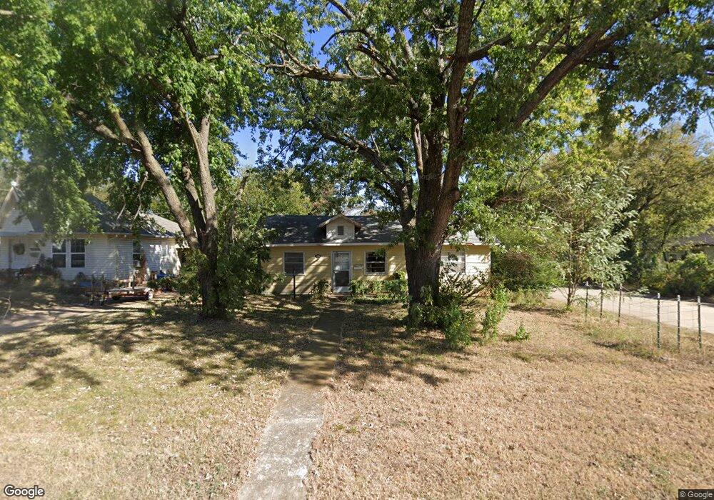
1301 N Union Ave Shawnee, OK 74801
Estimated Value: $53,000 - $104,000
3
Beds
1
Bath
1,123
Sq Ft
$75/Sq Ft
Est. Value
About This Home
This home is located at 1301 N Union Ave, Shawnee, OK 74801 and is currently estimated at $83,968, approximately $74 per square foot. 1301 N Union Ave is a home located in Pottawatomie County with nearby schools including Sequoyah Elementary School, Shawnee Middle School, and Shawnee High School.
Ownership History
Date
Name
Owned For
Owner Type
Purchase Details
Closed on
Sep 10, 2014
Sold by
Autaubo Cecil P and Autaubo Diana L
Bought by
Autaubo Cecil P and Autaubo Mary M
Current Estimated Value
Purchase Details
Closed on
Mar 29, 2005
Sold by
Jackson Alphonso
Bought by
Autaubo Cecil P and Autaubo Diana L
Home Financials for this Owner
Home Financials are based on the most recent Mortgage that was taken out on this home.
Original Mortgage
$36,174
Interest Rate
5.71%
Mortgage Type
Future Advance Clause Open End Mortgage
Purchase Details
Closed on
Jan 19, 2001
Sold by
Wetzel David and Wetzel Elisa
Bought by
Norris Lance and Norris Kara D
Create a Home Valuation Report for This Property
The Home Valuation Report is an in-depth analysis detailing your home's value as well as a comparison with similar homes in the area
Home Values in the Area
Average Home Value in this Area
Purchase History
| Date | Buyer | Sale Price | Title Company |
|---|---|---|---|
| Autaubo Cecil P | -- | -- | |
| Autaubo Cecil P | -- | None Available | |
| Norris Lance | $43,500 | -- |
Source: Public Records
Mortgage History
| Date | Status | Borrower | Loan Amount |
|---|---|---|---|
| Previous Owner | Autaubo Cecil P | $36,174 |
Source: Public Records
Tax History Compared to Growth
Tax History
| Year | Tax Paid | Tax Assessment Tax Assessment Total Assessment is a certain percentage of the fair market value that is determined by local assessors to be the total taxable value of land and additions on the property. | Land | Improvement |
|---|---|---|---|---|
| 2024 | $551 | $5,538 | $415 | $5,123 |
| 2023 | $551 | $5,274 | $415 | $4,859 |
| 2022 | $541 | $5,274 | $415 | $4,859 |
| 2021 | $531 | $5,274 | $415 | $4,859 |
| 2020 | $533 | $5,274 | $415 | $4,859 |
| 2019 | $551 | $5,274 | $415 | $4,859 |
| 2018 | $527 | $5,150 | $415 | $4,735 |
| 2017 | $520 | $5,150 | $415 | $4,735 |
| 2016 | $501 | $4,907 | $415 | $4,492 |
| 2015 | $491 | $4,905 | $415 | $4,490 |
| 2014 | $504 | $5,037 | $415 | $4,622 |
Source: Public Records
Map
Nearby Homes
- 1510 N Union Ave
- 0 Independence and Minnesota St
- 1017 N Bdwy Ave
- 1217 N Market Ave
- 1602 N Bdwy
- 1607 N Beard Ave
- 1006 N Market Ave
- 1324 N Park Ave
- 1003 N Minnesota Ave
- 1816 N Bell Ave
- 434 E Wallace St
- 1712 N Pennsylvania Ave
- 1822 N Phil Ave
- 824 N Beard Ave
- 1817 N Bell Ave
- 1710 N Park Ave
- 1901 N Bell Ave
- 727 N Beard Ave
- 318 W Dill St
- 717 N Broadway Ave
- 1303 N Union Ave
- 6 E Morgan St
- 1209 N Union Ave
- 4 E Morgan St
- 8 E Morgan St
- 1207 N Union Ave
- 1325 N Union Ave
- 5 E Morgan St
- 1205 N Union Ave
- 1210 N Phil
- 1212 N Union Ave
- 1206 N Philadelphia Ave
- 1208 N Phil
- 207 E Severn St
- 1327 N Union Ave
- 1203 N Union Ave
- 1302 N Union Ave
- 209 E Severn St
- 21 E Park Dr
- 1204 N Union Ave