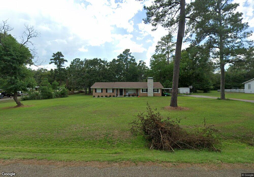
1301 Oleta Ave Lufkin, TX 75901
Estimated Value: $192,684 - $222,000
--
Bed
7
Baths
1,932
Sq Ft
$107/Sq Ft
Est. Value
About This Home
This home is located at 1301 Oleta Ave, Lufkin, TX 75901 and is currently estimated at $206,171, approximately $106 per square foot. 1301 Oleta Ave is a home located in Angelina County with nearby schools including Herty Primary School, Coston Elementary School, and Lufkin Middle School.
Ownership History
Date
Name
Owned For
Owner Type
Purchase Details
Closed on
Mar 29, 2021
Sold by
Allen Robin
Bought by
Cobos Jairo and Ceniceros Daisy
Current Estimated Value
Home Financials for this Owner
Home Financials are based on the most recent Mortgage that was taken out on this home.
Original Mortgage
$168,884
Outstanding Balance
$151,648
Interest Rate
2.8%
Mortgage Type
FHA
Estimated Equity
$54,523
Purchase Details
Closed on
Dec 20, 2018
Sold by
Purcell Bobby E and Purcell Brett Timothy
Bought by
Allen Robin
Create a Home Valuation Report for This Property
The Home Valuation Report is an in-depth analysis detailing your home's value as well as a comparison with similar homes in the area
Home Values in the Area
Average Home Value in this Area
Purchase History
| Date | Buyer | Sale Price | Title Company |
|---|---|---|---|
| Cobos Jairo | -- | Community Title | |
| Cobos Jairo | -- | Community Title | |
| Allen Robin | -- | None Available | |
| Allen Robin | -- | None Available |
Source: Public Records
Mortgage History
| Date | Status | Borrower | Loan Amount |
|---|---|---|---|
| Open | Cobos Jairo | $168,884 |
Source: Public Records
Tax History Compared to Growth
Tax History
| Year | Tax Paid | Tax Assessment Tax Assessment Total Assessment is a certain percentage of the fair market value that is determined by local assessors to be the total taxable value of land and additions on the property. | Land | Improvement |
|---|---|---|---|---|
| 2025 | $3,626 | $173,510 | $21,050 | $152,460 |
| 2024 | $3,491 | $171,260 | $21,050 | $150,210 |
| 2023 | $3,018 | $170,310 | $21,050 | $149,260 |
| 2022 | $3,145 | $138,070 | $12,560 | $125,510 |
| 2021 | $1,706 | $69,250 | $12,560 | $56,690 |
| 2020 | $1,494 | $60,800 | $12,560 | $48,240 |
| 2019 | $1,560 | $60,000 | $12,560 | $47,440 |
| 2018 | $923 | $104,270 | $12,560 | $91,710 |
| 2017 | $923 | $99,040 | $12,560 | $86,480 |
| 2016 | $1,705 | $71,500 | $17,770 | $53,730 |
| 2015 | $1,812 | $91,230 | $17,770 | $73,460 |
| 2014 | $1,812 | $91,520 | $17,770 | $73,750 |
Source: Public Records
Map
Nearby Homes
- 2404 Davisville Rd
- 2504 Davisville Rd
- 607 Humason Ave
- 916 Circle Dr
- 505 Brasell St
- 329 Humason Ave
- 3600 N Medford Dr
- n/a Loop 287 Frontage Rd
- 333 Humason Ave
- 217 Derek Rd
- 1518 Phelps St
- 1603 Atkinson Dr
- 201 Silver Spur Dr
- 1902 Pine Burr St
- TBD State Highway 103
- 233 N Banks St
- 2105 Paul Ave
- 223 Stoney Ridge
- n/a Farm To Market Road 2021
- 4344 N Highway 69