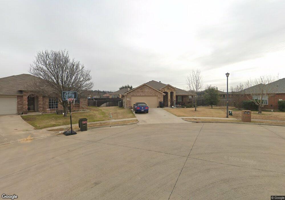
1301 Platte Ct Midlothian, TX 76065
Estimated Value: $380,944 - $446,000
4
Beds
2
Baths
2,080
Sq Ft
$199/Sq Ft
Est. Value
About This Home
This home is located at 1301 Platte Ct, Midlothian, TX 76065 and is currently estimated at $413,472, approximately $198 per square foot. 1301 Platte Ct is a home located in Ellis County with nearby schools including J A Vitovsky Elementary School and Walnut Grove Middle School.
Ownership History
Date
Name
Owned For
Owner Type
Purchase Details
Closed on
Mar 16, 2018
Sold by
Lemons Joseph M
Bought by
Johnston Steven James and Johnston Elizabeth
Current Estimated Value
Home Financials for this Owner
Home Financials are based on the most recent Mortgage that was taken out on this home.
Original Mortgage
$280,912
Outstanding Balance
$240,376
Interest Rate
4.32%
Mortgage Type
VA
Estimated Equity
$173,096
Purchase Details
Closed on
Jun 20, 2012
Sold by
Prosperity Bank
Bought by
Lemons Joseph M
Purchase Details
Closed on
Feb 23, 2005
Sold by
F & R Management Lp
Bought by
Prosperity Bank
Create a Home Valuation Report for This Property
The Home Valuation Report is an in-depth analysis detailing your home's value as well as a comparison with similar homes in the area
Home Values in the Area
Average Home Value in this Area
Purchase History
| Date | Buyer | Sale Price | Title Company |
|---|---|---|---|
| Johnston Steven James | $280,912 | Alamo Title Company | |
| Lemons Joseph M | -- | None Available | |
| Prosperity Bank | $33,000 | None Available |
Source: Public Records
Mortgage History
| Date | Status | Borrower | Loan Amount |
|---|---|---|---|
| Open | Johnston Steven James | $280,912 |
Source: Public Records
Tax History Compared to Growth
Tax History
| Year | Tax Paid | Tax Assessment Tax Assessment Total Assessment is a certain percentage of the fair market value that is determined by local assessors to be the total taxable value of land and additions on the property. | Land | Improvement |
|---|---|---|---|---|
| 2025 | $5,300 | $370,000 | $90,000 | $280,000 |
| 2024 | $5,300 | $368,629 | -- | -- |
| 2023 | $5,300 | $329,845 | $0 | $0 |
| 2022 | $6,718 | $299,859 | $0 | $0 |
| 2021 | $6,451 | $272,599 | $45,000 | $227,599 |
| 2020 | $6,857 | $272,599 | $45,000 | $227,599 |
| 2019 | $6,978 | $266,450 | $0 | $0 |
| 2018 | $6,611 | $252,430 | $20,000 | $232,430 |
| 2017 | $532 | $20,000 | $20,000 | $0 |
| 2016 | $532 | $20,000 | $20,000 | $0 |
| 2015 | $399 | $20,000 | $20,000 | $0 |
| 2014 | $399 | $15,000 | $0 | $0 |
Source: Public Records
Map
Nearby Homes
- 1410 Rye Glen Dr
- 1309 Rye Glen Dr
- 1105 Crooked Creek Ct
- 1511 Hillside Dr
- 1401 Yucca St
- 1421 N 9th St
- TBD 1 acre Overlook Dr
- TBD 8 acres N 9th St
- 912 Crockett St
- 807 Crockett St
- 0 U S Highway 67
- 714 Green Acres Ln
- 620 N 6th St
- 796 N 7th St
- 0 W Avenue A
- 312 Overlook Dr
- 7631 Woodstream Rd
- 2281 Key Way
- 414 N 5th St
- 412 N 5th St
- 1305 Platte Ct
- 1302 Platte Ct
- 1717 Sabine Dr
- 1309 Platte Ct
- 1713 Sabine Dr
- 1809 Sabine Dr
- 1805 Sabine Dr
- 1306 Platte Ct
- 1813 Sabine Dr
- 1814 Millbrook Dr
- 1709 Sabine Dr
- 1309 Yukon Dr
- 1313 Yukon Dr
- 1305 Yukon Dr
- 1317 Yukon Dr
- 1301 Yukon Dr
- 1714 Sabime Dr
- 1909 Millbrook Dr
- 1905 Millbrook Dr
- 1714 Sabine Dr