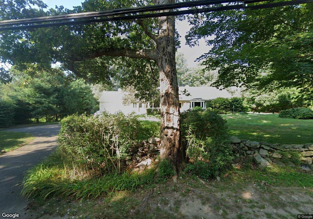
1301 Redding Rd Fairfield, CT 06824
Greenfield Hill NeighborhoodEstimated Value: $835,785 - $1,244,000
2
Beds
3
Baths
2,055
Sq Ft
$532/Sq Ft
Est. Value
About This Home
This home is located at 1301 Redding Rd, Fairfield, CT 06824 and is currently estimated at $1,093,446, approximately $532 per square foot. 1301 Redding Rd is a home located in Fairfield County with nearby schools including Dwight Elementary School, Roger Ludlowe Middle School, and Fairfield Ludlowe High School.
Ownership History
Date
Name
Owned For
Owner Type
Purchase Details
Closed on
Aug 24, 2017
Sold by
Tavormina Leonard
Bought by
Leonard Tavormina T
Current Estimated Value
Purchase Details
Closed on
Jan 31, 1997
Sold by
Gibbons Anne T
Bought by
Tavormina Leonard
Purchase Details
Closed on
Jul 15, 1994
Sold by
Schwab Gertrude G
Bought by
Gibbons Anne T
Create a Home Valuation Report for This Property
The Home Valuation Report is an in-depth analysis detailing your home's value as well as a comparison with similar homes in the area
Home Values in the Area
Average Home Value in this Area
Purchase History
| Date | Buyer | Sale Price | Title Company |
|---|---|---|---|
| Leonard Tavormina T | -- | -- | |
| Leonard Tavormina T | -- | -- | |
| Tavormina Leonard | $383,000 | -- | |
| Tavormina Leonard | $383,000 | -- | |
| Gibbons Anne T | $375,000 | -- | |
| Gibbons Anne T | $375,000 | -- |
Source: Public Records
Mortgage History
| Date | Status | Borrower | Loan Amount |
|---|---|---|---|
| Previous Owner | Gibbons Anne T | $257,500 | |
| Previous Owner | Gibbons Anne T | $254,850 | |
| Previous Owner | Gibbons Anne T | $262,534 |
Source: Public Records
Tax History
| Year | Tax Paid | Tax Assessment Tax Assessment Total Assessment is a certain percentage of the fair market value that is determined by local assessors to be the total taxable value of land and additions on the property. | Land | Improvement |
|---|---|---|---|---|
| 2025 | $9,950 | $350,490 | $227,290 | $123,200 |
| 2024 | $9,779 | $350,490 | $227,290 | $123,200 |
| 2023 | $9,642 | $350,490 | $227,290 | $123,200 |
| 2022 | $9,414 | $345,590 | $227,290 | $118,300 |
| 2021 | $9,324 | $345,590 | $227,290 | $118,300 |
| 2020 | $9,690 | $361,690 | $255,430 | $106,260 |
| 2019 | $9,690 | $361,690 | $255,430 | $106,260 |
| 2018 | $9,534 | $361,690 | $255,430 | $106,260 |
| 2017 | $9,339 | $361,690 | $255,430 | $106,260 |
| 2016 | $9,205 | $361,690 | $255,430 | $106,260 |
| 2015 | $9,647 | $389,130 | $293,720 | $95,410 |
| 2014 | $9,495 | $389,130 | $293,720 | $95,410 |
Source: Public Records
Map
Nearby Homes
- 1380 Old Academy Rd
- 3674 Congress St
- 2683 Bronson Rd
- 2177 Cross Hwy
- 88 Merry Meet Cir
- 688 Hulls Farm Rd
- 212 Fence Row Dr
- 22 Brett Rd
- 475 Fence Row Dr
- 4800 Congress St
- 180 Catamount Rd
- 1115 Galloping Hill Rd
- 281 Wood House Rd
- 21 Sturges Commons
- 360 Duck Farm Rd
- 148 Millspaugh Dr
- 1 Sturges Hwy Unit 2
- 6 Buckboard Ln
- 677 Eleven O Clock Rd
- 35 Woody Ln
- 1268 Redding Rd
- 1261 Redding Rd
- 1341 Redding Rd
- 1310 Redding Rd
- 1373 Redding Rd
- 1244 Redding Rd
- 457 Dunham Rd
- 457 Dunham Rd Unit Cottage
- 1220 Redding Rd
- 1407 Redding Rd
- 400 Dunham Rd
- 430 Dunham Rd
- 480 Riders Ln
- 450 Dunham Rd
- 1159 Redding Rd
- 1445 Redding Rd
- 1433 Redding Rd
- 311 Dunham Rd
- 364 Riders Ln
- 469 Riders Ln
Your Personal Tour Guide
Ask me questions while you tour the home.