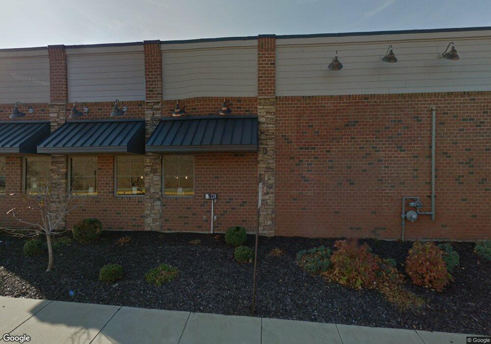
1301 Spring St Petoskey, MI 49770
Studio
--
Bath
4,200
Sq Ft
57,499
Sq Ft Lot
About This Home
This home is located at 1301 Spring St, Petoskey, MI 49770. 1301 Spring St is a home located in Emmet County with nearby schools including Petoskey High School, St. Francis Xavier School, and Petoskey Montessori Children's.
Ownership History
Date
Name
Owned For
Owner Type
Purchase Details
Closed on
Jan 19, 2023
Sold by
Store Master Funding Vii Llc
Bought by
Lucky'S Real Estate Of Petoskey Llc
Purchase Details
Closed on
Apr 3, 2015
Sold by
Miller Apple Limited Partnership
Bought by
Store Master Funding Llc
Purchase Details
Closed on
May 15, 2013
Sold by
Charlevoix State Bank
Bought by
Miller Apple Lp
Purchase Details
Closed on
Jul 21, 2010
Sold by
Moffat Aaron K and Moffat Robbin L
Bought by
Moffat Aaron K and Moffat Robbin L
Purchase Details
Closed on
Aug 18, 2004
Bought by
Moffat Aaron and Moffat Robbin
Purchase Details
Closed on
Dec 3, 2003
Bought by
Moffat Enterprises Too
Purchase Details
Closed on
Jun 1, 1994
Bought by
Nbd Bank Cash Rps
Create a Home Valuation Report for This Property
The Home Valuation Report is an in-depth analysis detailing your home's value as well as a comparison with similar homes in the area
Home Values in the Area
Average Home Value in this Area
Purchase History
| Date | Buyer | Sale Price | Title Company |
|---|---|---|---|
| Lucky'S Real Estate Of Petoskey Llc | -- | First American Title Insurance | |
| Store Master Funding Llc | -- | Crossroad Title | |
| Miller Apple Lp | $400,000 | -- | |
| Moffat Aaron K | -- | -- | |
| Moffat Aaron | -- | -- | |
| Moffat Enterprises Too | -- | -- | |
| Nbd Bank Cash Rps | $216,000 | -- |
Source: Public Records
Tax History
| Year | Tax Paid | Tax Assessment Tax Assessment Total Assessment is a certain percentage of the fair market value that is determined by local assessors to be the total taxable value of land and additions on the property. | Land | Improvement |
|---|---|---|---|---|
| 2025 | $31,541 | $619,700 | $619,700 | $0 |
| 2024 | $238 | $598,800 | $598,800 | $0 |
| 2023 | $22,738 | $533,700 | $533,700 | $0 |
| 2022 | $22,738 | $527,600 | $527,600 | $0 |
| 2021 | $22,089 | $509,500 | $509,500 | $0 |
| 2020 | $22,145 | $436,300 | $436,300 | $0 |
| 2019 | -- | $420,700 | $420,700 | $0 |
| 2018 | -- | $417,900 | $417,900 | $0 |
| 2017 | -- | $397,200 | $397,200 | $0 |
| 2016 | -- | $381,900 | $381,900 | $0 |
| 2015 | -- | $282,500 | $0 | $0 |
| 2014 | -- | $299,300 | $0 | $0 |
Source: Public Records
Map
Nearby Homes
- 1750 Spring St
- 810 Harbor Watch Dr Unit 102
- 814 Lakeview Ridge Unit 74
- 814 Lakeview Ridge
- 833 Hayner Dr
- 1570 Parmenter Ct Unit 5
- 1536 Parmenter Ct
- 1528 Parmenter Ct
- 1530 Parmenter Ct Unit 18
- 204 Winfield Ave
- 1520 Parmenter Ct
- 1477 Castle Dr
- 200 Lakewood Ct
- 46 Bridge St
- 138 E Sheridan St
- TBD Cemetery Rd
- 1035 Emmet St
- 1223 Petoskey St
- 513 Liberty St
- 431 Madison St
- 1310 Spring St
- 1007 Spring St
- 602 W Sheridan St
- 535 Lawrence St
- 533 Lawrence St
- 531 Lawrence St
- 526 W Sheridan St
- 1500 Spring St
- 529 Lawrence St
- 523 Lawrence St
- 520 W Sheridan St
- 725 Harbor Watch Dr Unit , 20
- 725 Harbor Watch Dr Unit , 14
- 725 Harbor Watch Dr Unit , 10
- 725 Harbor Watch Dr Unit , 8
- 725 Harbor Watch Dr Unit , 15
- 725 Harbor Watch Dr Unit , 21
- 725 Harbor Watch Dr Unit 312
- 725 Harbor Watch Dr Unit 306
- 725 Harbor Watch Dr Unit 310
Your Personal Tour Guide
Ask me questions while you tour the home.