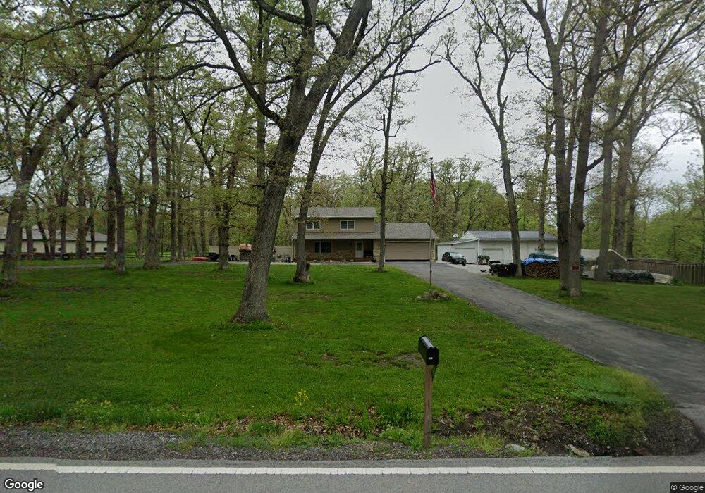
13010 W 173rd Ave Lowell, IN 46356
West Creek NeighborhoodEstimated Value: $489,210 - $556,000
3
Beds
3
Baths
2,436
Sq Ft
$212/Sq Ft
Est. Value
About This Home
This home is located at 13010 W 173rd Ave, Lowell, IN 46356 and is currently estimated at $517,070, approximately $212 per square foot. 13010 W 173rd Ave is a home located in Lake County with nearby schools including Lowell Middle School and Lowell Senior High School.
Ownership History
Date
Name
Owned For
Owner Type
Purchase Details
Closed on
Dec 30, 2011
Sold by
Parker D Jacob
Bought by
Parker D Jacob D and Parker Karen T
Current Estimated Value
Home Financials for this Owner
Home Financials are based on the most recent Mortgage that was taken out on this home.
Original Mortgage
$163,000
Interest Rate
3.98%
Mortgage Type
New Conventional
Purchase Details
Closed on
Dec 23, 2009
Sold by
Parker Donald E and Parker Sandra L
Bought by
Parker D Jacob
Home Financials for this Owner
Home Financials are based on the most recent Mortgage that was taken out on this home.
Original Mortgage
$134,000
Interest Rate
4.84%
Mortgage Type
New Conventional
Purchase Details
Closed on
Apr 13, 2009
Sold by
Parker Donald E and Parker Sandra L
Bought by
Parker Donald E and Parker Sandra L
Purchase Details
Closed on
Jun 21, 2007
Sold by
Parker Donald E
Bought by
Parker Donald E and Parker Sandra L
Create a Home Valuation Report for This Property
The Home Valuation Report is an in-depth analysis detailing your home's value as well as a comparison with similar homes in the area
Home Values in the Area
Average Home Value in this Area
Purchase History
| Date | Buyer | Sale Price | Title Company |
|---|---|---|---|
| Parker D Jacob D | -- | Premium Title | |
| Parker D Jacob | -- | Premium Title | |
| Parker Donald E | -- | None Available | |
| Parker Donald E | -- | None Available |
Source: Public Records
Mortgage History
| Date | Status | Borrower | Loan Amount |
|---|---|---|---|
| Closed | Parker D Jacob D | $163,000 | |
| Closed | Parker D Jacob | $134,000 |
Source: Public Records
Tax History Compared to Growth
Tax History
| Year | Tax Paid | Tax Assessment Tax Assessment Total Assessment is a certain percentage of the fair market value that is determined by local assessors to be the total taxable value of land and additions on the property. | Land | Improvement |
|---|---|---|---|---|
| 2024 | $7,173 | $383,500 | $118,900 | $264,600 |
| 2023 | $3,568 | $380,700 | $118,900 | $261,800 |
| 2022 | $3,760 | $368,900 | $118,900 | $250,000 |
| 2021 | $2,745 | $299,400 | $63,500 | $235,900 |
| 2020 | $2,553 | $289,100 | $63,500 | $225,600 |
| 2019 | $2,521 | $272,500 | $63,500 | $209,000 |
| 2018 | $2,459 | $266,000 | $63,500 | $202,500 |
| 2017 | $2,119 | $220,600 | $63,600 | $157,000 |
| 2016 | $1,987 | $214,000 | $63,600 | $150,400 |
| 2014 | $1,863 | $205,800 | $63,600 | $142,200 |
| 2013 | $1,940 | $205,200 | $63,600 | $141,600 |
Source: Public Records
Map
Nearby Homes
- 13199 W 169th Ave
- 17448 Kosciusko Place
- 17635 White Oak Ave
- 12610 W 162nd Ave
- 15507 Magoun St Unit 10
- 16468 Parrish Ave
- 14299 W 153rd Ln
- 647 Debra Kay Dr
- 631 Debra Kay Dr
- 615 Debra Kay Dr
- 623 Debra Kay Dr
- 688 Village Pkwy
- 833 Apache Ln
- The Emma Grace Plan at Sierra Ridge
- The Bristol Plan at Sierra Ridge
- The Kinkaid Plan at Sierra Ridge
- The Brianna Lynn Plan at Sierra Ridge
- The Lindsay Marie Plan at Sierra Ridge
- The Olivia Plan at Sierra Ridge
- The Ashley Plan at Sierra Ridge
- 13000 W 173rd Ave
- 13207 W 173rd Ave Unit 10
- 13210 W 173rd Ave
- 12950 W 173rd Ave
- 13701 W 173rd Ave
- 17304 White Oak Ave
- 17274 White Oak Ave
- 13448 W 173rd Ave
- 17188 White Oak Ave
- 17216 White Oak Ave
- 17238 White Oak Ave
- 17384 White Oak Ave
- Lot 11 White Oak Ave
- ac White Oak Ave
- 13443 W 173rd Ave
- 17317 White Oak Ave Unit 10
- 17110 White Oak Ave
- 17424 White Oak Ave
- 13351 W 173rd Ave
- 13500 W 173rd Ave