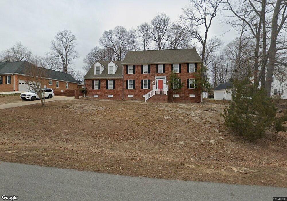
13016 Chipstead Rd Chester, VA 23831
Estimated Value: $469,000 - $580,000
4
Beds
4
Baths
3,963
Sq Ft
$136/Sq Ft
Est. Value
About This Home
This home is located at 13016 Chipstead Rd, Chester, VA 23831 and is currently estimated at $537,871, approximately $135 per square foot. 13016 Chipstead Rd is a home located in Chesterfield County with nearby schools including C.C. Wells Elementary School, George W. Carver Middle School, and Thomas Dale High School - Main Campus.
Ownership History
Date
Name
Owned For
Owner Type
Purchase Details
Closed on
Apr 1, 2019
Sold by
Lamb George W and Lamb Brenda L
Bought by
Ford Leon Anthony and Cales Paula Nicole
Current Estimated Value
Home Financials for this Owner
Home Financials are based on the most recent Mortgage that was taken out on this home.
Original Mortgage
$318,250
Outstanding Balance
$280,362
Interest Rate
4.4%
Mortgage Type
New Conventional
Estimated Equity
$257,509
Create a Home Valuation Report for This Property
The Home Valuation Report is an in-depth analysis detailing your home's value as well as a comparison with similar homes in the area
Home Values in the Area
Average Home Value in this Area
Purchase History
| Date | Buyer | Sale Price | Title Company |
|---|---|---|---|
| Ford Leon Anthony | $335,000 | Attorney |
Source: Public Records
Mortgage History
| Date | Status | Borrower | Loan Amount |
|---|---|---|---|
| Open | Ford Leon Anthony | $318,250 |
Source: Public Records
Tax History
| Year | Tax Paid | Tax Assessment Tax Assessment Total Assessment is a certain percentage of the fair market value that is determined by local assessors to be the total taxable value of land and additions on the property. | Land | Improvement |
|---|---|---|---|---|
| 2025 | $5,187 | $580,000 | $83,000 | $497,000 |
| 2024 | $5,187 | $544,800 | $81,000 | $463,800 |
| 2023 | $4,508 | $495,400 | $81,000 | $414,400 |
| 2022 | $4,132 | $449,100 | $71,000 | $378,100 |
| 2021 | $4,069 | $421,400 | $68,000 | $353,400 |
| 2020 | $3,692 | $388,600 | $64,000 | $324,600 |
| 2019 | $3,528 | $371,400 | $60,000 | $311,400 |
| 2018 | $3,426 | $354,800 | $56,000 | $298,800 |
| 2017 | $3,432 | $352,300 | $56,000 | $296,300 |
| 2016 | $3,046 | $317,300 | $54,000 | $263,300 |
| 2015 | $3,345 | $345,800 | $54,000 | $291,800 |
| 2014 | $3,040 | $314,100 | $54,000 | $260,100 |
Source: Public Records
Map
Nearby Homes
- 4248 Wells Ridge Ct
- 12780 Richmond St
- 13443 Greenham Ct
- 3554 Thornsett Dr
- 12869 Richmond St
- 13101 Harrowgate Rd
- 4331 Poplar Village Dr
- 12618 Poplar Village Place
- 13012 Harrowgate Rd
- 4313 Poplar Village Dr
- 12606 Poplar Village Place
- 4308 Hyde Park Dr
- 12607 Poplar Village Place
- 4324 Poplar Village Dr
- 12601 Poplar Village Place
- 4306 Poplar Village Dr
- 4248 Poplar Village Dr
- The Cordova Plan at Poplar Village
- The Shenandoah Plan at Poplar Village
- The Westwood Plan at Poplar Village
- 13018 Chipstead Rd
- 13012 Chipstead Rd
- 4001 Rockridge Ct
- 13001 Rockridge Rd
- 13019 Chipstead Rd
- 13010 Chipstead Rd
- 13017 Chipstead Rd
- 13005 Rockridge Rd
- 13021 Chipstead Rd
- 13015 Chipstead Rd
- 4003 Rockridge Ct
- 4000 Rockridge Ct
- 13011 Chipstead Rd
- 13008 Chipstead Rd
- 13105 Rockridge Rd
- 3930 Cresthill Rd
- 13009 Chipstead Rd
- 3926 Cresthill Rd
- 4101 Rockridge Place
- 4002 Rockridge Ct