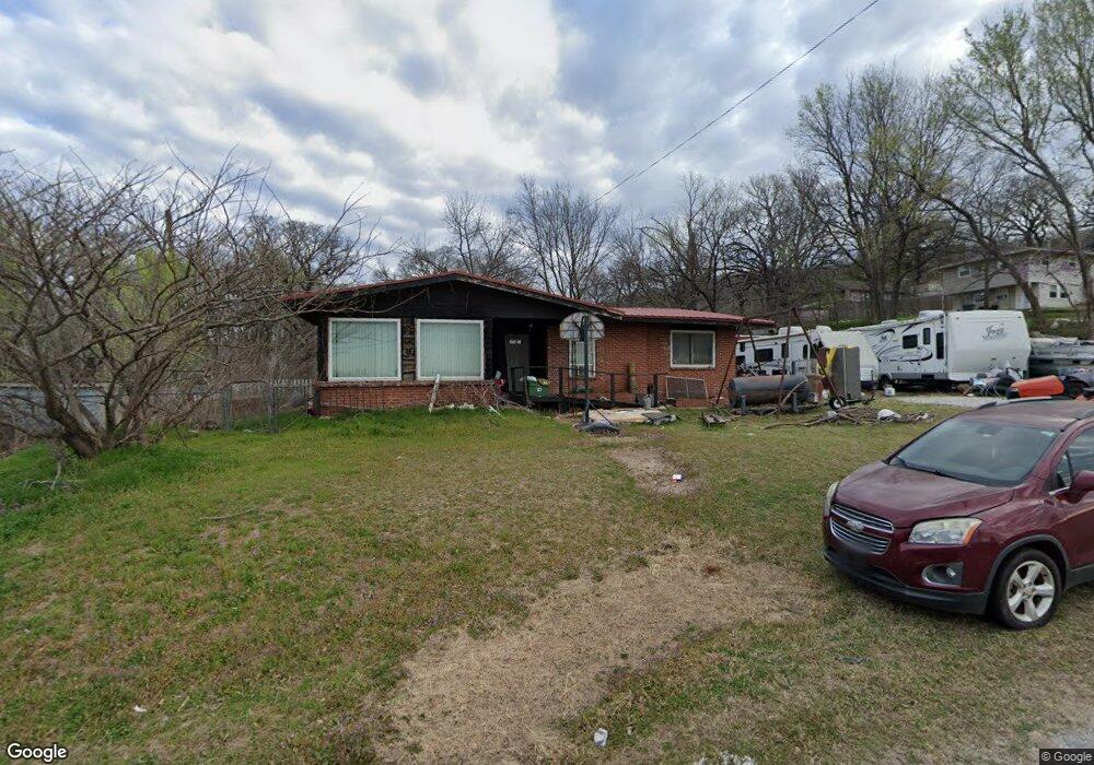
13017 W Southard Rd Sand Springs, OK 74063
Estimated Value: $136,927 - $202,000
--
Bed
2
Baths
1,672
Sq Ft
$106/Sq Ft
Est. Value
About This Home
This home is located at 13017 W Southard Rd, Sand Springs, OK 74063 and is currently estimated at $177,982, approximately $106 per square foot. 13017 W Southard Rd is a home located in Tulsa County with nearby schools including Garfield STEAM Academy, Northwoods Fine Arts Academy, and Clyde Boyd Middle School.
Ownership History
Date
Name
Owned For
Owner Type
Purchase Details
Closed on
Dec 15, 2020
Sold by
Simpson Russell and Simpson Carolyn
Bought by
Simpson Russell and Simpson Carolyn
Current Estimated Value
Purchase Details
Closed on
Dec 11, 2020
Sold by
Simpson Tyler Keith
Bought by
Simpson Russell and Simpson Carolyn
Purchase Details
Closed on
Dec 9, 2020
Sold by
Simpson Russell and Simpson Carolyn
Bought by
Simpson Russell and Simpson Carolyn
Purchase Details
Closed on
Jul 11, 2009
Sold by
Simpson Russell L
Bought by
Simpson Carolyn and Simpson Tyler Keith
Create a Home Valuation Report for This Property
The Home Valuation Report is an in-depth analysis detailing your home's value as well as a comparison with similar homes in the area
Home Values in the Area
Average Home Value in this Area
Purchase History
| Date | Buyer | Sale Price | Title Company |
|---|---|---|---|
| Simpson Russell | -- | None Listed On Document | |
| Simpson Russell | -- | None Available | |
| Simpson Russell | -- | None Available | |
| Simpson Carolyn | -- | None Available |
Source: Public Records
Tax History Compared to Growth
Tax History
| Year | Tax Paid | Tax Assessment Tax Assessment Total Assessment is a certain percentage of the fair market value that is determined by local assessors to be the total taxable value of land and additions on the property. | Land | Improvement |
|---|---|---|---|---|
| 2024 | $902 | $7,906 | $908 | $6,998 |
| 2023 | $902 | $8,906 | $1,023 | $7,883 |
| 2022 | $967 | $8,646 | $993 | $7,653 |
| 2021 | $936 | $8,235 | $946 | $7,289 |
| 2020 | $904 | $7,843 | $901 | $6,942 |
| 2019 | $868 | $7,469 | $858 | $6,611 |
| 2018 | $822 | $7,113 | $930 | $6,183 |
| 2017 | $776 | $6,775 | $886 | $5,889 |
| 2016 | $737 | $6,452 | $843 | $5,609 |
| 2015 | $707 | $6,985 | $913 | $6,072 |
| 2014 | $675 | $5,852 | $913 | $4,939 |
Source: Public Records
Map
Nearby Homes
- 405 Loop Dr
- 824 Long St
- 14615 W 17th St S
- 307 N Industrial Ave
- 405 N Industrial Ave
- 600 N Franklin Ave
- 518 N Franklin Ave
- 416 N Franklin Ave
- 0 N Franklin Ave
- 14510 Mockingbird Ln
- 820 N Grant Ave
- 14515 Mockingbird Ln
- 306 N Grant Ave
- 1008 N Grant Ave
- 14925 W 17th St S
- 917 N Grant Ave
- 214 N Wilson
- 907 N Wilson Ave
- 702 W 26th St
- 608 N Roosevelt Ave
- 724 N Walnut Creek Dr
- 13027 W Southard Rd
- 726 N Walnut Creek Dr
- 734 N Walnut Creek Dr
- 738 N Walnut Creek Dr
- 742 N Walnut Creek Dr
- 742 N Walnut Creek Dr
- 721 N Walnut Creek Dr
- 750 N Walnut Creek Dr
- 750 N Walnut Creek Dr
- 1647 W 4th St
- 1651 W 4th St
- 758 N Walnut Creek Dr
- 703 N Willow Rd
- 0 4th St Unit 1733146
- 735 N Willow Rd
- 701 N Willow Rd
- 1659 W 4th St
- 766 N Walnut Creek Dr
- 757 N Walnut Creek Dr