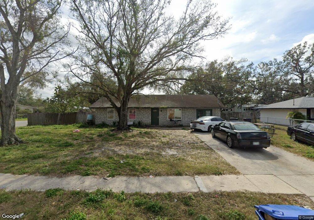
1302 Atlantic Dr Ruskin, FL 33570
Estimated Value: $225,011 - $247,000
2
Beds
1
Bath
1,275
Sq Ft
$181/Sq Ft
Est. Value
About This Home
This home is located at 1302 Atlantic Dr, Ruskin, FL 33570 and is currently estimated at $231,253, approximately $181 per square foot. 1302 Atlantic Dr is a home located in Hillsborough County with nearby schools including Thompson Elementary School, Shields Middle School, and Lennard High School.
Ownership History
Date
Name
Owned For
Owner Type
Purchase Details
Closed on
Apr 2, 2017
Sold by
Duerr Christpher P
Bought by
Duerr Christipher P
Current Estimated Value
Purchase Details
Closed on
Jul 20, 2002
Sold by
Joiner Virginia
Bought by
Duerr Christoper P
Home Financials for this Owner
Home Financials are based on the most recent Mortgage that was taken out on this home.
Original Mortgage
$73,841
Outstanding Balance
$31,214
Interest Rate
6.67%
Mortgage Type
FHA
Estimated Equity
$200,039
Create a Home Valuation Report for This Property
The Home Valuation Report is an in-depth analysis detailing your home's value as well as a comparison with similar homes in the area
Home Values in the Area
Average Home Value in this Area
Purchase History
| Date | Buyer | Sale Price | Title Company |
|---|---|---|---|
| Duerr Christipher P | -- | Attorney | |
| Duerr Christoper P | $75,000 | -- |
Source: Public Records
Mortgage History
| Date | Status | Borrower | Loan Amount |
|---|---|---|---|
| Open | Duerr Christoper P | $73,841 |
Source: Public Records
Tax History Compared to Growth
Tax History
| Year | Tax Paid | Tax Assessment Tax Assessment Total Assessment is a certain percentage of the fair market value that is determined by local assessors to be the total taxable value of land and additions on the property. | Land | Improvement |
|---|---|---|---|---|
| 2024 | $2,903 | $132,018 | $55,296 | $76,722 |
| 2023 | $2,813 | $130,399 | $46,080 | $84,319 |
| 2022 | $2,643 | $140,045 | $36,864 | $103,181 |
| 2021 | $2,384 | $110,210 | $29,030 | $81,180 |
| 2020 | $2,155 | $99,527 | $29,952 | $69,575 |
| 2019 | $1,939 | $87,476 | $21,658 | $65,818 |
| 2018 | $1,803 | $80,844 | $0 | $0 |
| 2017 | $492 | $64,073 | $0 | $0 |
| 2016 | $465 | $34,591 | $0 | $0 |
| 2015 | $464 | $34,351 | $0 | $0 |
| 2014 | $442 | $34,078 | $0 | $0 |
| 2013 | -- | $33,574 | $0 | $0 |
Source: Public Records
Map
Nearby Homes
- 731 Cristelle Jean Dr
- 1402 Delano Trent St
- 947 Brenton Leaf Dr
- 110 14th St SE
- 313 Shell Manor Dr
- 702 Cristelle Jean Dr
- 111 14th St SE
- 1603 Carson White Ln
- 316 Crichton St
- 1023 Chandler Snowden Ct
- 1739 Broad Winged Hawk Dr
- 1609 Delano Trent St
- 501 Delwood Breck St
- 262 Royal Spoonbill Dr
- 264 Royal Spoonbill Dr
- 256 Royal Spoonbill Dr
- 258 Royal Spoonbill Dr
- 260 Royal Spoonbill Dr
- 843 Royal Empress Dr
- 408 Delwood Breck St
- 404 13th St NE
- 1304 Atlantic Dr
- 410 13th St NE
- 402 13th St NE
- 407 13th St NE
- 1302 4th Ave NE
- 1306 Atlantic Dr
- 1311 Atlantic Dr
- 409 13th St NE
- 412 13th St NE
- 312 13th St NE
- 1304 4th Ave NE
- 1313 Atlantic Dr Unit 3B
- 411 13th St NE
- 1409 Murillo Loop
- 1308 Atlantic Dr
- 1301 4th Ave NE
- 1407 Murillo Loop
- 414 13th St NE
- 310 13th St NE