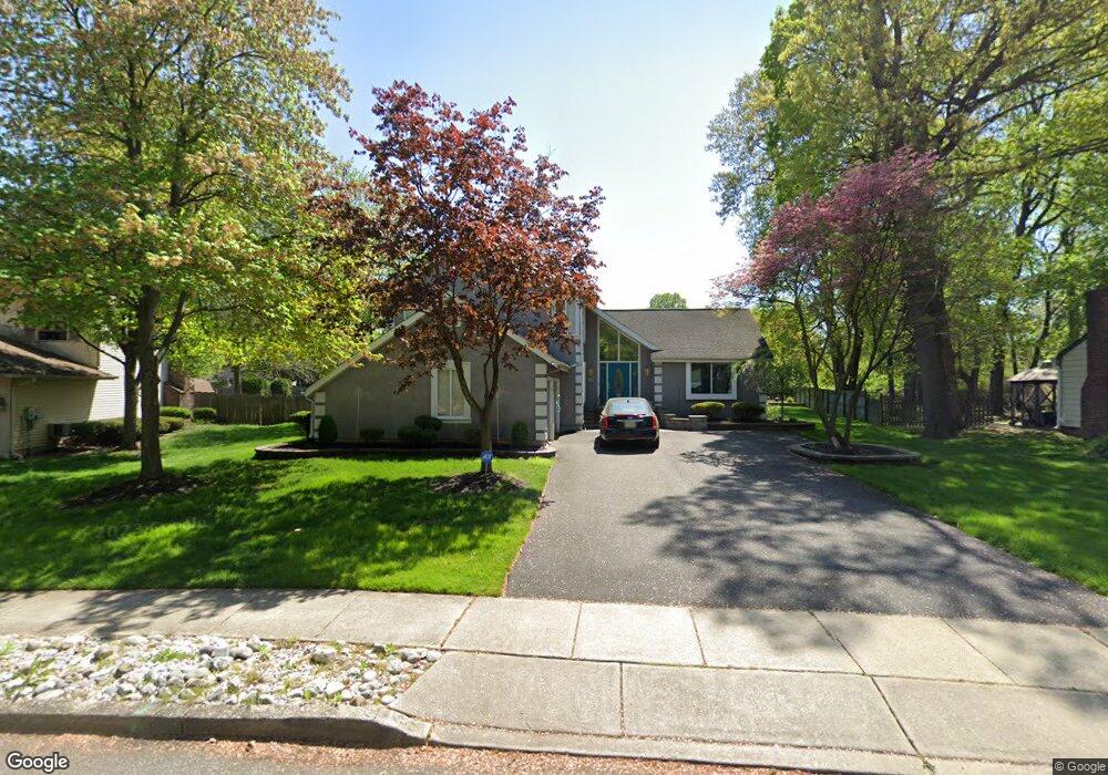
1302 Barnesdale Rd West Deptford, NJ 08096
West Deptford Township NeighborhoodEstimated Value: $558,000 - $592,000
--
Bed
--
Bath
2,988
Sq Ft
$192/Sq Ft
Est. Value
About This Home
This home is located at 1302 Barnesdale Rd, West Deptford, NJ 08096 and is currently estimated at $573,892, approximately $192 per square foot. 1302 Barnesdale Rd is a home located in Gloucester County with nearby schools including Green-Fields Elementary School, Oakview Elementary School, and Red Bank Elementary School.
Ownership History
Date
Name
Owned For
Owner Type
Purchase Details
Closed on
Jan 15, 2001
Sold by
Herrick Andrew L and Moyer Robert K
Bought by
Craig James W and Mahon Carol A
Current Estimated Value
Home Financials for this Owner
Home Financials are based on the most recent Mortgage that was taken out on this home.
Original Mortgage
$130,000
Outstanding Balance
$47,443
Interest Rate
7.39%
Mortgage Type
Stand Alone First
Estimated Equity
$526,449
Create a Home Valuation Report for This Property
The Home Valuation Report is an in-depth analysis detailing your home's value as well as a comparison with similar homes in the area
Home Values in the Area
Average Home Value in this Area
Purchase History
| Date | Buyer | Sale Price | Title Company |
|---|---|---|---|
| Craig James W | $205,750 | -- |
Source: Public Records
Mortgage History
| Date | Status | Borrower | Loan Amount |
|---|---|---|---|
| Open | Craig James W | $130,000 |
Source: Public Records
Tax History Compared to Growth
Tax History
| Year | Tax Paid | Tax Assessment Tax Assessment Total Assessment is a certain percentage of the fair market value that is determined by local assessors to be the total taxable value of land and additions on the property. | Land | Improvement |
|---|---|---|---|---|
| 2025 | $11,241 | $321,900 | $73,400 | $248,500 |
| 2024 | $11,096 | $321,900 | $73,400 | $248,500 |
| 2023 | $11,096 | $321,900 | $73,400 | $248,500 |
| 2022 | $11,044 | $321,900 | $73,400 | $248,500 |
| 2021 | $10,347 | $321,900 | $73,400 | $248,500 |
| 2020 | $10,980 | $321,900 | $73,400 | $248,500 |
| 2019 | $10,674 | $321,900 | $73,400 | $248,500 |
| 2018 | $10,384 | $321,900 | $73,400 | $248,500 |
| 2017 | $10,143 | $321,900 | $73,400 | $248,500 |
| 2016 | $9,860 | $321,900 | $73,400 | $248,500 |
| 2015 | $9,393 | $321,900 | $73,400 | $248,500 |
| 2014 | $8,926 | $321,900 | $73,400 | $248,500 |
Source: Public Records
Map
Nearby Homes
- 1102 Barnesdale Rd
- 4 Saint Emilion Ct
- 1311 Barnesdale Rd
- 1220 Royal Ln
- 1810 Fernwood Dr
- 87 Woodway Dr Unit 87
- 863 Doncaster Dr
- 740 Carter Hill Dr
- 558 Prince St
- 640 Worcester Dr
- 344 S Girard St
- 12 Highbridge Ln Unit I2
- 125 Lionheart Ln Unit C125
- 438 S Columbia St
- 609 Salem Ave
- 608 Salem Ave
- 1012 Moore Rd Unit 6
- 64 Tilden Rd
- 1091 Buckingham Dr Unit 45
- 1066 Buckingham Dr
- 1063 Barnesdale Rd
- 1304 Barnesdale Rd
- 1069 Barnesdale Rd
- 1306 Barnesdale Rd
- 1301 Barnesdale Rd
- 482 Westwood Dr
- 1062 Barnesdale Rd
- 1083 Barnesdale Rd
- 1308 Barnesdale Rd
- 1103 Barnesdale Rd
- 1068 Barnesdale Rd
- 478 Westwood Dr
- 486 Westwood Dr
- 2 Latour Ct
- 490 Westwood Dr
- 1310 Barnesdale Rd
- 1111 Barnesdale Rd
- 474 Westwood Dr
- 392 Nottingham Rd
- 4 Latour Ct